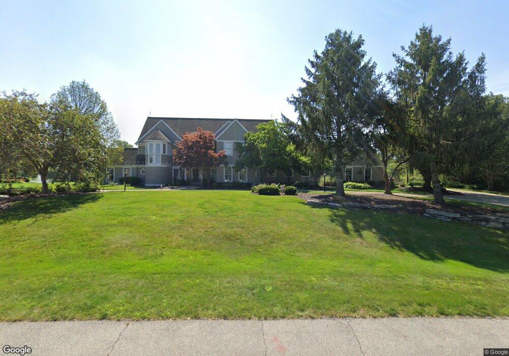
11117 Carnoustie Ln Fort Wayne, IN 46814
Aboite NeighborhoodEstimated Value: $982,113 - $1,122,000
5
Beds
8
Baths
6,018
Sq Ft
$178/Sq Ft
Est. Value
About This Home
This home is located at 11117 Carnoustie Ln, Fort Wayne, IN 46814 and is currently estimated at $1,070,371, approximately $177 per square foot. 11117 Carnoustie Ln is a home located in Allen County with nearby schools including Deer Ridge Elementary School, Woodside Middle School, and Homestead Senior High School.
Ownership History
Date
Name
Owned For
Owner Type
Purchase Details
Closed on
Nov 15, 2010
Sold by
Gouloff Michael S and Gouloff Gretchen K
Bought by
Bussick Timothy J
Current Estimated Value
Home Financials for this Owner
Home Financials are based on the most recent Mortgage that was taken out on this home.
Original Mortgage
$800,000
Outstanding Balance
$527,828
Interest Rate
4.27%
Mortgage Type
New Conventional
Estimated Equity
$542,543
Create a Home Valuation Report for This Property
The Home Valuation Report is an in-depth analysis detailing your home's value as well as a comparison with similar homes in the area
Home Values in the Area
Average Home Value in this Area
Purchase History
| Date | Buyer | Sale Price | Title Company |
|---|---|---|---|
| Bussick Timothy J | -- | None Available |
Source: Public Records
Mortgage History
| Date | Status | Borrower | Loan Amount |
|---|---|---|---|
| Open | Bussick Timothy J | $800,000 |
Source: Public Records
Tax History Compared to Growth
Tax History
| Year | Tax Paid | Tax Assessment Tax Assessment Total Assessment is a certain percentage of the fair market value that is determined by local assessors to be the total taxable value of land and additions on the property. | Land | Improvement |
|---|---|---|---|---|
| 2024 | $11,941 | $1,060,700 | $101,400 | $959,300 |
| 2023 | $11,941 | $1,097,700 | $101,400 | $996,300 |
| 2022 | $10,551 | $961,000 | $101,400 | $859,600 |
| 2021 | $9,153 | $863,800 | $101,400 | $762,400 |
| 2020 | $8,638 | $812,600 | $101,400 | $711,200 |
| 2019 | $8,530 | $800,000 | $101,400 | $698,600 |
| 2018 | $7,921 | $741,800 | $101,400 | $640,400 |
| 2017 | $7,975 | $743,800 | $101,400 | $642,400 |
| 2016 | $8,091 | $751,300 | $101,400 | $649,900 |
| 2014 | $7,027 | $658,200 | $102,400 | $555,800 |
| 2013 | $6,998 | $651,400 | $102,400 | $549,000 |
Source: Public Records
Map
Nearby Homes
- 2826 Little River Run
- 2805 Little River Run
- 1521 Sycamore Hills Dr
- 2910 Covington Lake Dr
- 1511 Sycamore Hills Pkwy
- 1430 Copper Beech Run
- 2704 Grenadier Ct
- 2707 Grenadier Ct
- 10121 Mesa Glen Ct
- 2088 Seward Lake Pass
- 12273 Rain Lily Ct
- 12342 Blue Jay Trail Unit 98
- 12408 Blue Jay Trail
- 9738 Kalmia Ct
- 2241 Banyan Hill Ct Unit 66
- 2275 Banyan Hill Ct Unit 65
- TBD S Scott Rd Unit 303
- 10832 Deep Creek Ct
- 1854 Carica Ct
- 2042 Burnt Lake Dr
- 11023 Carnoustie Ln
- 11129 Carnoustie Ln
- 11032 Carnoustie Ln
- 11120 Carnoustie Ln
- 11011 Carnoustie Ln
- 10936 Birkdale Ct
- 11132 Carnoustie Ln
- 10935 Birkdale Ct
- 11020 Carnoustie Ln
- 10928 Birkdale Ct
- 10929 Birkdale Ct
- 10933 Carnoustie Ln
- 2522 Sycamore Hills Dr
- 10920 Birkdale Ct
- 10923 Birkdale Ct
- 11008 Carnoustie Ln
- 2528 Sycamore Hills Dr
- 11134 Shiregreen Ln
- 11020 Shiregreen Ln
- 2516 Sycamore Hills Dr