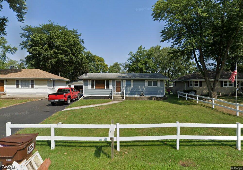
11118 Bryant Rd Mokena, IL 60448
Estimated Value: $345,874 - $384,000
3
Beds
2
Baths
1,888
Sq Ft
$194/Sq Ft
Est. Value
About This Home
This home is located at 11118 Bryant Rd, Mokena, IL 60448 and is currently estimated at $365,719, approximately $193 per square foot. 11118 Bryant Rd is a home located in Will County with nearby schools including Mokena Elementary School, Mokena Intermediate School, and Mokena Jr High School.
Ownership History
Date
Name
Owned For
Owner Type
Purchase Details
Closed on
Jan 8, 2025
Sold by
Boling Michael and Boling Gerri
Bought by
Mgb Family Trust and Boling
Current Estimated Value
Purchase Details
Closed on
Jun 25, 2021
Sold by
Palmer Paul J and Paul J Palmer Trust
Bought by
Boling Michael and Boling Gerri
Home Financials for this Owner
Home Financials are based on the most recent Mortgage that was taken out on this home.
Original Mortgage
$212,000
Interest Rate
2.5%
Mortgage Type
New Conventional
Purchase Details
Closed on
Sep 19, 2019
Sold by
Palmer Paul J
Bought by
Palmer Paul J and Paul J Palmer Trust
Purchase Details
Closed on
Jul 10, 2001
Sold by
Palmer Linda L and Martinez Linda L
Bought by
Palmer Paul J and Palmer Linda L
Purchase Details
Closed on
Jun 7, 1995
Sold by
Martinez Louis A
Bought by
Martinez Linda L
Create a Home Valuation Report for This Property
The Home Valuation Report is an in-depth analysis detailing your home's value as well as a comparison with similar homes in the area
Home Values in the Area
Average Home Value in this Area
Purchase History
| Date | Buyer | Sale Price | Title Company |
|---|---|---|---|
| Mgb Family Trust | -- | None Listed On Document | |
| Boling Michael | $265,000 | Fidelity National Title Ins | |
| Palmer Paul J | -- | None Available | |
| Palmer Paul J | -- | -- | |
| Martinez Linda L | -- | -- |
Source: Public Records
Mortgage History
| Date | Status | Borrower | Loan Amount |
|---|---|---|---|
| Previous Owner | Boling Michael | $212,000 |
Source: Public Records
Tax History
| Year | Tax Paid | Tax Assessment Tax Assessment Total Assessment is a certain percentage of the fair market value that is determined by local assessors to be the total taxable value of land and additions on the property. | Land | Improvement |
|---|---|---|---|---|
| 2024 | $7,277 | $103,922 | $18,312 | $85,610 |
| 2023 | $7,277 | $92,812 | $16,354 | $76,458 |
| 2022 | $6,383 | $84,536 | $14,896 | $69,640 |
| 2021 | $6,001 | $79,087 | $13,936 | $65,151 |
| 2020 | $5,874 | $76,858 | $13,543 | $63,315 |
| 2019 | $5,688 | $74,801 | $13,181 | $61,620 |
| 2018 | $5,496 | $72,650 | $12,802 | $59,848 |
| 2017 | $5,392 | $70,954 | $12,503 | $58,451 |
| 2016 | $5,238 | $68,521 | $12,074 | $56,447 |
| 2015 | $5,091 | $66,108 | $11,649 | $54,459 |
| 2014 | $5,091 | $65,648 | $11,568 | $54,080 |
| 2013 | $5,091 | $66,499 | $11,718 | $54,781 |
Source: Public Records
Map
Nearby Homes
- 19380 Wolf Rd Unit 6
- 11025 Revere Rd
- 11254 192nd St
- 10814 3rd St
- 10752 First Ct
- Lot 7 Block 3 McGovn Mcgovney St
- 11321 1st St
- 11325 1st St
- 11317 1st St
- 11329 1st St
- 11319 1st St
- 11323 1st St
- 11315 1st St
- 11144 Denny Ave
- 19539 116th Ave Unit B
- 19602 Swanberg Ln
- 19545 116th Ave Unit A
- 19502 116th Ave Unit C
- 11617 Parkside Ln
- W Maple Rd
- 11114 Bryant Rd
- 11124 Bryant Rd
- 11128 Bryant Rd
- 11104 Bryant Rd
- 19324 Union St
- 11134 Bryant Rd
- 11127 Bryant Rd
- 19320 Union St
- 11117 Bryant Rd
- 11123 Bryant Rd
- 19402 Union St
- 11113 Bryant Rd
- 19316 Union St
- 11133 Bryant Rd
- 11117 Revere Rd
- 11123 Revere Rd
- 11111 Revere Rd
- 19333 Wolf Rd
- 11137 Bryant Rd
- 11127 Revere Rd
Your Personal Tour Guide
Ask me questions while you tour the home.