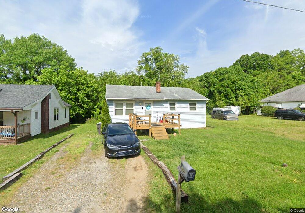
1112 Carter St High Point, NC 27260
Greater High Point NeighborhoodEstimated Value: $80,000 - $153,000
2
Beds
1
Bath
910
Sq Ft
$129/Sq Ft
Est. Value
About This Home
This home is located at 1112 Carter St, High Point, NC 27260 and is currently estimated at $117,478, approximately $129 per square foot. 1112 Carter St is a home located in Guilford County with nearby schools including Triangle Lake Montessori School, Southwest Guilford Middle School, and Southwest Guilford High School.
Ownership History
Date
Name
Owned For
Owner Type
Purchase Details
Closed on
Nov 26, 2019
Sold by
Manning Mark
Bought by
Manning Property Group Llc
Current Estimated Value
Purchase Details
Closed on
Jan 7, 2014
Sold by
Moonpie Llc
Bought by
Manning Mark
Home Financials for this Owner
Home Financials are based on the most recent Mortgage that was taken out on this home.
Original Mortgage
$20,000
Interest Rate
4.38%
Mortgage Type
Purchase Money Mortgage
Purchase Details
Closed on
Dec 31, 2013
Sold by
Jester Ella Jean
Bought by
Moonpie Llc
Home Financials for this Owner
Home Financials are based on the most recent Mortgage that was taken out on this home.
Original Mortgage
$20,000
Interest Rate
4.38%
Mortgage Type
Purchase Money Mortgage
Create a Home Valuation Report for This Property
The Home Valuation Report is an in-depth analysis detailing your home's value as well as a comparison with similar homes in the area
Home Values in the Area
Average Home Value in this Area
Purchase History
| Date | Buyer | Sale Price | Title Company |
|---|---|---|---|
| Manning Property Group Llc | -- | None Available | |
| Manning Mark | $6,000 | None Available | |
| Moonpie Llc | $15,000 | None Available |
Source: Public Records
Mortgage History
| Date | Status | Borrower | Loan Amount |
|---|---|---|---|
| Previous Owner | Moonpie Llc | $20,000 |
Source: Public Records
Tax History
| Year | Tax Paid | Tax Assessment Tax Assessment Total Assessment is a certain percentage of the fair market value that is determined by local assessors to be the total taxable value of land and additions on the property. | Land | Improvement |
|---|---|---|---|---|
| 2025 | $1,295 | $47,500 | $8,000 | $39,500 |
| 2024 | $1,295 | $47,500 | $8,000 | $39,500 |
| 2023 | $1,295 | $47,500 | $8,000 | $39,500 |
| 2022 | $640 | $47,500 | $8,000 | $39,500 |
| 2021 | $492 | $35,700 | $5,000 | $30,700 |
| 2020 | $492 | $35,700 | $5,000 | $30,700 |
| 2019 | $492 | $35,700 | $0 | $0 |
| 2018 | $489 | $35,700 | $0 | $0 |
| 2017 | $489 | $35,700 | $0 | $0 |
| 2016 | $641 | $45,700 | $0 | $0 |
| 2015 | $644 | $45,700 | $0 | $0 |
| 2014 | $655 | $45,700 | $0 | $0 |
Source: Public Records
Map
Nearby Homes
- 1110 Worth St
- 1806 Franklin Ave
- 1809 Franklin Ave
- 1111 Winslow St
- 1314 Franklin Ave
- 1423 E Commerce Ave
- 1914 E Russell Ave
- 811 Worth St
- 640 Wesley Dr
- 650 Wesley Dr
- 1908 Leonard Ave
- 2317 Purdy Ave
- 430 New St
- 1219 Furlough Ave
- 812 E Russell Ave
- 505 Kent Ct
- 412 Meredith St
- 1204 Pearson Place
- 410 Meredith St
- 1224 S Downing St
- 1114 Carter St
- 1116 Carter St
- 1108 Carter St
- 1106 Carter St
- 1907 E Green Dr
- 1113 Carter St
- 1111 Carter St
- 1115 Carter St
- 509 Hill St
- 1109 Carter St
- 1117 Carter St
- 507 Hill St
- 1107 Carter St
- 515 Hill St
- 1100 Carter St
- 2001 B E Green Dr
- 1604 Franklin Ave
- 2003 E Green Dr
- 1105 Carter St
- 1105 Carter St Unit 3
Your Personal Tour Guide
Ask me questions while you tour the home.