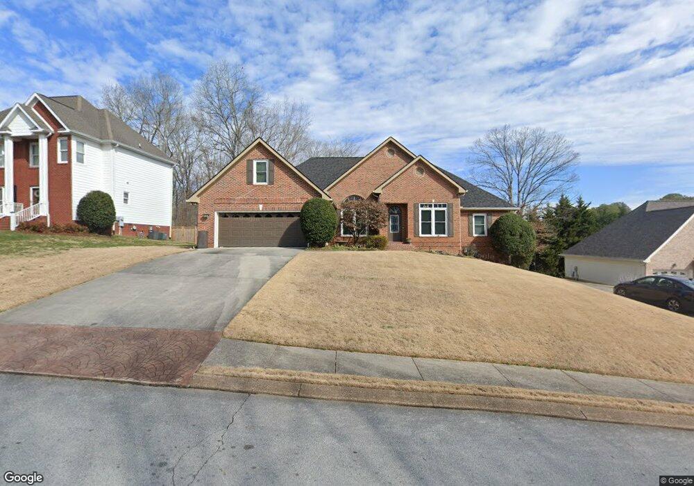
1112 Harbor Landing Dr Soddy Daisy, TN 37379
Estimated Value: $678,511 - $870,000
4
Beds
4
Baths
3,900
Sq Ft
$199/Sq Ft
Est. Value
About This Home
This home is located at 1112 Harbor Landing Dr, Soddy Daisy, TN 37379 and is currently estimated at $774,878, approximately $198 per square foot. 1112 Harbor Landing Dr is a home located in Hamilton County.
Ownership History
Date
Name
Owned For
Owner Type
Purchase Details
Closed on
Sep 9, 2002
Sold by
Roberts Samuel Scott and Roberts Gayle D
Bought by
Vaughn Larry D and Vaughn Jacqueline D
Current Estimated Value
Home Financials for this Owner
Home Financials are based on the most recent Mortgage that was taken out on this home.
Original Mortgage
$150,050
Outstanding Balance
$63,001
Interest Rate
6.31%
Estimated Equity
$711,877
Purchase Details
Closed on
Apr 27, 1998
Sold by
Mcgarrity Andrew and Mcgarrity Teresa
Bought by
Roberts Samuel Scott and Roberts Gayle D
Home Financials for this Owner
Home Financials are based on the most recent Mortgage that was taken out on this home.
Original Mortgage
$227,100
Interest Rate
7.03%
Purchase Details
Closed on
Jul 30, 1997
Sold by
Luttrell George W
Bought by
Mcgarrity Andrew and Mcgarrity Teresa
Home Financials for this Owner
Home Financials are based on the most recent Mortgage that was taken out on this home.
Original Mortgage
$160,000
Interest Rate
7.59%
Mortgage Type
Credit Line Revolving
Create a Home Valuation Report for This Property
The Home Valuation Report is an in-depth analysis detailing your home's value as well as a comparison with similar homes in the area
Home Values in the Area
Average Home Value in this Area
Purchase History
| Date | Buyer | Sale Price | Title Company |
|---|---|---|---|
| Vaughn Larry D | $280,000 | Century Title & Escrow Inc | |
| Roberts Samuel Scott | $239,100 | -- | |
| Mcgarrity Andrew | $26,000 | -- |
Source: Public Records
Mortgage History
| Date | Status | Borrower | Loan Amount |
|---|---|---|---|
| Open | Vaughn Larry D | $150,050 | |
| Previous Owner | Roberts Samuel Scott | $227,100 | |
| Previous Owner | Mcgarrity Andrew | $160,000 |
Source: Public Records
Tax History Compared to Growth
Tax History
| Year | Tax Paid | Tax Assessment Tax Assessment Total Assessment is a certain percentage of the fair market value that is determined by local assessors to be the total taxable value of land and additions on the property. | Land | Improvement |
|---|---|---|---|---|
| 2024 | $2,125 | $95,000 | $0 | $0 |
| 2023 | $3,195 | $95,000 | $0 | $0 |
| 2022 | $3,195 | $95,000 | $0 | $0 |
| 2021 | $3,195 | $95,000 | $0 | $0 |
| 2020 | $3,624 | $87,800 | $0 | $0 |
| 2019 | $3,624 | $87,800 | $0 | $0 |
| 2018 | $3,624 | $87,800 | $0 | $0 |
| 2017 | $3,624 | $87,800 | $0 | $0 |
| 2016 | $3,345 | $0 | $0 | $0 |
| 2015 | $3,345 | $81,025 | $0 | $0 |
| 2014 | $3,345 | $0 | $0 | $0 |
Source: Public Records
Map
Nearby Homes
- 11312 Hixson Pike
- 11734 Armstrong Rd
- 1055 Apollo Dr
- 11636 Holly Cir
- 11652 Hixson Pike
- 11570 Armstrong Rd
- 1235 Bentley Ln
- 11008 Lovell Rd
- 1708 Restful Dr
- 11219 Dayton Pike
- 11213 Dayton Pike
- 11317 Cape View
- 10496 Sovereign Pointe Dr
- 10627 Jeneva Ln
- 11036 High River Dr
- 10428 Jeneva Ln
- 11015 High River Dr
- 1121 Natural Way
- 191 Depot St
- 176 Depot St
- 1110 Harbor Landing Dr
- 1114 Harbor Landing Dr
- 1144 Clift Cave Dr
- 1108 Harbor Landing Dr
- 1111 Harbor Landing Dr
- 710 Harbor Crest Dr
- 1115 Harbor Landing Dr
- 1106 Harbor Landing Dr
- 1109 Harbor Landing Dr
- 1107 Harbor Landing Dr
- 1104 Harbor Landing Dr
- 1140 Clift Cave Dr
- 1140 Clift Cave Dr
- 1126 Harbor Point Dr
- 1102 Harbor Landing Dr
- 1227 Harbor Point Dr
- 1124 Harbor Point Dr
- 1124 Harbor Point Dr Unit 24
- 1220 Harbor Point Dr
- 1200 Harbor Point Dr