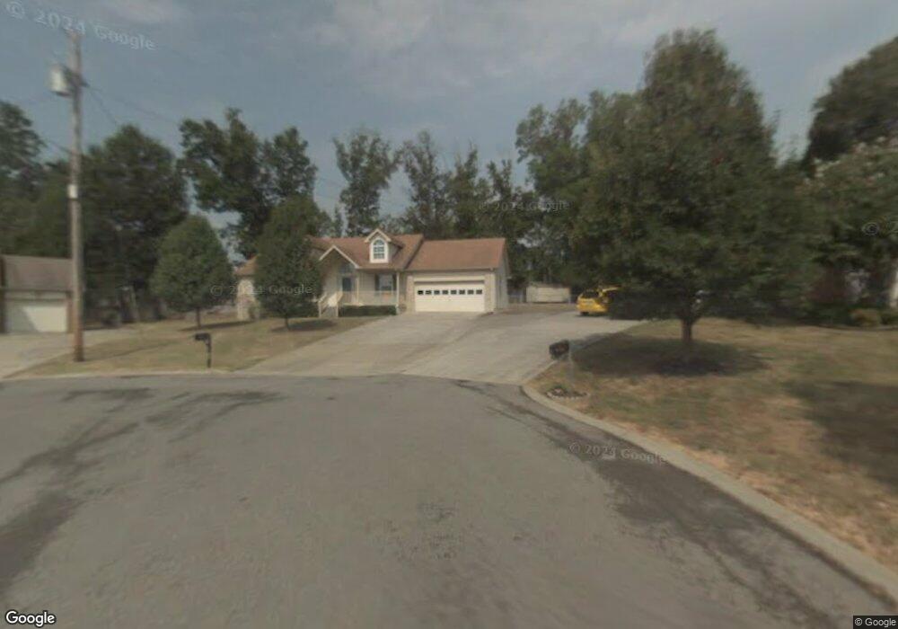
1112 Odom Ct Smyrna, TN 37167
Estimated Value: $324,889 - $363,000
--
Bed
3
Baths
1,233
Sq Ft
$280/Sq Ft
Est. Value
About This Home
This home is located at 1112 Odom Ct, Smyrna, TN 37167 and is currently estimated at $345,222, approximately $279 per square foot. 1112 Odom Ct is a home located in Rutherford County with nearby schools including David Youree Elementary School, Rocky Fork Middle School, and Smyrna High School.
Ownership History
Date
Name
Owned For
Owner Type
Purchase Details
Closed on
Feb 14, 2002
Sold by
Bundrant William H and Bundrant Kimbe
Bought by
Bannister Michael R
Current Estimated Value
Home Financials for this Owner
Home Financials are based on the most recent Mortgage that was taken out on this home.
Original Mortgage
$82,400
Interest Rate
7.16%
Purchase Details
Closed on
Feb 27, 1995
Bought by
Bundrant William H
Create a Home Valuation Report for This Property
The Home Valuation Report is an in-depth analysis detailing your home's value as well as a comparison with similar homes in the area
Home Values in the Area
Average Home Value in this Area
Purchase History
| Date | Buyer | Sale Price | Title Company |
|---|---|---|---|
| Bannister Michael R | $103,000 | -- | |
| Bundrant William H | $85,900 | -- |
Source: Public Records
Mortgage History
| Date | Status | Borrower | Loan Amount |
|---|---|---|---|
| Closed | Bundrant William H | $82,400 |
Source: Public Records
Tax History Compared to Growth
Tax History
| Year | Tax Paid | Tax Assessment Tax Assessment Total Assessment is a certain percentage of the fair market value that is determined by local assessors to be the total taxable value of land and additions on the property. | Land | Improvement |
|---|---|---|---|---|
| 2025 | $1,600 | $66,600 | $13,750 | $52,850 |
| 2024 | $1,600 | $66,600 | $13,750 | $52,850 |
| 2023 | $1,600 | $66,600 | $13,750 | $52,850 |
| 2022 | $1,426 | $66,600 | $13,750 | $52,850 |
| 2021 | $1,314 | $45,000 | $8,750 | $36,250 |
| 2020 | $1,314 | $45,000 | $8,750 | $36,250 |
| 2019 | $1,314 | $45,000 | $8,750 | $36,250 |
| 2018 | $1,260 | $45,000 | $0 | $0 |
| 2017 | $1,049 | $29,425 | $0 | $0 |
| 2016 | $1,049 | $29,425 | $0 | $0 |
| 2015 | $1,049 | $29,425 | $0 | $0 |
| 2014 | $732 | $29,425 | $0 | $0 |
| 2013 | -- | $32,325 | $0 | $0 |
Source: Public Records
Map
Nearby Homes
- 630 Rock Springs Rd
- 1305 Reinfield Ct
- 726 Mason Tucker Dr
- 1102 Forestwood Ct
- 1412 Saint Edmonds Ct
- 4026 Gaskill Dr Unit 118D
- 4042 Gaskill Dr Unit 113C
- 1226 Bronte Dr Unit 23D
- 1222 Bronte Dr Unit 23C
- 1226 Bronte Dr
- 1222 Bronte Dr
- 4046 Gaskill Dr Unit 113D
- 4018 Gaskill Dr
- 570 Rock Springs Rd
- Caroline Plan at Spring Branch - Townhomes
- Bruckner Plan at Spring Branch - Townhomes
- Mozart Plan at Spring Branch - Townhomes
- 115 Saint Michaels Ln
- 107 Irish Place
- 4372 Spregan Way