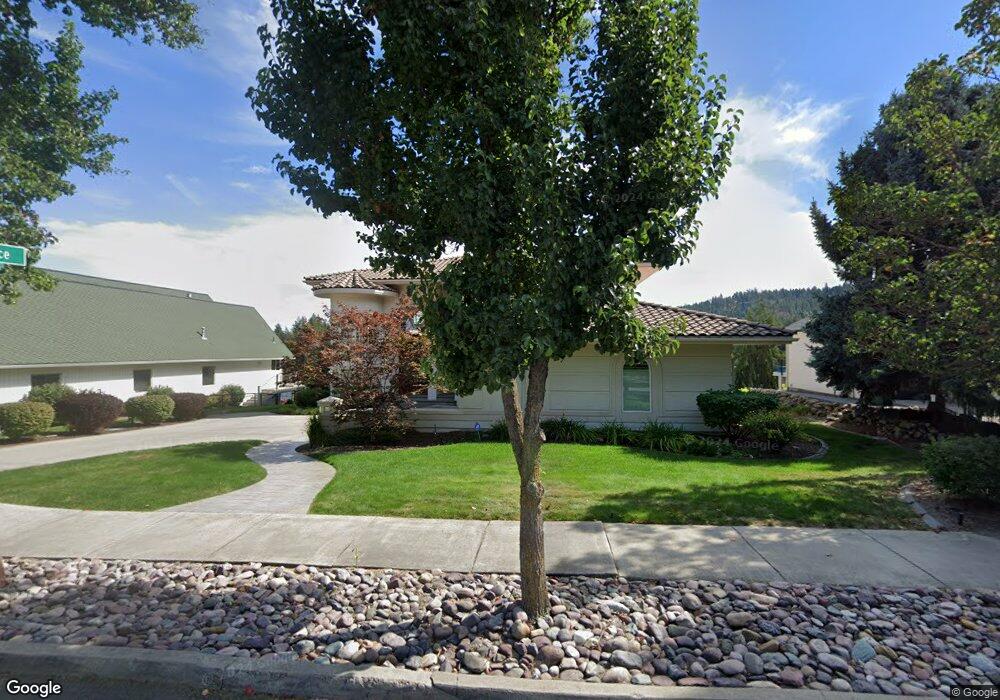
1112 S Riverside Harbor Dr Post Falls, ID 83854
Centennial NeighborhoodEstimated Value: $1,772,000 - $3,084,000
3
Beds
4
Baths
5,652
Sq Ft
$450/Sq Ft
Est. Value
About This Home
This home is located at 1112 S Riverside Harbor Dr, Post Falls, ID 83854 and is currently estimated at $2,545,669, approximately $450 per square foot. 1112 S Riverside Harbor Dr is a home located in Kootenai County with nearby schools including Ponderosa Elementary School, Post Falls Middle School, and Post Falls High School.
Ownership History
Date
Name
Owned For
Owner Type
Purchase Details
Closed on
May 27, 2015
Sold by
Riverside Harbor Llc
Bought by
Sargent Brett and Sargent Jodie
Current Estimated Value
Purchase Details
Closed on
Oct 3, 2008
Sold by
Schwehr Joseph R and Schwehr Dianne R
Bought by
Riverside Harbor Llc
Home Financials for this Owner
Home Financials are based on the most recent Mortgage that was taken out on this home.
Original Mortgage
$1,207,500
Interest Rate
6.12%
Mortgage Type
Adjustable Rate Mortgage/ARM
Create a Home Valuation Report for This Property
The Home Valuation Report is an in-depth analysis detailing your home's value as well as a comparison with similar homes in the area
Home Values in the Area
Average Home Value in this Area
Purchase History
| Date | Buyer | Sale Price | Title Company |
|---|---|---|---|
| Sargent Brett | -- | Kooteni County Title | |
| Riverside Harbor Llc | -- | Kootenai County Title Co |
Source: Public Records
Mortgage History
| Date | Status | Borrower | Loan Amount |
|---|---|---|---|
| Previous Owner | Riverside Harbor Llc | $1,207,500 |
Source: Public Records
Tax History
| Year | Tax Paid | Tax Assessment Tax Assessment Total Assessment is a certain percentage of the fair market value that is determined by local assessors to be the total taxable value of land and additions on the property. | Land | Improvement |
|---|---|---|---|---|
| 2025 | $14,369 | $2,469,094 | $1,571,406 | $897,688 |
| 2024 | $17,164 | $2,819,460 | $1,916,294 | $903,166 |
| 2023 | $17,164 | $2,819,460 | $1,916,294 | $903,166 |
| 2022 | $17,780 | $2,973,609 | $2,017,152 | $956,457 |
| 2021 | $14,661 | $1,492,501 | $806,861 | $685,640 |
| 2020 | $13,157 | $1,185,608 | $591,698 | $593,910 |
| 2019 | $13,321 | $1,083,839 | $537,907 | $545,932 |
| 2018 | $13,404 | $992,004 | $493,082 | $498,922 |
| 2017 | $14,733 | $1,000,756 | $537,660 | $463,096 |
| 2016 | $16,332 | $1,052,121 | $582,465 | $469,656 |
| 2015 | $17,331 | $1,099,690 | $519,738 | $579,952 |
| 2013 | $17,848 | $48,932 | $0 | $0 |
Source: Public Records
Map
Nearby Homes
- 5214 E Twila Ct
- 6451 W Harbor Dr
- 102 S Riverwood Ct
- 6246 W Ebbtide Dr
- 400 S Ohana Beach Dr
- 5439 E Steamboat Bend
- 5377 E Steamboat Bend
- 5079 E Portside Ct
- 5892 W Harbor Dr
- 8817 W Riverview Dr
- 5969 W Highland Dr
- 690 N McDonald Ct
- NKA S Mossy Rock Ln
- 518 S Hidden Island Ln
- 398 N Seeley St
- 706 N Dundee Dr
- 4745 W Kona Dr
- 768 N Neufeld Ln
- 4715 W Reeves St
- 8497 W Highland Dr
- 1200 S Riverside Harbor Dr
- 1108 S Riverside Harbor Dr
- 1104 S Riverside Harbor Dr
- 1206 S Riverside Harbor Dr
- 1109 S Riverside Harbor Dr
- 1203 S Riverside Harbor Dr
- 1100 S Riverside Harbor Dr
- 1208 S Riverside Harbor Dr
- 1107 S Riverside Harbor Dr
- 1205 S Riverside Harbor Dr
- 1103 S Riverside Harbor Dr
- 1209 S Riverside Harbor Dr
- 5236 E River Place
- 1212 S Riverside Harbor Dr
- 5236 River Place
- 5231 E River Place
- 1014 S Riverside Harbor Dr
- 5215 E Twila Ct
- 5218 E River Place
- 1213 S Riverside Harbor Dr
Your Personal Tour Guide
Ask me questions while you tour the home.