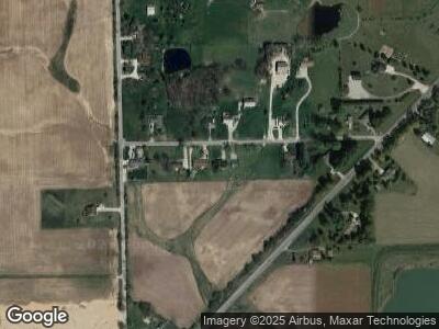
11122 Birky Dr Spencerville, IN 46788
Estimated Value: $320,000 - $364,000
3
Beds
3
Baths
1,779
Sq Ft
$189/Sq Ft
Est. Value
About This Home
This home is located at 11122 Birky Dr, Spencerville, IN 46788 and is currently estimated at $337,112, approximately $189 per square foot. 11122 Birky Dr is a home located in Allen County with nearby schools including Leo Elementary School, Cedarville Elementary School, and Leo Junior/Senior High School.
Ownership History
Date
Name
Owned For
Owner Type
Purchase Details
Closed on
Aug 30, 2019
Sold by
Belvin Sharon
Bought by
Moreau Brayden S
Current Estimated Value
Home Financials for this Owner
Home Financials are based on the most recent Mortgage that was taken out on this home.
Original Mortgage
$207,900
Outstanding Balance
$185,203
Interest Rate
3.7%
Mortgage Type
New Conventional
Estimated Equity
$157,540
Purchase Details
Closed on
Oct 13, 2005
Sold by
Pulver Raymond and Pulver Janice
Bought by
Belvin Clifford and Belvin Sharon
Home Financials for this Owner
Home Financials are based on the most recent Mortgage that was taken out on this home.
Original Mortgage
$138,000
Interest Rate
6.17%
Mortgage Type
Fannie Mae Freddie Mac
Create a Home Valuation Report for This Property
The Home Valuation Report is an in-depth analysis detailing your home's value as well as a comparison with similar homes in the area
Home Values in the Area
Average Home Value in this Area
Purchase History
| Date | Buyer | Sale Price | Title Company |
|---|---|---|---|
| Moreau Brayden S | $231,000 | Trademark Title | |
| Belvin Clifford | -- | Mid West Title |
Source: Public Records
Mortgage History
| Date | Status | Borrower | Loan Amount |
|---|---|---|---|
| Open | Moreau Brayden S | $207,900 | |
| Previous Owner | Belvin Clifford | $158,400 | |
| Previous Owner | Belvin Clifford | $138,000 | |
| Previous Owner | Belvin Clifford | $17,250 | |
| Previous Owner | Pulver Raymond L | $60,000 |
Source: Public Records
Tax History Compared to Growth
Tax History
| Year | Tax Paid | Tax Assessment Tax Assessment Total Assessment is a certain percentage of the fair market value that is determined by local assessors to be the total taxable value of land and additions on the property. | Land | Improvement |
|---|---|---|---|---|
| 2024 | $2,863 | $327,000 | $46,400 | $280,600 |
| 2023 | $2,787 | $310,500 | $39,200 | $271,300 |
| 2022 | $2,285 | $258,100 | $39,200 | $218,900 |
| 2021 | $1,821 | $220,900 | $39,200 | $181,700 |
| 2020 | $1,809 | $211,700 | $39,200 | $172,500 |
| 2019 | $1,502 | $186,300 | $39,200 | $147,100 |
| 2018 | $1,407 | $172,000 | $29,200 | $142,800 |
| 2017 | $1,416 | $168,800 | $29,200 | $139,600 |
| 2016 | $1,281 | $157,500 | $29,200 | $128,300 |
| 2014 | $1,150 | $147,200 | $29,200 | $118,000 |
| 2013 | $1,444 | $161,700 | $29,200 | $132,500 |
Source: Public Records
Map
Nearby Homes
- 15471 Makarios Pass Unit 35
- 10802 Conrad Creek Ct Unit 23
- 10932 Conrad Creek Ct
- 15386 Makarios Pass Unit 8
- 15329 Makarios Pass Unit 29
- 10878 Conrad Creek Ct Unit 17
- 10964 Conrad Creek Ct Unit 14
- 16529 N State Road 1
- 10612 Walnut St
- 12314 Bayshore Blvd
- 15207 James Dr
- 10596 Spamount Cove Unit 114
- 17455 Lochner Rd
- 17330 Letterbrick Run
- 10483 Spamount Cove
- 10031 Hosler Rd
- 10516 Beaugreen Cove Unit 43
- 10502 Beaugreen Cove Unit 42
- 10480 Beaugreen Cove Unit 41
- 17581 Letterbrick Run Unit 82
- 11122 Birky Dr
- 11200 Birky Dr
- 11133 Birky Dr
- 11132 Birky Dr
- 11125 Birky Dr
- 11320 Birky Dr
- 11127 Birky Dr
- 11019 Birky Dr
- 15922 Lochner Rd
- 15925 N State Road 1
- 11145 Birky Dr
- 15818 N State Road 1
- 16124 Lochner Rd
- 15910 N State Road 1
- 11225 Birky Dr
- 15905 Lochner Rd
- 16003 N State Road 1
- 16206 Lochner Rd
- 15932 N State Road 1
- 12500 Page Tract 1 Rd
