11125 NE 134th Ave Maxwell, IA 50161
Estimated Value: $269,089 - $643,000
--
Bed
--
Bath
17,733
Sq Ft
$21/Sq Ft
Est. Value
About This Home
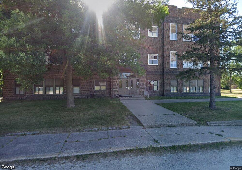
This home is located at 11125 NE 134th Ave, Maxwell, IA 50161 and is currently estimated at $367,272, approximately $20 per square foot. 11125 NE 134th Ave is a home located in Polk County with nearby schools including Anderson Elementary School, Morris Elementary School, and Washington County Middle School.
Ownership History
Date
Name
Owned For
Owner Type
Purchase Details
Closed on
Jun 28, 2024
Sold by
Oliver James K and Oliver Nancy
Bought by
Sc Iowa Llc
Current Estimated Value
Purchase Details
Closed on
Dec 19, 2006
Sold by
Geddes Donald Rodney and Geddes Kathy A
Bought by
Oliver James K and Oliver Nancy
Home Financials for this Owner
Home Financials are based on the most recent Mortgage that was taken out on this home.
Original Mortgage
$112,500
Interest Rate
6.24%
Mortgage Type
Purchase Money Mortgage
Create a Home Valuation Report for This Property
The Home Valuation Report is an in-depth analysis detailing your home's value as well as a comparison with similar homes in the area
Home Values in the Area
Average Home Value in this Area
Purchase History
| Date | Buyer | Sale Price | Title Company |
|---|---|---|---|
| Sc Iowa Llc | $260,000 | None Listed On Document | |
| Oliver James K | $124,500 | None Available |
Source: Public Records
Mortgage History
| Date | Status | Borrower | Loan Amount |
|---|---|---|---|
| Previous Owner | Oliver James K | $112,500 |
Source: Public Records
Tax History Compared to Growth
Tax History
| Year | Tax Paid | Tax Assessment Tax Assessment Total Assessment is a certain percentage of the fair market value that is determined by local assessors to be the total taxable value of land and additions on the property. | Land | Improvement |
|---|---|---|---|---|
| 2025 | $3,374 | $245,200 | $83,200 | $162,000 |
| 2024 | $3,374 | $220,300 | $74,600 | $145,700 |
| 2023 | $3,284 | $220,300 | $74,600 | $145,700 |
| 2022 | $3,270 | $180,200 | $63,600 | $116,600 |
| 2021 | $3,320 | $180,200 | $63,600 | $116,600 |
| 2020 | $3,278 | $165,700 | $58,800 | $106,900 |
| 2019 | $3,116 | $165,700 | $58,800 | $106,900 |
| 2018 | $3,060 | $151,900 | $53,500 | $98,400 |
| 2017 | $3,000 | $151,900 | $53,500 | $98,400 |
| 2016 | $2,936 | $145,500 | $51,100 | $94,400 |
| 2015 | $2,936 | $145,500 | $51,100 | $94,400 |
| 2014 | $2,884 | $148,500 | $52,100 | $96,400 |
Source: Public Records
Map
Nearby Homes
- 14039 NE 112th St
- TBD NE 134th Ave
- 10803 NE 118th Ave
- 11301 NE 110th Ave
- 5768 W 148th St N
- 33975 663rd Ave
- 5280 Fairview Ln
- 5460 Fairview Ln
- 5220 Fairview Ln
- 5397 Fairview Ln
- 5527 Fairview Ln
- 5517 Fairview Ln
- 5520 Fairview Ln
- 5457 Fariview Ln
- 5277 Fairview Ln
- 5217 Fairview Ln
- 5157 Fairview Ln
- 5400 Fairview Ln
- 5530 Fairview Ln
- 5340 Fariview Ln
- 11110 NE 134th Ave
- 13310 NE 112th St
- 13394 NE 112th St
- 13425 NE 111th St
- 13435 NE 111th St
- 13426 NE 111th St
- 13405 NE 110th Ct
- 13434 NE 111th St
- 13375 NE 112th St
- 13450 NE 111th St
- 13420 NE 110th Ct
- 13455 NE 110th Ct
- 13440 NE 110th Ct
- 13475 NE 110th Ct
- 13456 NE 110th Ct
- 13495 NE 110th Ct
- 13470 NE 110th Ct
- 13490 NE 110th Ct
- 13510 NE 110th Ct
- 13540 NE 110th Ct