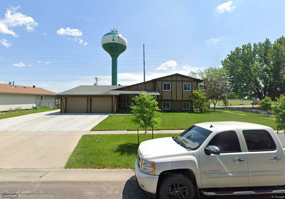
1113 4th St E West Fargo, ND 58078
Eastwood NeighborhoodEstimated Value: $309,000 - $357,097
4
Beds
2
Baths
1,802
Sq Ft
$185/Sq Ft
Est. Value
About This Home
This home is located at 1113 4th St E, West Fargo, ND 58078 and is currently estimated at $333,049, approximately $184 per square foot. 1113 4th St E is a home located in Cass County with nearby schools including Eastwood Elementary School, Cheney Middle School, and West Fargo High School.
Ownership History
Date
Name
Owned For
Owner Type
Purchase Details
Closed on
May 24, 2007
Sold by
Bertzyk Peter and Bertzyk Evelyn
Bought by
Ketterling Douglas M and Ketterling Amanda W
Current Estimated Value
Home Financials for this Owner
Home Financials are based on the most recent Mortgage that was taken out on this home.
Original Mortgage
$121,850
Outstanding Balance
$74,521
Interest Rate
6.27%
Mortgage Type
New Conventional
Estimated Equity
$258,528
Create a Home Valuation Report for This Property
The Home Valuation Report is an in-depth analysis detailing your home's value as well as a comparison with similar homes in the area
Home Values in the Area
Average Home Value in this Area
Purchase History
| Date | Buyer | Sale Price | Title Company |
|---|---|---|---|
| Ketterling Douglas M | -- | -- |
Source: Public Records
Mortgage History
| Date | Status | Borrower | Loan Amount |
|---|---|---|---|
| Open | Ketterling Douglas M | $121,850 |
Source: Public Records
Tax History Compared to Growth
Tax History
| Year | Tax Paid | Tax Assessment Tax Assessment Total Assessment is a certain percentage of the fair market value that is determined by local assessors to be the total taxable value of land and additions on the property. | Land | Improvement |
|---|---|---|---|---|
| 2024 | $3,902 | $162,550 | $26,150 | $136,400 |
| 2023 | $4,273 | $157,150 | $26,150 | $131,000 |
| 2022 | $4,138 | $145,350 | $26,150 | $119,200 |
| 2021 | $3,818 | $128,950 | $19,000 | $109,950 |
| 2020 | $3,413 | $117,500 | $19,000 | $98,500 |
| 2019 | $3,289 | $114,900 | $19,000 | $95,900 |
| 2018 | $3,071 | $112,050 | $19,000 | $93,050 |
| 2017 | $2,901 | $108,450 | $19,000 | $89,450 |
| 2016 | $2,556 | $105,200 | $19,000 | $86,200 |
| 2015 | $2,457 | $92,950 | $14,900 | $78,050 |
| 2014 | $2,402 | $86,850 | $14,900 | $71,950 |
| 2013 | $2,291 | $82,800 | $14,900 | $67,900 |
Source: Public Records
Map
Nearby Homes
- 245 12th Ave E
- 336 13th Ave E
- 243 12 1 2 Ave E
- 437 10th Ave E
- 237 10th Ave E
- 670 13th Ave E
- 631 15th Ave E
- 851 12th Ave E
- 226 10 1/2 Ave W
- 109 7th Ave E
- 232 15th Ave W
- 109 5th Ave W
- 1633 3rd St W
- 987 14th Ave E
- 426 3rd Ave E
- 1844 1st St
- 716 Northridge Way
- 724 Northridge Way
- 1809 Pentland St
- 431 Morrison St
- 321 12th Ave E
- 1101 4th St E
- 1108 4th St E
- 405 12th Ave E
- 401 12th Ave E
- 403 12th Ave E
- 407 12th Ave E
- 311 12th Ave E
- 11th 11th Ave E
- 1102 4th St E
- 309 12th Ave E
- 307 12th Ave E
- 302 12th Ave E
- 305 12th Ave E
- 320 11th Ave E
- 332 12 1 2 Ave E
- 301 11th Ave E
- 303 12th Ave E
- 342 12th Ave E
- 342 12th Ave E Unit 21