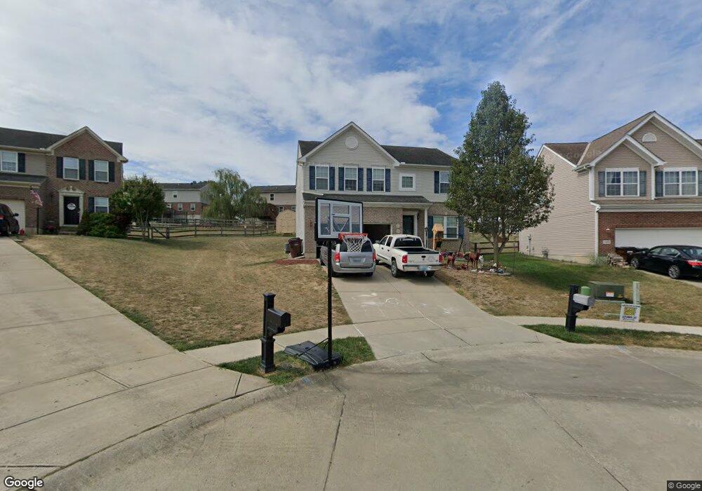
1113 Audas Ct Independence, KY 41051
Estimated Value: $360,000 - $385,000
4
Beds
3
Baths
2,384
Sq Ft
$155/Sq Ft
Est. Value
About This Home
This home is located at 1113 Audas Ct, Independence, KY 41051 and is currently estimated at $369,229, approximately $154 per square foot. 1113 Audas Ct is a home located in Kenton County with nearby schools including Kenton Elementary School, Twenhofel Middle School, and Simon Kenton High School.
Ownership History
Date
Name
Owned For
Owner Type
Purchase Details
Closed on
Jul 21, 2020
Sold by
Landoll Nathan L and Landoll Davya J
Bought by
Duncan James E and Duncan Pearl L
Current Estimated Value
Home Financials for this Owner
Home Financials are based on the most recent Mortgage that was taken out on this home.
Original Mortgage
$197,910
Outstanding Balance
$174,709
Interest Rate
3.1%
Mortgage Type
New Conventional
Estimated Equity
$194,520
Purchase Details
Closed on
May 24, 2010
Sold by
Nvr Inc
Bought by
Landoll Nathan L and Landoll Davya J
Home Financials for this Owner
Home Financials are based on the most recent Mortgage that was taken out on this home.
Original Mortgage
$166,836
Interest Rate
5.15%
Mortgage Type
FHA
Purchase Details
Closed on
Mar 16, 2010
Sold by
First Security Trust Bank Inc
Bought by
Nvr Inc
Create a Home Valuation Report for This Property
The Home Valuation Report is an in-depth analysis detailing your home's value as well as a comparison with similar homes in the area
Home Values in the Area
Average Home Value in this Area
Purchase History
| Date | Buyer | Sale Price | Title Company |
|---|---|---|---|
| Duncan James E | $219,900 | 360 American Title Svcs Llc | |
| Landoll Nathan L | $169,915 | Kentucky Land Title Agency | |
| Nvr Inc | $30,000 | None Available |
Source: Public Records
Mortgage History
| Date | Status | Borrower | Loan Amount |
|---|---|---|---|
| Open | Duncan James E | $197,910 | |
| Previous Owner | Landoll Nathan L | $166,836 |
Source: Public Records
Tax History
| Year | Tax Paid | Tax Assessment Tax Assessment Total Assessment is a certain percentage of the fair market value that is determined by local assessors to be the total taxable value of land and additions on the property. | Land | Improvement |
|---|---|---|---|---|
| 2025 | $3,466 | $298,000 | $45,000 | $253,000 |
| 2024 | $2,694 | $219,900 | $30,000 | $189,900 |
| 2023 | $2,775 | $219,900 | $30,000 | $189,900 |
| 2022 | $2,833 | $219,900 | $30,000 | $189,900 |
| 2021 | $2,875 | $219,900 | $30,000 | $189,900 |
| 2020 | $2,612 | $195,000 | $30,000 | $165,000 |
| 2019 | $2,619 | $195,000 | $30,000 | $165,000 |
| 2018 | $2,633 | $195,000 | $30,000 | $165,000 |
| 2017 | $2,561 | $195,000 | $30,000 | $165,000 |
| 2015 | $2,176 | $169,900 | $30,000 | $139,900 |
| 2014 | $2,145 | $169,900 | $30,000 | $139,900 |
Source: Public Records
Map
Nearby Homes
- 532 Old Bristow Rd
- 1202 Wellford Dr
- 1211 Wellford Dr
- 10422 Flintrock Bluff
- 1748 Cherry Blossom Dr
- 1739 Cherry Blossom Dr
- 1736 Cherry Blossom Dr
- 1727 Cherry Blossom Dr
- 1707 Cherry Blossom Dr
- 1727 Cherry Blossom Dr
- 1707 Cherry Blossom Dr
- 1217 Cannonball Way
- 10529 Greenbrook Dr
- 10700 Melbury Ct
- 10690 Melbury Ct Unit 305GL
- 1368 Independence Rd
- 1368 Independence Rd
- 1372 Independence Rd
- 1372 Independence Rd
- 11108 Woodmont Way
- 1109 Audas Ct
- 1117 Audas Ct
- 10579 Pepperwood Dr
- 10579 Pepperwood Dr Unit 37BL
- 1105 Audas Ct
- 10583 Pepperwood Dr
- 1118 Audas Ct
- 10575 Pepperwood Dr
- 10575 Pepperwood Dr Unit 38BL
- 10587 Pepperwood Dr
- 10587 Pepperwood Dr Unit 35BL
- 1114 Audas Ct
- 10571 Pepperwood Dr
- 1110 Audas Ct
- 1101 Audas Ct
- 1106 Audas Ct
- 10567 Pepperwood Dr Unit 40BL
- 10567 Pepperwood Dr
- 10591 Pepperwood Dr
- 10591 Pepperwood Dr Unit 162WW
Your Personal Tour Guide
Ask me questions while you tour the home.