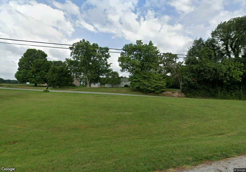
1113 Mitchell Rd McMinnville, TN 37110
Estimated Value: $104,808 - $263,000
--
Bed
1
Bath
1,118
Sq Ft
$150/Sq Ft
Est. Value
About This Home
This home is located at 1113 Mitchell Rd, McMinnville, TN 37110 and is currently estimated at $167,202, approximately $149 per square foot. 1113 Mitchell Rd is a home located in Warren County with nearby schools including Dibrell Elementary School and Warren County High School.
Ownership History
Date
Name
Owned For
Owner Type
Purchase Details
Closed on
Sep 9, 2015
Sold by
Foster Peggy Sue
Bought by
Foster Peggy Sue Life Estate
Current Estimated Value
Purchase Details
Closed on
Feb 4, 2014
Bought by
Foster Peggy Sue Life Estate
Purchase Details
Closed on
Feb 5, 2013
Bought by
Foster Peggy Sue Life Estate
Purchase Details
Closed on
Jan 19, 2012
Bought by
Foster Peggy Sue Life Estate
Purchase Details
Closed on
Dec 28, 2011
Bought by
Foster Peggy Sue Life Estate
Purchase Details
Closed on
Nov 10, 1986
Bought by
Foster Peggy Sue
Create a Home Valuation Report for This Property
The Home Valuation Report is an in-depth analysis detailing your home's value as well as a comparison with similar homes in the area
Home Values in the Area
Average Home Value in this Area
Purchase History
| Date | Buyer | Sale Price | Title Company |
|---|---|---|---|
| Foster Peggy Sue Life Estate | $13,000 | -- | |
| Foster Peggy Sue Life Estate | $13,000 | -- | |
| Foster Peggy Sue Life Estate | $13,000 | -- | |
| Foster Peggy Sue Life Estate | $13,000 | -- | |
| Foster Peggy Sue Life Estate | $13,000 | -- | |
| Foster Peggy Sue | -- | -- |
Source: Public Records
Tax History Compared to Growth
Tax History
| Year | Tax Paid | Tax Assessment Tax Assessment Total Assessment is a certain percentage of the fair market value that is determined by local assessors to be the total taxable value of land and additions on the property. | Land | Improvement |
|---|---|---|---|---|
| 2024 | $294 | $14,925 | $3,975 | $10,950 |
| 2023 | $294 | $14,925 | $3,975 | $10,950 |
| 2022 | $294 | $14,925 | $3,975 | $10,950 |
| 2021 | $294 | $14,925 | $3,975 | $10,950 |
| 2020 | $253 | $14,925 | $3,975 | $10,950 |
| 2019 | $289 | $12,875 | $3,575 | $9,300 |
| 2018 | $253 | $12,875 | $3,575 | $9,300 |
| 2017 | $253 | $12,875 | $3,575 | $9,300 |
| 2016 | $253 | $12,875 | $3,575 | $9,300 |
| 2015 | $257 | $12,875 | $3,575 | $9,300 |
| 2014 | $198 | $12,875 | $3,575 | $9,300 |
| 2013 | $198 | $9,899 | $0 | $0 |
Source: Public Records
Map
Nearby Homes
- 266 Hampton Pointe Ln
- 506 Bill Fuson Rd
- 125 Maple Ridge Ct
- 268 Mike Muncey Rd
- 6005 Smithville Hwy
- 8324 Smithville Hwy
- 0 Fuston Cemetery Rd
- 65 Sun Valley Dr
- 1896 Dibrell Lucky Rd
- 52 Dale St
- 1264 Meiser Ln
- 311 Meiser Ln
- 1656 Dibrell Lucky Rd
- 26 Melanie St
- 26 Delores Ln
- 502 Circle Hill Dr
- 486 Circle Hill Dr
- 392 Sullivan Rd
- 4226 Old Smithville Rd
- 1190 Hutchins Rd
- 7162 Smithville Hwy
- 7223 Smithville Hwy
- 7140 Smithville Hwy
- 7267 Smithville Hwy
- 83 Vandagriff Rd
- 7323 Smithville Hwy
- 7312 Smithville Hwy
- 7363 Smithville Hwy
- 91 Vandagriff Rd
- 69 Vandagriff Rd
- 7386 Smithville Hwy
- 7411 Smithville Hwy
- 0 Mike Muncey Rd
- 0 Mike Muncey Rd Unit RTC2560470
- 0 Mike Muncey Rd Unit 2140158
- 1 Mike Muncey Rd
- 3 Mike Muncey Rd
- 161 Vandagriff Rd
- 404 Bill Fuson Rd
- 442 Bill Fuson Rd
