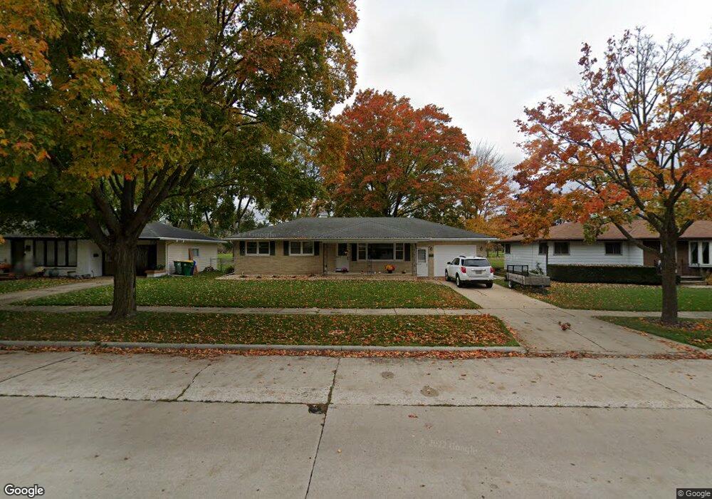
1113 N Locust St Green Bay, WI 54303
Perkins Park Area NeighborhoodEstimated Value: $241,489 - $271,000
--
Bed
--
Bath
--
Sq Ft
9,191
Sq Ft Lot
About This Home
This home is located at 1113 N Locust St, Green Bay, WI 54303 and is currently estimated at $259,872. 1113 N Locust St is a home located in Brown County with nearby schools including Chappell Elementary School, Franklin Middle School, and West High School.
Ownership History
Date
Name
Owned For
Owner Type
Purchase Details
Closed on
Sep 30, 2013
Sold by
Saunders Brian W
Bought by
Saunders Brian W
Current Estimated Value
Home Financials for this Owner
Home Financials are based on the most recent Mortgage that was taken out on this home.
Original Mortgage
$110,600
Interest Rate
4.59%
Mortgage Type
New Conventional
Purchase Details
Closed on
Jul 30, 2002
Sold by
Saunders Mary Ann
Bought by
Saunders James R
Purchase Details
Closed on
Jul 25, 2001
Sold by
Saunders Mary Ann
Bought by
Saunders James R
Create a Home Valuation Report for This Property
The Home Valuation Report is an in-depth analysis detailing your home's value as well as a comparison with similar homes in the area
Home Values in the Area
Average Home Value in this Area
Purchase History
| Date | Buyer | Sale Price | Title Company |
|---|---|---|---|
| Saunders Brian W | -- | Pioneer Title Llc | |
| Saunders James R | -- | -- | |
| Saunders James R | -- | -- |
Source: Public Records
Mortgage History
| Date | Status | Borrower | Loan Amount |
|---|---|---|---|
| Closed | Saunders Brian W | $110,600 |
Source: Public Records
Tax History Compared to Growth
Tax History
| Year | Tax Paid | Tax Assessment Tax Assessment Total Assessment is a certain percentage of the fair market value that is determined by local assessors to be the total taxable value of land and additions on the property. | Land | Improvement |
|---|---|---|---|---|
| 2024 | $2,808 | $155,700 | $25,200 | $130,500 |
| 2023 | $2,660 | $155,700 | $25,200 | $130,500 |
| 2022 | $2,617 | $155,700 | $25,200 | $130,500 |
| 2021 | $2,443 | $110,900 | $18,500 | $92,400 |
| 2020 | $2,718 | $110,900 | $18,500 | $92,400 |
| 2019 | $2,463 | $110,900 | $18,500 | $92,400 |
| 2018 | $2,619 | $110,900 | $18,500 | $92,400 |
| 2017 | $2,338 | $110,900 | $18,500 | $92,400 |
| 2016 | $2,298 | $110,900 | $18,500 | $92,400 |
| 2015 | $2,768 | $110,900 | $18,500 | $92,400 |
| 2014 | $2,452 | $110,900 | $18,500 | $92,400 |
| 2013 | $2,452 | $110,900 | $18,500 | $92,400 |
Source: Public Records
Map
Nearby Homes
- 1013 N Locust St
- 1037 Royal Blvd
- 1037 Park St
- 819 N Platten St
- 820 N Platten St
- 709 N Locust St
- 710 Royal Blvd
- 717 Park St
- 1036 Neville Ave
- 1261 Mather St
- 412 Saratoga St
- 1193 Bond St
- 1280 Division St Unit 1282
- 1095 Minahan St
- 1125 Elmore St
- 1751 Lenwood Ave
- 1169 Division St
- 1716 Nancy Ave
- 120 Reinhard Ct
- 1411 Shawano Ave
- 1107 N Locust St
- 1117 N Locust St
- 1125 N Locust St
- 1101 N Locust St
- 1129 N Locust St
- 1114 N Locust St
- 1108 N Locust St
- 1039 N Locust St
- 1118 N Locust St
- 1104 N Locust St
- 1122 N Locust St
- 1135 N Locust St
- 1100 N Locust St
- 1128 N Locust St
- 1033 N Locust St
- 1139 N Locust St
- 1134 N Locust St
- 1115 N Platten St
- 1109 N Platten St
- 1034 N Locust St