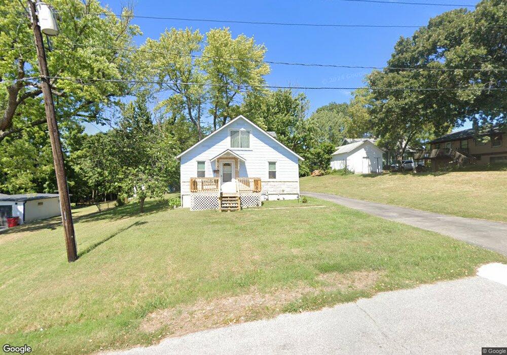
11134 E 27th St S Independence, MO 64052
Rock Creek NeighborhoodEstimated Value: $138,356 - $165,000
3
Beds
1
Bath
1,021
Sq Ft
$148/Sq Ft
Est. Value
About This Home
This home is located at 11134 E 27th St S, Independence, MO 64052 and is currently estimated at $151,339, approximately $148 per square foot. 11134 E 27th St S is a home located in Jackson County with nearby schools including Korte Elementary School, Clifford H. Nowlin Middle School, and Van Horn High School.
Ownership History
Date
Name
Owned For
Owner Type
Purchase Details
Closed on
Dec 1, 2010
Sold by
Suntrust Mortgage Inc
Bought by
Secretary Of Housing & Urban Development
Current Estimated Value
Purchase Details
Closed on
Dec 7, 2007
Sold by
Mortgage Electronic Registration Systems
Bought by
Hud
Purchase Details
Closed on
Sep 24, 2001
Sold by
Dell James and Dell Norma
Bought by
Guinn Buddy C and Guinn Rhonda J
Purchase Details
Closed on
Sep 10, 2001
Sold by
Minter Daniel E and Minter Janet L
Bought by
John Alton H and John Sharlette A
Create a Home Valuation Report for This Property
The Home Valuation Report is an in-depth analysis detailing your home's value as well as a comparison with similar homes in the area
Home Values in the Area
Average Home Value in this Area
Purchase History
| Date | Buyer | Sale Price | Title Company |
|---|---|---|---|
| Secretary Of Housing & Urban Development | -- | None Available | |
| Hud | -- | None Available | |
| Guinn Buddy C | -- | Old Republic Title Company | |
| John Alton H | -- | Chicago Title Co |
Source: Public Records
Tax History
| Year | Tax Paid | Tax Assessment Tax Assessment Total Assessment is a certain percentage of the fair market value that is determined by local assessors to be the total taxable value of land and additions on the property. | Land | Improvement |
|---|---|---|---|---|
| 2025 | $1,186 | $15,076 | $3,948 | $11,128 |
| 2024 | $1,157 | $16,629 | $4,904 | $11,725 |
| 2023 | $1,157 | $16,629 | $1,600 | $15,029 |
| 2022 | $868 | $11,400 | $1,917 | $9,483 |
| 2021 | $865 | $11,400 | $1,917 | $9,483 |
| 2020 | $882 | $11,320 | $1,917 | $9,403 |
| 2019 | $869 | $11,320 | $1,917 | $9,403 |
| 2018 | $779 | $9,851 | $1,668 | $8,183 |
| 2016 | $750 | $9,269 | $2,153 | $7,116 |
Source: Public Records
Map
Nearby Homes
- 2700 Englewood Terrace
- 10003 E 36th St S
- 1611 - 1613 S Claremont N A
- 10816 E 27th St S
- 2716 Appleton Ave
- 2604 S Northern Blvd
- 2917 Mason Ave
- 2916 S Mason Ave
- 1524 W Sheley Rd
- 2929 S Northern Blvd
- 2316 S Vermont Ave
- 2925 S Norwood Ave
- 2601 S Hardy Ave
- 1408 W 28th St S
- 1403 W 27th Terrace S
- 1319 W 29th St S
- 1316 W 29th Terrace S
- 2805 S Fuller Ave
- 2010 S Northern Blvd
- 10212 E 31st St S
- 2632 S Sterling Ave
- 11128 E 27th St S
- 2630 S Sterling Ave
- 2628 S Sterling Ave
- 11126 E 27th St S
- 2700 S Sterling Ave
- 3111 S Sterling Ave
- 11124 E 27th St S
- 11207 E 27th St
- 11125 E 27th St S
- 2723 & 2725 Englewood Terrace
- 1802 & 1804 S Arlington Ave
- 11715 E 35th St S
- 2649 S Sterling Ave
- 2701 S Sterling Ave
- 2911 S Sterling Ave
- 2705 S Sterling Ave
- 2631 S Sterling Ave
- 2651 S Sterling Ave
- 2603 S Sterling Ave
Your Personal Tour Guide
Ask me questions while you tour the home.