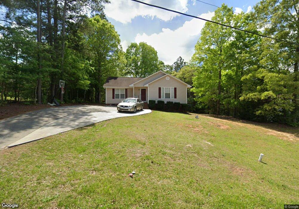
1114 Westminister Dr Lancaster, SC 29720
Estimated Value: $198,000 - $254,000
--
Bed
2
Baths
1,233
Sq Ft
$176/Sq Ft
Est. Value
About This Home
This home is located at 1114 Westminister Dr, Lancaster, SC 29720 and is currently estimated at $217,434, approximately $176 per square foot. 1114 Westminister Dr is a home located in Lancaster County with nearby schools including Erwin Elementary School, South Middle School, and Lancaster High School.
Ownership History
Date
Name
Owned For
Owner Type
Purchase Details
Closed on
Feb 15, 2016
Sold by
Ingram Kenisha L
Bought by
Hood Briasia
Current Estimated Value
Home Financials for this Owner
Home Financials are based on the most recent Mortgage that was taken out on this home.
Original Mortgage
$53,000
Outstanding Balance
$42,278
Interest Rate
3.97%
Mortgage Type
New Conventional
Estimated Equity
$175,156
Purchase Details
Closed on
Aug 16, 2001
Sold by
Plyler Douglas Ray and Plyler Sandra M
Bought by
Ingram Kenisha L
Create a Home Valuation Report for This Property
The Home Valuation Report is an in-depth analysis detailing your home's value as well as a comparison with similar homes in the area
Home Values in the Area
Average Home Value in this Area
Purchase History
| Date | Buyer | Sale Price | Title Company |
|---|---|---|---|
| Hood Briasia | $99,900 | -- | |
| Ingram Kenisha L | $11,300 | -- |
Source: Public Records
Mortgage History
| Date | Status | Borrower | Loan Amount |
|---|---|---|---|
| Open | Hood Briasia | $53,000 |
Source: Public Records
Tax History Compared to Growth
Tax History
| Year | Tax Paid | Tax Assessment Tax Assessment Total Assessment is a certain percentage of the fair market value that is determined by local assessors to be the total taxable value of land and additions on the property. | Land | Improvement |
|---|---|---|---|---|
| 2024 | $677 | $4,412 | $360 | $4,052 |
| 2023 | $674 | $4,412 | $360 | $4,052 |
| 2022 | $672 | $4,412 | $360 | $4,052 |
| 2021 | $657 | $4,412 | $360 | $4,052 |
| 2020 | $616 | $4,020 | $360 | $3,660 |
| 2019 | $1,359 | $4,020 | $360 | $3,660 |
| 2018 | $1,308 | $4,020 | $360 | $3,660 |
| 2017 | $602 | $0 | $0 | $0 |
| 2016 | $587 | $0 | $0 | $0 |
| 2015 | $1,635 | $0 | $0 | $0 |
| 2014 | $1,635 | $0 | $0 | $0 |
| 2013 | $1,635 | $0 | $0 | $0 |
Source: Public Records
Map
Nearby Homes
- 1447 Carmel Rd
- 1530 Danlee Dr
- 1428 Boxwood Ave
- 1324 Mason St
- 1795 Grace Ave
- 1324 Jefferson St
- 1250 Hampton Grace Ave
- 1631 Oakdale Dr
- 1397 Grace Ave
- 5.45 acres Memorial Park Rd
- 3.04 acres Memorial Park Rd
- 1658 Oakdale Dr
- 1746 Grace Ave Unit 1
- 1797 Drywood Cir
- 1801 Grace Ave
- 1500 Victoria St Unit 4
- 1501 Victoria St Unit 11
- 1503 Victoria St
- 1509 Victoria St Unit 13
- 1817 Grace Ave
- 1142 Westminister Dr
- 1147 Westminster Dr
- 1216 Belmont Circle Dr
- 1372 Carmel Rd
- 1140 Westminister Dr
- 1127 Westminster Dr Unit 103
- 1147 Westminster Dr
- 1383 Carmel Rd
- 1143 Westminister Rd
- 1141 Westminister Dr
- 1365 Carmel Rd
- 1357 Carmel Rd
- 1371 Carmel Rd
- 1232 Belmont Circle Dr
- Lot 82 Belmont Circle Dr
- 1332 Carmel Rd
- 1396 Carmel Rd
- 1349 Carmel Rd
- 168 Carmel Rd Unit 67
- 101 Westminister Dr