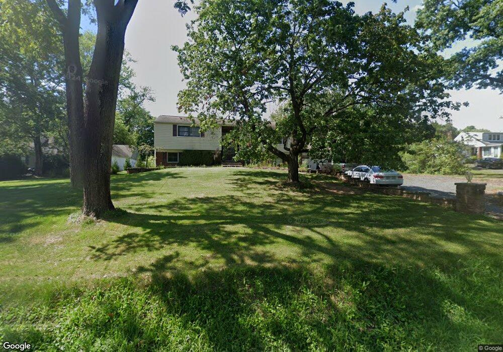
1114 Wrightstown Rd Newtown, PA 18940
Estimated Value: $640,546 - $884,000
3
Beds
3
Baths
1,544
Sq Ft
$487/Sq Ft
Est. Value
About This Home
This home is located at 1114 Wrightstown Rd, Newtown, PA 18940 and is currently estimated at $751,387, approximately $486 per square foot. 1114 Wrightstown Rd is a home located in Bucks County with nearby schools including Wrightstown Elementary School, Newtown Middle School, and Council Rock High School North.
Ownership History
Date
Name
Owned For
Owner Type
Purchase Details
Closed on
Mar 24, 2001
Sold by
Kline Jeffrey P and Kline Lisa A
Bought by
Kline Jeffrey P and Kline Lisa A
Current Estimated Value
Purchase Details
Closed on
Jun 28, 1998
Sold by
Estenich Lawrence and Estenich Nancy
Bought by
Kline Jeffrey P and Sheluga Lisa A
Home Financials for this Owner
Home Financials are based on the most recent Mortgage that was taken out on this home.
Original Mortgage
$148,800
Interest Rate
6.9%
Purchase Details
Closed on
May 18, 1998
Sold by
Estenich Lawrence
Bought by
Estenich Lawrence and Estenich Nancy
Home Financials for this Owner
Home Financials are based on the most recent Mortgage that was taken out on this home.
Original Mortgage
$148,800
Interest Rate
6.9%
Create a Home Valuation Report for This Property
The Home Valuation Report is an in-depth analysis detailing your home's value as well as a comparison with similar homes in the area
Home Values in the Area
Average Home Value in this Area
Purchase History
| Date | Buyer | Sale Price | Title Company |
|---|---|---|---|
| Kline Jeffrey P | -- | -- | |
| Kline Jeffrey P | $186,000 | -- | |
| Estenich Lawrence | -- | -- |
Source: Public Records
Mortgage History
| Date | Status | Borrower | Loan Amount |
|---|---|---|---|
| Previous Owner | Kline Jeffrey P | $148,800 | |
| Previous Owner | Estenich Lawrence | $70,000 |
Source: Public Records
Tax History Compared to Growth
Tax History
| Year | Tax Paid | Tax Assessment Tax Assessment Total Assessment is a certain percentage of the fair market value that is determined by local assessors to be the total taxable value of land and additions on the property. | Land | Improvement |
|---|---|---|---|---|
| 2025 | $6,499 | $36,800 | $9,000 | $27,800 |
| 2024 | $6,499 | $36,800 | $9,000 | $27,800 |
| 2023 | $6,225 | $36,800 | $9,000 | $27,800 |
| 2022 | $6,164 | $36,800 | $9,000 | $27,800 |
| 2021 | $6,068 | $36,800 | $9,000 | $27,800 |
| 2020 | $5,924 | $36,800 | $9,000 | $27,800 |
| 2019 | $5,788 | $36,800 | $9,000 | $27,800 |
| 2018 | $5,682 | $36,800 | $9,000 | $27,800 |
| 2017 | $5,457 | $36,800 | $9,000 | $27,800 |
| 2016 | $5,457 | $36,800 | $9,000 | $27,800 |
| 2015 | -- | $36,800 | $9,000 | $27,800 |
| 2014 | -- | $36,800 | $9,000 | $27,800 |
Source: Public Records
Map
Nearby Homes
- 288 Jane Chapman Dr E Unit E
- 632 Durham Rd
- 309 Matthews Ln
- 313 Matthews Ln
- 0 Augusta Dr Unit LANEY
- 0 Augusta Dr Unit RAINTREE
- 0 Augusta Dr Unit KINGSWOOD
- 0 Augusta Dr Unit MAYWEATHER
- 0 Augusta Dr Unit ROLLINS
- 0 Augusta Dr Unit CLOVERFIELD
- 101 Laurel Cir
- 40 Hallowell Dr
- Rollins Plan at Lyondale Meadows
- Laney Plan at Lyondale Meadows
- Kingswood Plan at Lyondale Meadows
- Raintree Plan at Lyondale Meadows
- Mayweather Plan at Lyondale Meadows
- Cloverfield Plan at Lyondale Meadows
- 10 Providence Ct
- 401 Society Place Unit A1
- 1118 Wrightstown Rd
- 510 Durham Rd
- 510b Durham Rd
- Wrightstown Rd
- 588 Durham Rd
- 522 Durham Rd
- 1093 Worthington Mill Rd
- 495 Durham Rd
- 532 Durham Rd Unit S-100
- 532 Durham Rd Unit 100A
- 532 Durham Rd
- 532 Durham Rd Unit 200
- 487 Durham Rd
- 1146 Wrightstown Rd
- 491 Durham Rd
- 489 Durham Rd
- 1141 Wrightstown Rd
- 1083 Worthington Mill Rd
- 249 Jane Chapman Dr E
- 538 Durham Rd Unit B1