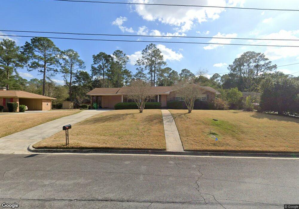
1115 Kimberly Dr Valdosta, GA 31602
Estimated Value: $168,622 - $206,000
--
Bed
2
Baths
1,546
Sq Ft
$126/Sq Ft
Est. Value
About This Home
This home is located at 1115 Kimberly Dr, Valdosta, GA 31602 and is currently estimated at $194,656, approximately $125 per square foot. 1115 Kimberly Dr is a home located in Lowndes County with nearby schools including S.L. Mason Elementary School, Valdosta Middle School, and Valdosta High School.
Ownership History
Date
Name
Owned For
Owner Type
Purchase Details
Closed on
Jun 29, 2023
Sold by
Wiggins Wanda Gail
Bought by
Kenyon William Gerald
Current Estimated Value
Purchase Details
Closed on
Dec 1, 2010
Sold by
Shiver Peggy S
Bought by
Shiver Todd F and Shiver Kelly S
Purchase Details
Closed on
Aug 29, 1985
Bought by
Wiggins Wanda G
Purchase Details
Closed on
Oct 17, 1980
Bought by
Sullins Donald L
Purchase Details
Closed on
Jul 12, 1978
Bought by
Moffatt John J and Moffatt Elza
Purchase Details
Closed on
Dec 30, 1971
Bought by
Fleming Glenn J
Purchase Details
Closed on
Sep 17, 1971
Bought by
Minchew Construction Co
Purchase Details
Closed on
Jan 16, 1969
Bought by
Crane Frank F
Purchase Details
Closed on
Dec 31, 1968
Bought by
Martin Jack S
Create a Home Valuation Report for This Property
The Home Valuation Report is an in-depth analysis detailing your home's value as well as a comparison with similar homes in the area
Home Values in the Area
Average Home Value in this Area
Purchase History
| Date | Buyer | Sale Price | Title Company |
|---|---|---|---|
| Kenyon William Gerald | -- | -- | |
| Shiver Todd F | -- | -- | |
| Wiggins Wanda G | -- | -- | |
| Sullins Donald L | $8,000 | -- | |
| Moffatt John J | $49,800 | -- | |
| Fleming Glenn J | $30,200 | -- | |
| Minchew Construction Co | $5,000 | -- | |
| Crane Frank F | -- | -- | |
| Martin Jack S | -- | -- |
Source: Public Records
Tax History Compared to Growth
Tax History
| Year | Tax Paid | Tax Assessment Tax Assessment Total Assessment is a certain percentage of the fair market value that is determined by local assessors to be the total taxable value of land and additions on the property. | Land | Improvement |
|---|---|---|---|---|
| 2024 | $1,498 | $53,638 | $8,000 | $45,638 |
| 2023 | $1,498 | $53,638 | $8,000 | $45,638 |
| 2022 | $1,485 | $53,948 | $8,000 | $45,948 |
| 2021 | $1,263 | $46,310 | $8,000 | $38,310 |
| 2020 | $1,098 | $40,908 | $8,000 | $32,908 |
| 2019 | $1,097 | $40,908 | $8,000 | $32,908 |
| 2018 | $0 | $40,908 | $8,000 | $32,908 |
| 2017 | $1,119 | $40,908 | $8,000 | $32,908 |
| 2016 | $1,117 | $40,908 | $8,000 | $32,908 |
| 2015 | -- | $45,553 | $8,000 | $37,553 |
| 2014 | $1,196 | $45,553 | $8,000 | $37,553 |
Source: Public Records
Map
Nearby Homes
- 1108 Kimberly Dr
- 1212 Dellwood Dr
- 1104 Linda Dr
- 1211 Gornto Rd
- 5 Dellwood Cir
- 908 Maplewood Dr
- 2502B Jerry Jones Dr Unit 1
- 903 Gornto Rd
- 2208 Dogwood Dr
- 2325 White Oak Dr
- 2214 Park Ln
- 68 Pineridge Dr
- 2211 Jerry Jones Dr
- 2424 Westwood Dr
- 2217 Brighton Place
- 1 Fox Hollow Cir
- 2436 Meadowbrook Dr
- 2432 Meadowbrook Dr
- 2207 S Sherwood Dr
- 2206 White Oak Dr
- 1113 Kimberly Dr
- 1201 Kimberly Dr
- 1204 Linda Dr
- 1206 Linda Dr
- 1202 Linda Dr
- 1111 Kimberly Dr
- 1208 Linda Dr
- 1203 Kimberly Dr
- 1112 Kimberly Dr
- 1200 Linda Dr
- 1202 Kimberly Dr
- 1210 Linda Dr
- 1110 Kimberly Dr
- 1205 Kimberly Dr
- 1205 Linda Dr
- 1207 Linda Dr
- 1204 Kimberly Dr
- 1203 Linda Dr
- 1201 Gornto Rd
- 1113 Gornto Rd