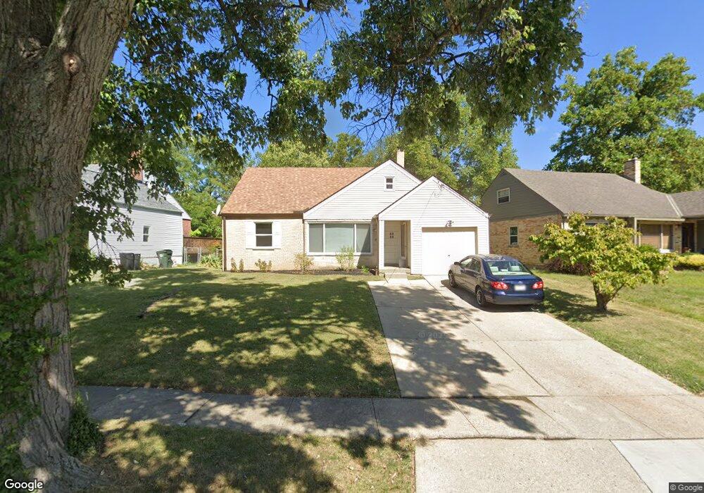
1115 Madeleine Cir Cincinnati, OH 45231
Finneytown NeighborhoodEstimated Value: $156,000 - $216,000
4
Beds
2
Baths
1,728
Sq Ft
$110/Sq Ft
Est. Value
About This Home
This home is located at 1115 Madeleine Cir, Cincinnati, OH 45231 and is currently estimated at $190,257, approximately $110 per square foot. 1115 Madeleine Cir is a home located in Hamilton County with nearby schools including Finneytown Elementary School, Finneytown Secondary Campus, and St. Vivian School.
Ownership History
Date
Name
Owned For
Owner Type
Purchase Details
Closed on
May 20, 2022
Sold by
Marie Malone Donna
Bought by
Parkinson Stanley C and Parkinson Amy
Current Estimated Value
Home Financials for this Owner
Home Financials are based on the most recent Mortgage that was taken out on this home.
Original Mortgage
$93,750
Outstanding Balance
$88,858
Interest Rate
5%
Mortgage Type
New Conventional
Estimated Equity
$101,399
Purchase Details
Closed on
Jan 5, 2017
Sold by
Fleshman Donna
Bought by
Fleshman Joseph F
Purchase Details
Closed on
Nov 7, 1991
Sold by
Watanasin Staporn
Bought by
Fleshman Donna M
Create a Home Valuation Report for This Property
The Home Valuation Report is an in-depth analysis detailing your home's value as well as a comparison with similar homes in the area
Home Values in the Area
Average Home Value in this Area
Purchase History
| Date | Buyer | Sale Price | Title Company |
|---|---|---|---|
| Parkinson Stanley C | $125,000 | Fletcher Michael C | |
| Fleshman Joseph F | -- | -- | |
| Fleshman Donna M | $47,100 | -- |
Source: Public Records
Mortgage History
| Date | Status | Borrower | Loan Amount |
|---|---|---|---|
| Open | Parkinson Stanley C | $93,750 |
Source: Public Records
Tax History Compared to Growth
Tax History
| Year | Tax Paid | Tax Assessment Tax Assessment Total Assessment is a certain percentage of the fair market value that is determined by local assessors to be the total taxable value of land and additions on the property. | Land | Improvement |
|---|---|---|---|---|
| 2024 | $3,146 | $43,751 | $8,775 | $34,976 |
| 2023 | $3,040 | $43,751 | $8,775 | $34,976 |
| 2022 | $3,320 | $34,727 | $8,659 | $26,068 |
| 2021 | $3,325 | $34,727 | $8,659 | $26,068 |
| 2020 | $3,293 | $34,727 | $8,659 | $26,068 |
| 2019 | $3,045 | $29,432 | $7,340 | $22,092 |
| 2018 | $2,818 | $29,432 | $7,340 | $22,092 |
| 2017 | $2,726 | $29,432 | $7,340 | $22,092 |
| 2016 | $2,902 | $30,423 | $7,578 | $22,845 |
| 2015 | $2,874 | $30,423 | $7,578 | $22,845 |
| 2014 | $2,870 | $30,423 | $7,578 | $22,845 |
| 2013 | $2,924 | $32,022 | $7,977 | $24,045 |
Source: Public Records
Map
Nearby Homes
- 1116 Madeleine Cir
- 8693 Mockingbird Ln
- 8663 Mockingbird Ln
- 1125 Murkett Ct
- 8627 Mockingbird Ln
- 1052 Vacationland Dr
- 8622 Mockingbird Ln
- 8772 Balboa Dr
- 8831 Daly Rd
- 8543 Foxcroft Dr
- 8584 Mockingbird Ln
- 1101 Meadowind Ct
- 8579 Daly Rd
- 8925 Monsanto Dr
- 1013 Vacationland Dr
- 8950 Daly Rd
- 1100 Gracewind Ct
- 8840 Grenada Dr
- 1190 Sugartree Ct
- 1029 Bluejay Dr
- 1113 Madeleine Cir
- 1119 Madeleine Cir
- 1121 Madeleine Cir
- 1109 Madeleine Cir
- 1123 Madeleine Cir
- 1107 Madeleine Cir
- 1116 Murkett Ct
- 1114 Murkett Ct
- 1125 Madeleine Cir
- 1114 Madeleine Cir
- 1105 Madeleine Cir
- 1118 Murkett Ct
- 1112 Madeleine Cir
- 1112 Murkett Ct
- 1120 Madeleine Cir
- 1110 Madeleine Cir
- 1122 Madeleine Cir
- 1127 Madeleine Cir
- 1103 Madeleine Cir
- 1108 Madeleine Cir