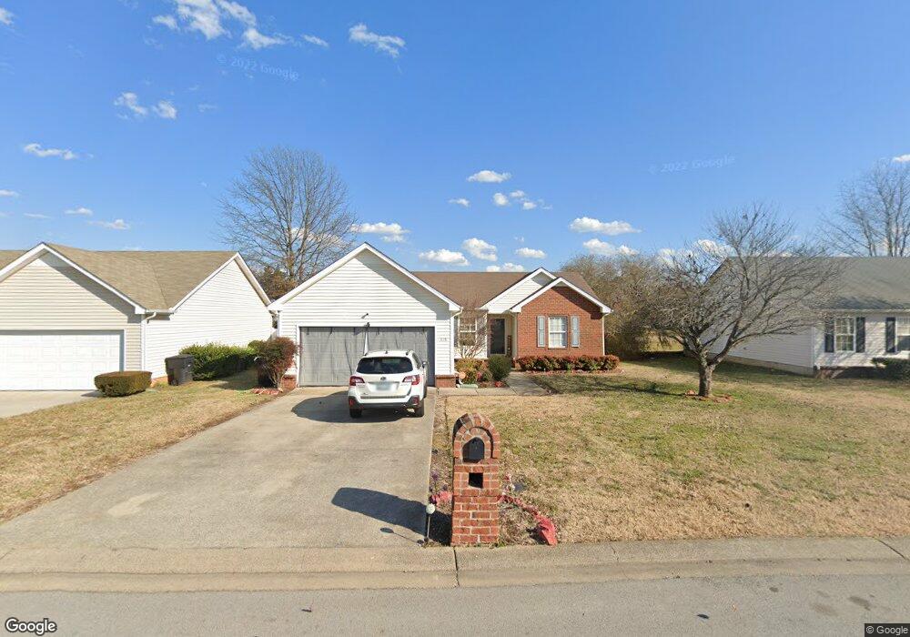
1115 Melvin Dr Murfreesboro, TN 37128
Estimated Value: $295,461 - $332,000
Studio
2
Baths
1,238
Sq Ft
$253/Sq Ft
Est. Value
About This Home
This home is located at 1115 Melvin Dr, Murfreesboro, TN 37128 and is currently estimated at $313,615, approximately $253 per square foot. 1115 Melvin Dr is a home located in Rutherford County with nearby schools including Cason Lane Academy, Rockvale Middle School, and Rockvale High School.
Ownership History
Date
Name
Owned For
Owner Type
Purchase Details
Closed on
Sep 1, 2006
Sold by
Prudential Relocation Inc
Bought by
Lam and Margaret
Current Estimated Value
Home Financials for this Owner
Home Financials are based on the most recent Mortgage that was taken out on this home.
Original Mortgage
$115,200
Outstanding Balance
$67,766
Interest Rate
6.58%
Mortgage Type
Purchase Money Mortgage
Estimated Equity
$245,849
Purchase Details
Closed on
Aug 10, 2006
Sold by
Mcbride Kimberly D
Bought by
Prudenital Relocation Inc
Home Financials for this Owner
Home Financials are based on the most recent Mortgage that was taken out on this home.
Original Mortgage
$115,200
Outstanding Balance
$67,766
Interest Rate
6.58%
Mortgage Type
Purchase Money Mortgage
Estimated Equity
$245,849
Purchase Details
Closed on
Sep 27, 2001
Sold by
Phillip Woodford
Bought by
Mcbride Kimberly D
Home Financials for this Owner
Home Financials are based on the most recent Mortgage that was taken out on this home.
Original Mortgage
$100,826
Interest Rate
6.87%
Create a Home Valuation Report for This Property
The Home Valuation Report is an in-depth analysis detailing your home's value as well as a comparison with similar homes in the area
Home Values in the Area
Average Home Value in this Area
Purchase History
| Date | Buyer | Sale Price | Title Company |
|---|---|---|---|
| Lam | $128,000 | -- | |
| Prudenital Relocation Inc | $128,000 | -- | |
| Mcbride Kimberly D | $101,900 | -- |
Source: Public Records
Mortgage History
| Date | Status | Borrower | Loan Amount |
|---|---|---|---|
| Open | Mcbride Kimberly D | $115,200 | |
| Previous Owner | Mcbride Kimberly D | $100,826 |
Source: Public Records
Tax History
| Year | Tax Paid | Tax Assessment Tax Assessment Total Assessment is a certain percentage of the fair market value that is determined by local assessors to be the total taxable value of land and additions on the property. | Land | Improvement |
|---|---|---|---|---|
| 2025 | $1,779 | $62,875 | $13,750 | $49,125 |
| 2024 | $1,779 | $62,875 | $13,750 | $49,125 |
| 2023 | $1,180 | $62,875 | $13,750 | $49,125 |
| 2022 | $1,016 | $62,875 | $13,750 | $49,125 |
| 2021 | $1,018 | $45,875 | $9,375 | $36,500 |
| 2020 | $1,018 | $45,875 | $9,375 | $36,500 |
| 2019 | $1,018 | $45,875 | $9,375 | $36,500 |
| 2018 | $1,399 | $45,875 | $0 | $0 |
| 2017 | $1,264 | $32,525 | $0 | $0 |
| 2016 | $1,264 | $32,525 | $0 | $0 |
| 2015 | $1,264 | $32,525 | $0 | $0 |
| 2014 | $809 | $32,525 | $0 | $0 |
| 2013 | -- | $33,100 | $0 | $0 |
Source: Public Records
Map
Nearby Homes
- 3012 Roscommon Dr
- 2729 Stonehedge Dr
- 1312 Azure Way
- 2905 Stonehedge Dr
- 3050 Weybridge Dr
- 1242 Mac Duff Dr
- 1521 Carrick Dr
- 1447 Doc Johns Blvd
- 807 River Rock Blvd
- 1430 Amal Dr
- 3511 Quaker Ct
- 3337 Alta Ln
- 1715 Locerbie Dr
- 2526 Tiffany Ct
- 3352 Alta Ln
- 412 Conhocken Ct
- 3144 Sherborne Ct
- 1810 Venada Trail
- 543 River Rock Blvd
- 2123 River Chase Dr
- 1111 Melvin Dr
- 1119 Melvin Dr
- 1123 Melvin Dr
- 1107 Melvin Dr
- 2829 Roscommon Dr
- 1118 Melvin Dr
- 1122 Melvin Dr
- 1114 Melvin Dr
- 2825 Roscommon Dr
- 1127 Melvin Dr
- 1110 Melvin Dr
- 1126 Melvin Dr
- 2821 Roscommon Dr
- 1131 Melvin Dr
- 1175 Saint Andrews Dr
- 1130 Melvin Dr
- 2727 Roscommon Dr
- 2832 Roscommon Dr
- 2836 Roscommon Dr
- 1179 Saint Andrews Dr
Your Personal Tour Guide
Ask me questions while you tour the home.