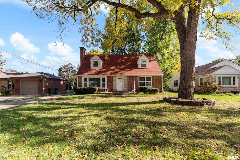
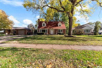
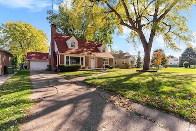
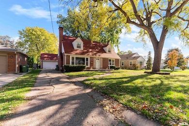
1115 N 4th St Clinton, IA 52732
Estimated payment $1,084/month
Highlights
- Hot Property
- Forced Air Heating and Cooling System
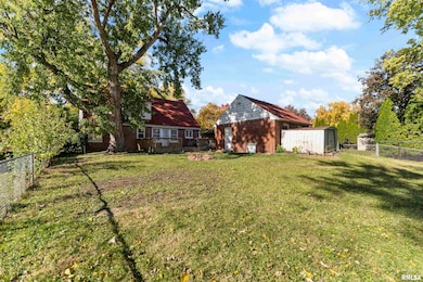
- Level Lot
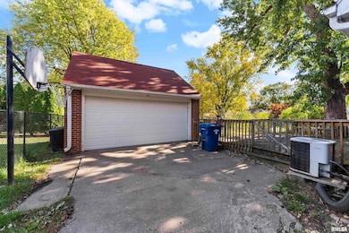
- 2 Car Detached Garage
- Dining Room
- Wood Burning Fireplace
About This Home
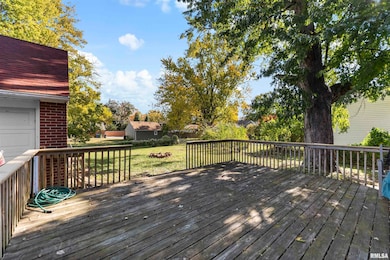
Charming 4-Bedroom Cape Cod Style Home in Clinton! Welcome to 1115 N 4th Street, Clinton, IA! This beautiful Cape Cod Style home features 4 bedrooms and 2 full bathrooms, perfect for anyone who loves space and comfort. Enjoy the warmth of hardwood floors and cozy up by the fireplace in the living room. The main level features the kitchen, informal dining room open to the living room and two bedrooms and a full bathroom. Upstairs there are two bedrooms and a full bathroom tucked into the eves of the roof giving each room plenty of character! The basement is ready to be finished, offering endless possibilities for an extra living area, home gym, or entertainment space. The 2-car garage provides convenience and storage, while the fenced-in yard ensures privacy and safety for kids and pets. Step outside onto the large back deck—perfect for summer barbecues or relaxing evenings. With plenty of storage throughout, this home combines functionality with classic Cape Cod charm. Don’t miss the opportunity to make this move-in-ready house your new home!
Listing Agent
Mel Foster Co. Clinton Brokerage Phone: 563-249-9170 License #B62454000/471.021655 Listed on: 10/31/2025

Open House Schedule
-
Sunday, November 16, 20251:00 to 2:00 pm11/16/2025 1:00:00 PM +00:0011/16/2025 2:00:00 PM +00:00Add to Calendar
Home Details
Home Type
- Single Family
Est. Annual Taxes
- $2,912
Year Built
- Built in 1949
Lot Details
- 9,583 Sq Ft Lot
- Lot Dimensions are 66x143
- Level Lot
Parking
- 2 Car Detached Garage
Home Design
- Brick Exterior Construction
- Shingle Roof
Interior Spaces
- 1,648 Sq Ft Home
- Wood Burning Fireplace
- Living Room with Fireplace
- Dining Room
- Basement Fills Entire Space Under The House
Bedrooms and Bathrooms
- 4 Bedrooms
- 2 Full Bathrooms
Schools
- Clinton High School
Utilities
- Forced Air Heating and Cooling System
- Heating System Uses Natural Gas
Listing and Financial Details
- Assessor Parcel Number 8405640000
Map
Home Values in the Area
Average Home Value in this Area
Tax History
| Year | Tax Paid | Tax Assessment Tax Assessment Total Assessment is a certain percentage of the fair market value that is determined by local assessors to be the total taxable value of land and additions on the property. | Land | Improvement |
|---|---|---|---|---|
| 2025 | $2,912 | $166,630 | $21,050 | $145,580 |
| 2024 | $2,912 | $156,420 | $21,050 | $135,370 |
| 2023 | $2,870 | $156,420 | $21,050 | $135,370 |
| 2022 | $2,527 | $110,115 | $12,664 | $97,451 |
| 2021 | $2,542 | $110,115 | $12,664 | $97,451 |
| 2020 | $2,542 | $110,115 | $12,664 | $97,451 |
| 2019 | $2,624 | $110,115 | $0 | $0 |
| 2018 | $2,556 | $110,115 | $0 | $0 |
| 2017 | $2,556 | $110,115 | $0 | $0 |
| 2016 | $2,544 | $110,115 | $0 | $0 |
| 2015 | $2,544 | $110,115 | $0 | $0 |
| 2014 | $2,554 | $110,115 | $0 | $0 |
| 2013 | $2,518 | $0 | $0 | $0 |
Property History
| Date | Event | Price | List to Sale | Price per Sq Ft |
|---|---|---|---|---|
| 10/31/2025 10/31/25 | For Sale | $159,900 | -- | $97 / Sq Ft |
Purchase History
| Date | Type | Sale Price | Title Company |
|---|---|---|---|
| Joint Tenancy Deed | $130,000 | None Available |
Mortgage History
| Date | Status | Loan Amount | Loan Type |
|---|---|---|---|
| Open | $132,560 | Adjustable Rate Mortgage/ARM |
Source: RMLS Alliance
MLS Number: QC4268942
APN: 84-0564-0000
Disclaimer: Certain information contained herein is derived from information provided by parties other than Homes.com. All information provided is deemed reliable, but is not guaranteed to be accurate and should be independently verified.
![]() IDX information is provided exclusively for personal, non-commercial use, and may not be used for any purpose other than to identify prospective properties consumers may be interested in purchasing. Information is deemed reliable but not guaranteed.
IDX information is provided exclusively for personal, non-commercial use, and may not be used for any purpose other than to identify prospective properties consumers may be interested in purchasing. Information is deemed reliable but not guaranteed.
- 1022 Pershing Blvd
- 924 N 3rd St
- 923 Pershing Blvd
- 814 Park Place
- 806 Park Place
- 811 Pershing Blvd
- 728 Park Place
- 582 Breezy Point Dr
- 229 8th Ave N
- 1423 Pershing Blvd
- 591 Breezy Point Dr
- 1522 N 4th St
- 515 Woodland Dr
- 700 N Bluff Blvd
- 814 13th Ave N Unit 1-C
- 515 16th Ave N
- 511 16th Ave N
- 620 N 4th St
- 348 6th Ave N
- 320 16th Ave N
- 847 Gateway Ave
- 907 Ikes Peak Rd
- 751 2nd Ave S
- 2582 Friendship Trail
- 2575 Gates Dr
- 1215 7th Ave
- 116 E Main St Unit 2
- 511 E Main St
- 509 9th St
- 509 9th St Unit 307
- 509 9th St Unit 304
- 111 Ewing St Unit 111 Ewing Upper Unit
- 206 E Washington St
- 1444 Dodge St
- 723 Cox Ct
- 54 Cobblestone Ln
- 73 Manor Dr
- 6817 Timber Ct
- 7118 International Dr
- 7216-7220 Grove Crossing