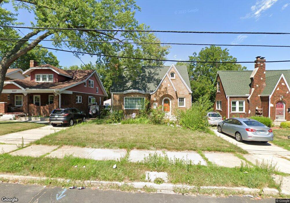
1115 W Loucks Ave Peoria, IL 61604
West Bluff NeighborhoodEstimated Value: $133,000 - $162,000
3
Beds
2
Baths
2,683
Sq Ft
$57/Sq Ft
Est. Value
About This Home
This home is located at 1115 W Loucks Ave, Peoria, IL 61604 and is currently estimated at $153,556, approximately $57 per square foot. 1115 W Loucks Ave is a home located in Peoria County with nearby schools including Dr. C. T. Vivian Primary School, Sterling Middle School, and Peoria High School.
Ownership History
Date
Name
Owned For
Owner Type
Purchase Details
Closed on
Mar 31, 2021
Sold by
Grant Dale G
Bought by
Mills Josilynne
Current Estimated Value
Home Financials for this Owner
Home Financials are based on the most recent Mortgage that was taken out on this home.
Original Mortgage
$102,116
Outstanding Balance
$92,020
Interest Rate
2.88%
Mortgage Type
FHA
Estimated Equity
$61,536
Purchase Details
Closed on
Jul 27, 1999
Bought by
Grant Dale G and Grant Elizabeth A
Create a Home Valuation Report for This Property
The Home Valuation Report is an in-depth analysis detailing your home's value as well as a comparison with similar homes in the area
Home Values in the Area
Average Home Value in this Area
Purchase History
| Date | Buyer | Sale Price | Title Company |
|---|---|---|---|
| Mills Josilynne | $104,000 | Elias Meginnes & Seghetti Pc | |
| Mills Josilynne | $104,000 | Elias Meginnes & Seghetti Pc | |
| Grant Dale G | $105,000 | -- |
Source: Public Records
Mortgage History
| Date | Status | Borrower | Loan Amount |
|---|---|---|---|
| Open | Mills Josilynne | $102,116 | |
| Closed | Mills Josilynne | $102,116 |
Source: Public Records
Tax History Compared to Growth
Tax History
| Year | Tax Paid | Tax Assessment Tax Assessment Total Assessment is a certain percentage of the fair market value that is determined by local assessors to be the total taxable value of land and additions on the property. | Land | Improvement |
|---|---|---|---|---|
| 2024 | $3,278 | $42,240 | $6,800 | $35,440 |
| 2023 | $3,081 | $38,750 | $6,240 | $32,510 |
| 2022 | $3,203 | $39,210 | $5,950 | $33,260 |
| 2021 | $3,713 | $37,350 | $5,670 | $31,680 |
| 2020 | $3,705 | $36,980 | $5,610 | $31,370 |
| 2019 | $3,759 | $37,730 | $5,720 | $32,010 |
| 2018 | $3,768 | $38,690 | $5,770 | $32,920 |
| 2017 | $3,739 | $39,080 | $5,830 | $33,250 |
| 2016 | $3,090 | $39,080 | $5,830 | $33,250 |
| 2015 | $2,797 | $38,320 | $5,720 | $32,600 |
| 2014 | $2,804 | $36,380 | $5,430 | $30,950 |
| 2013 | -- | $36,830 | $5,500 | $31,330 |
Source: Public Records
Map
Nearby Homes
- 3026 N Parish Ave
- 1105 W Gilbert Ave
- 3121 N Isabell Ave
- 1017 W Willcox Ave
- 2905 N University St
- 2908 N Saint Philomena Ct
- 1013 W Hanssler Place
- 723 W Melbourne Ave
- 3203 N Biltmore Ave
- 720 W Corrington Ave
- 718 W Corrington Ave
- 3007 N Sheridan Rd
- 810 W Hanssler Place
- 1207 W Mcclure Ave
- 604 W Forrest Hill Ave
- 609 W Hudson St
- 617 W Hanssler Place
- 807 W Mcclure Ave
- 502 W Melbourne Ave
- 518 W Willcox Ave
- 1117 W Loucks Ave
- 1113 W Loucks Ave
- 1109 W Loucks Ave
- 3015 N Parish Ave
- 1119 W Loucks Ave
- 1105 W Loucks Ave
- 3017 N Parish Ave
- 3016 N Isabell Ave
- 1108 W Loucks Ave
- 1122 W Loucks Ave
- 3021 N Parish Ave
- 3020 N Isabell Ave
- 1203 W Loucks Ave
- 3023 N Parish Ave
- 1104 W Loucks Ave
- 1124 W Loucks Ave
- 3024 N Isabell Ave
- 1106 W Forrest Hill Ave
- 1102 W Loucks Ave
- 1209 W Loucks Ave