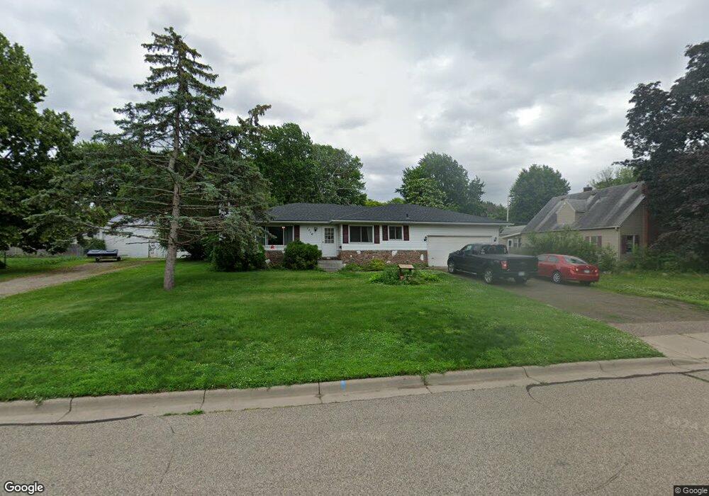
1116 Ashland Ave Saint Paul Park, MN 55071
Estimated Value: $338,000 - $361,000
3
Beds
2
Baths
1,264
Sq Ft
$276/Sq Ft
Est. Value
About This Home
This home is located at 1116 Ashland Ave, Saint Paul Park, MN 55071 and is currently estimated at $348,841, approximately $275 per square foot. 1116 Ashland Ave is a home located in Washington County with nearby schools including Pullman Elementary School, Oltman Middle School, and Park Senior High School.
Ownership History
Date
Name
Owned For
Owner Type
Purchase Details
Closed on
May 27, 1999
Sold by
Velez Felix A and Velez Rosa
Bought by
Johnson Blaise and Johnson Sheri L
Current Estimated Value
Purchase Details
Closed on
Dec 15, 1995
Sold by
Curti Kostelecky
Bought by
Velez Felix A and Velez Rosa
Create a Home Valuation Report for This Property
The Home Valuation Report is an in-depth analysis detailing your home's value as well as a comparison with similar homes in the area
Home Values in the Area
Average Home Value in this Area
Purchase History
| Date | Buyer | Sale Price | Title Company |
|---|---|---|---|
| Johnson Blaise | $149,500 | -- | |
| Velez Felix A | $95,000 | -- |
Source: Public Records
Mortgage History
| Date | Status | Borrower | Loan Amount |
|---|---|---|---|
| Open | Johnson Sheri Lynn | $200,447 | |
| Closed | Johnson Sheri Lynn | $177,971 | |
| Closed | Johnson Sheri Lynn | $207,000 | |
| Closed | Johnson Sheri Lynn | $197,000 | |
| Closed | Johnson Sheri Lynn | $25,000 | |
| Closed | Johnson Sheri Lynn | $199,800 |
Source: Public Records
Tax History Compared to Growth
Tax History
| Year | Tax Paid | Tax Assessment Tax Assessment Total Assessment is a certain percentage of the fair market value that is determined by local assessors to be the total taxable value of land and additions on the property. | Land | Improvement |
|---|---|---|---|---|
| 2024 | $4,478 | $347,400 | $90,000 | $257,400 |
| 2023 | $4,478 | $355,300 | $106,900 | $248,400 |
| 2022 | $3,924 | $341,600 | $106,900 | $234,700 |
| 2021 | $3,866 | $286,700 | $89,000 | $197,700 |
| 2020 | $3,612 | $287,100 | $99,000 | $188,100 |
| 2019 | $3,260 | $266,300 | $74,000 | $192,300 |
| 2018 | $3,116 | $229,200 | $50,000 | $179,200 |
| 2017 | $3,070 | $219,800 | $50,000 | $169,800 |
| 2016 | $2,936 | $221,200 | $55,000 | $166,200 |
| 2015 | $2,876 | $202,900 | $50,700 | $152,200 |
| 2013 | -- | $169,800 | $40,600 | $129,200 |
Source: Public Records
Map
Nearby Homes
- 1200 Laurel Ave
- 1200 Summit Ave
- 1033 Portland Ave
- 1313 11th Ave
- 816 Holley Ave
- 1121 5th St
- 1227 5th St
- 1601 14th Ave
- 801 Summit Ave
- 1020 Gary Dr
- 730 Pleasant Ave
- 1142 1st St
- 11XX 1st St
- 928 1st St
- 6467 82nd St S
- TBD Broadway Ave
- 10503 Glenbrook Ave S
- 10406 Glenbrook Ave S
- 10502 Glenbrook Ave S
- 10508 Glenbrook Ave S
- 1126 1126 Ashland-Avenue-
- 1126 Ashland Ave
- 1108 1108 Ashland-Avenue-
- 1108 Ashland Ave
- 1130 Ashland Ave
- 1109 Laurel Ave
- 1125 Laurel Ave
- 1105 Laurel Ave
- 1100 1100 Ashland Ave
- 1123 Ashland Ave
- 1101 Laurel Ave
- 1133 Laurel Ave
- 1109 Ashland Ave
- 1129 1129 Ashland Ave
- 1129 Ashland Ave
- 1124 1124 Laurel Ave
- 1101 Ashland Ave
- 1144 Ashland Ave
- 1139 Laurel Ave
- 1139 Ashland Ave