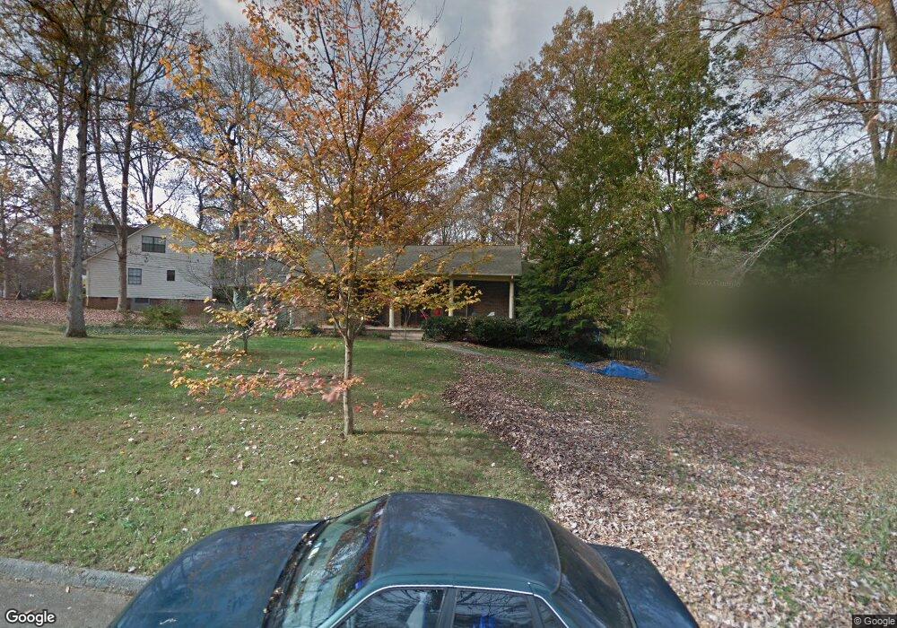
1117 Burning Tree Ln Knoxville, TN 37923
West Knoxville NeighborhoodEstimated Value: $458,204 - $476,000
4
Beds
2
Baths
2,042
Sq Ft
$230/Sq Ft
Est. Value
About This Home
This home is located at 1117 Burning Tree Ln, Knoxville, TN 37923 and is currently estimated at $469,051, approximately $229 per square foot. 1117 Burning Tree Ln is a home located in Knox County with nearby schools including Cedar Bluff Elementary School, Cedar Bluff Middle School, and Hardin Valley Academy.
Ownership History
Date
Name
Owned For
Owner Type
Purchase Details
Closed on
May 24, 1999
Sold by
Neil Lane Steven and Sinclair Beverly J
Bought by
Frizzell Mark Dillard and Frizzell Marjorie Dietz
Current Estimated Value
Home Financials for this Owner
Home Financials are based on the most recent Mortgage that was taken out on this home.
Original Mortgage
$88,000
Outstanding Balance
$22,418
Interest Rate
6.87%
Mortgage Type
Purchase Money Mortgage
Estimated Equity
$446,633
Create a Home Valuation Report for This Property
The Home Valuation Report is an in-depth analysis detailing your home's value as well as a comparison with similar homes in the area
Home Values in the Area
Average Home Value in this Area
Purchase History
| Date | Buyer | Sale Price | Title Company |
|---|---|---|---|
| Frizzell Mark Dillard | $148,000 | -- |
Source: Public Records
Mortgage History
| Date | Status | Borrower | Loan Amount |
|---|---|---|---|
| Open | Frizzell Mark Dillard | $88,000 |
Source: Public Records
Tax History Compared to Growth
Tax History
| Year | Tax Paid | Tax Assessment Tax Assessment Total Assessment is a certain percentage of the fair market value that is determined by local assessors to be the total taxable value of land and additions on the property. | Land | Improvement |
|---|---|---|---|---|
| 2024 | $118 | $97,475 | $0 | $0 |
| 2023 | $1,515 | $97,475 | $0 | $0 |
| 2022 | $1,515 | $97,475 | $0 | $0 |
| 2021 | $1,287 | $60,700 | $0 | $0 |
| 2020 | $1,287 | $60,700 | $0 | $0 |
| 2019 | $1,287 | $60,700 | $0 | $0 |
| 2018 | $1,287 | $60,700 | $0 | $0 |
| 2017 | $1,287 | $60,700 | $0 | $0 |
| 2016 | $1,312 | $0 | $0 | $0 |
| 2015 | $1,312 | $0 | $0 | $0 |
| 2014 | $1,312 | $0 | $0 | $0 |
Source: Public Records
Map
Nearby Homes
- 1000 Harrogate Dr
- 915 Miles Ct
- 1104 Burning Tree Ln
- 1246 Edenbridge Way
- 10109 Delle Meade Dr
- 10002 Mccormick Place Unit 3
- 9970 Hummingbird Ln
- 10027 Mccormick Place
- 10108 Delle Meade Dr
- 1101 Edenbridge Way
- 1220 Kirby Glen Dr
- 9852 Chesney Hills Ln
- 10030 Double Tree Rd
- 1017 Sanders Rd
- 934 Ethans Glen Dr
- 1325 Sloping Hill Ln
- 838 Ethans Glen Dr
- 1300 Whittbier Dr
- 10300 Mantooth Ln
- 813 Naples Rd
- 1115 Burning Tree Ln
- 1121 Burning Tree Ln
- 1113 Burning Tree Ln
- 1123 Burning Tree Ln
- 1120 Burning Tree Ln
- 1118 Burning Tree Ln
- 1116 Burning Tree Ln
- 1108 Rain Tree Rd
- 1110 Rain Tree Rd
- 1122 Burning Tree Ln
- 1111 Burning Tree Ln
- 1112 Rain Tree Rd
- 1104 Rain Tree Rd
- 1124 Burning Tree Ln
- 1125 Burning Tree Ln
- 1114 Burning Tree Ln
- 1112 Burning Tree Ln
- 1025 Glennshire Dr
- 1021 Glennshire Dr
- 1017 Glennshire Dr