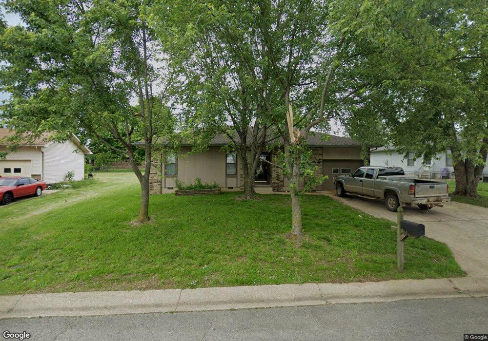
1117 Fowler Rd Lebanon, MO 65536
Estimated Value: $149,086 - $225,000
--
Bed
--
Bath
1,286
Sq Ft
$140/Sq Ft
Est. Value
About This Home
This home is located at 1117 Fowler Rd, Lebanon, MO 65536 and is currently estimated at $180,022, approximately $139 per square foot. 1117 Fowler Rd is a home located in Laclede County with nearby schools including Joe D. Esther Elementary School, Maplecrest Elementary School, and Boswell Elementary School.
Ownership History
Date
Name
Owned For
Owner Type
Purchase Details
Closed on
Nov 16, 2018
Sold by
Mcculloch Dennis and Mcculloch Patricia
Bought by
Prestige Worldwide Rentals Llc
Current Estimated Value
Home Financials for this Owner
Home Financials are based on the most recent Mortgage that was taken out on this home.
Original Mortgage
$104,000
Outstanding Balance
$91,260
Interest Rate
4.7%
Mortgage Type
Future Advance Clause Open End Mortgage
Estimated Equity
$88,762
Purchase Details
Closed on
Aug 20, 2012
Sold by
Crisp Michael M and Crisp Stephanie M
Bought by
Mcculloch Dennis and Mcculloch Patricia
Create a Home Valuation Report for This Property
The Home Valuation Report is an in-depth analysis detailing your home's value as well as a comparison with similar homes in the area
Home Values in the Area
Average Home Value in this Area
Purchase History
| Date | Buyer | Sale Price | Title Company |
|---|---|---|---|
| Prestige Worldwide Rentals Llc | -- | None Available | |
| Mcculloch Dennis | $57,500 | None Available |
Source: Public Records
Mortgage History
| Date | Status | Borrower | Loan Amount |
|---|---|---|---|
| Open | Prestige Worldwide Rentals Llc | $104,000 |
Source: Public Records
Tax History Compared to Growth
Tax History
| Year | Tax Paid | Tax Assessment Tax Assessment Total Assessment is a certain percentage of the fair market value that is determined by local assessors to be the total taxable value of land and additions on the property. | Land | Improvement |
|---|---|---|---|---|
| 2025 | $626 | $12,200 | $0 | $0 |
| 2024 | $626 | $10,980 | $0 | $0 |
| 2023 | $645 | $10,980 | $0 | $0 |
| 2022 | $601 | $10,980 | $0 | $0 |
| 2021 | $662 | $10,982 | $2,033 | $8,949 |
| 2020 | $665 | $10,982 | $2,033 | $8,949 |
| 2019 | $637 | $10,980 | $2,030 | $8,950 |
| 2018 | $583 | $10,690 | $2,030 | $8,660 |
| 2017 | $553 | $10,700 | $0 | $0 |
| 2016 | $553 | $10,700 | $0 | $0 |
| 2015 | $553 | $10,700 | $0 | $0 |
| 2014 | $553 | $10,700 | $0 | $0 |
| 2013 | -- | $10,700 | $0 | $0 |
Source: Public Records
Map
Nearby Homes
- TBD Phillips Dr
- 000 U S Route 66
- 1507 Finn Dr
- 11 Sunrise Dr
- 1511 Rader Dr
- 1515 Rader Dr
- 2176 Beck Ln
- 0 Ivey Ln Unit MIS25060889
- 2133 Cedarwood Ct
- 2101 Emmy Ave
- 2301 Cranberry Ln
- 517 Holly St
- 11 Willow Ln
- 225 Garfield St
- 888 W 2nd St
- 216 Coach Rd
- 704 W 2nd St
- 100 State Highway 32
- 14300 State Highway 32
- 000 #25 U S Route 66