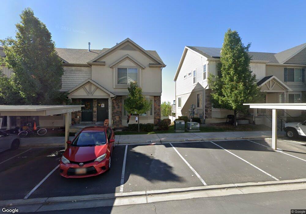
1117 N 1880 W Provo, UT 84604
Rivergrove NeighborhoodEstimated Value: $394,000 - $410,701
3
Beds
3
Baths
2,126
Sq Ft
$189/Sq Ft
Est. Value
About This Home
This home is located at 1117 N 1880 W, Provo, UT 84604 and is currently estimated at $401,925, approximately $189 per square foot. 1117 N 1880 W is a home located in Utah County with nearby schools including Westridge Elementary School, Dixon Middle School, and Provo High School.
Ownership History
Date
Name
Owned For
Owner Type
Purchase Details
Closed on
Apr 16, 2015
Sold by
Georgetown Development Inc
Bought by
Collins John Matthew and Collins Megan Marie
Current Estimated Value
Home Financials for this Owner
Home Financials are based on the most recent Mortgage that was taken out on this home.
Original Mortgage
$168,000
Outstanding Balance
$129,141
Interest Rate
3.7%
Mortgage Type
New Conventional
Estimated Equity
$272,784
Create a Home Valuation Report for This Property
The Home Valuation Report is an in-depth analysis detailing your home's value as well as a comparison with similar homes in the area
Home Values in the Area
Average Home Value in this Area
Purchase History
| Date | Buyer | Sale Price | Title Company |
|---|---|---|---|
| Collins John Matthew | -- | United West Title |
Source: Public Records
Mortgage History
| Date | Status | Borrower | Loan Amount |
|---|---|---|---|
| Open | Collins John Matthew | $168,000 |
Source: Public Records
Tax History Compared to Growth
Tax History
| Year | Tax Paid | Tax Assessment Tax Assessment Total Assessment is a certain percentage of the fair market value that is determined by local assessors to be the total taxable value of land and additions on the property. | Land | Improvement |
|---|---|---|---|---|
| 2025 | $2,113 | $210,155 | $56,200 | $325,900 |
| 2024 | $2,113 | $208,010 | $0 | $0 |
| 2023 | $2,040 | $197,945 | $0 | $0 |
| 2022 | $2,131 | $208,560 | $0 | $0 |
| 2021 | $1,671 | $285,100 | $42,800 | $242,300 |
| 2020 | $1,643 | $262,800 | $39,400 | $223,400 |
| 2019 | $1,563 | $260,000 | $33,800 | $226,200 |
| 2018 | $1,410 | $238,000 | $29,000 | $209,000 |
| 2017 | $1,305 | $121,000 | $0 | $0 |
| 2016 | $1,336 | $115,500 | $0 | $0 |
| 2015 | $482 | $42,130 | $0 | $0 |
| 2014 | $308 | $28,000 | $0 | $0 |
Source: Public Records
Map
Nearby Homes
- 1127 Independence Ave
- 2043 W 1100 N
- 2075 W 1080 N
- 1893 Cascade Dr
- 962 Independence Ave
- 927 Independence Ave
- 932 N 1760 W
- 2397 W 1160 N
- 1503 N 1980 W
- 1620 W 1000 N
- 1616 N 2100 W
- 1574 W 1400 N
- 1682 N 2250 W
- 582 N 2310 W
- 1679 N 2250 W
- 1471 W 1460 N
- 2216 W 480 N
- 2316 W 510 N
- 1475 Arthur Dr Unit 7A
- 2711 W 1390 N
- 1121 N 1880 W
- 1113 N 1880 W
- 1133 N 1880 W Unit 141
- 1133 N 1880 W
- 1137 N 1880 W
- 2054 W 1100 N
- 2050 W 1100 N
- 2062 W 1100 N
- 1141 N 1880 W Unit 143
- 1141 N 1880 W
- 2066 W 1100 N
- 1115 Independence Ave Unit 147C
- 1115 Independence Ave
- 1119 Independence Ave Unit 148
- 1123 Independence Ave Unit 149
- 1127 Independence Ave Unit 150
- 2070 W 1100 N
- 1145 N 1880 W
- 1131 Independence Ave Unit 151
- 1131 Independence Ave