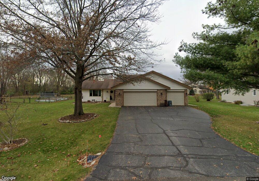
1118 Aldrin Rd Rockton, IL 61072
Estimated Value: $264,000 - $300,000
3
Beds
3
Baths
1,379
Sq Ft
$204/Sq Ft
Est. Value
About This Home
This home is located at 1118 Aldrin Rd, Rockton, IL 61072 and is currently estimated at $280,891, approximately $203 per square foot. 1118 Aldrin Rd is a home located in Winnebago County with nearby schools including Rockton Elementary School, Whitman Post Elementary School, and Stephen Mack Middle School.
Ownership History
Date
Name
Owned For
Owner Type
Purchase Details
Closed on
Dec 13, 1993
Bought by
Rieder Jerome R and Rieder Debora M
Current Estimated Value
Create a Home Valuation Report for This Property
The Home Valuation Report is an in-depth analysis detailing your home's value as well as a comparison with similar homes in the area
Home Values in the Area
Average Home Value in this Area
Purchase History
| Date | Buyer | Sale Price | Title Company |
|---|---|---|---|
| Rieder Jerome R | $116,000 | -- |
Source: Public Records
Tax History
| Year | Tax Paid | Tax Assessment Tax Assessment Total Assessment is a certain percentage of the fair market value that is determined by local assessors to be the total taxable value of land and additions on the property. | Land | Improvement |
|---|---|---|---|---|
| 2024 | $5,619 | $82,340 | $12,297 | $70,043 |
| 2023 | $5,291 | $73,420 | $10,965 | $62,455 |
| 2022 | $2,867 | $67,074 | $10,017 | $57,057 |
| 2021 | $2,930 | $62,768 | $9,374 | $53,394 |
| 2020 | $2,991 | $60,774 | $9,076 | $51,698 |
| 2019 | $3,061 | $58,544 | $8,743 | $49,801 |
| 2018 | $3,365 | $47,671 | $10,576 | $37,095 |
| 2017 | $3,185 | $45,692 | $10,137 | $35,555 |
| 2016 | $3,145 | $44,194 | $9,805 | $34,389 |
| 2015 | $3,602 | $43,184 | $9,581 | $33,603 |
| 2014 | $3,739 | $43,184 | $9,581 | $33,603 |
Source: Public Records
Map
Nearby Homes
- 304 Bunn Dr
- 537 Byrnes Dr
- 328 Harwich Place
- 127 W River St
- 1XX W River St
- 611 Lanae Way
- 14049 Hanna Way
- 13802 Dorr Rd
- 0 School St
- 217 W Franklin St
- 227 Foxfire Place
- 1897 Wyndham Ln
- 2096 Edge Rock Rd
- 304 Trading Post Ct
- 12715 Waltham Close
- 0000-03 Nautical Ct
- 0000-04 Nautical Ct
- 11641 Deacon Dr
- 11785 Balsa Ln
- 12029 Granite Ct
Your Personal Tour Guide
Ask me questions while you tour the home.