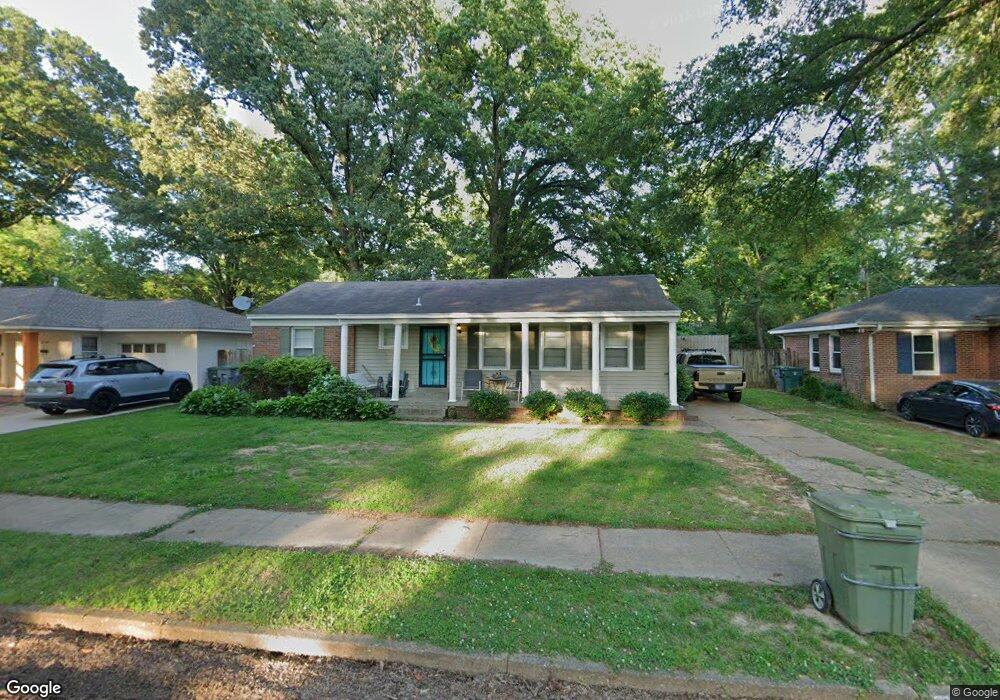
1118 Dearing Rd Memphis, TN 38117
Colonial Acres NeighborhoodEstimated Value: $174,000 - $223,968
3
Beds
2
Baths
1,263
Sq Ft
$164/Sq Ft
Est. Value
About This Home
This home is located at 1118 Dearing Rd, Memphis, TN 38117 and is currently estimated at $206,992, approximately $163 per square foot. 1118 Dearing Rd is a home located in Shelby County with nearby schools including Sea Isle Elementary School, Colonial Middle, and Overton High.
Ownership History
Date
Name
Owned For
Owner Type
Purchase Details
Closed on
Feb 29, 2000
Sold by
Porter Mary R
Bought by
Roberts Nicholas A and Keen Amy L
Current Estimated Value
Home Financials for this Owner
Home Financials are based on the most recent Mortgage that was taken out on this home.
Original Mortgage
$89,954
Outstanding Balance
$30,486
Interest Rate
8.29%
Mortgage Type
FHA
Estimated Equity
$176,506
Create a Home Valuation Report for This Property
The Home Valuation Report is an in-depth analysis detailing your home's value as well as a comparison with similar homes in the area
Home Values in the Area
Average Home Value in this Area
Purchase History
| Date | Buyer | Sale Price | Title Company |
|---|---|---|---|
| Roberts Nicholas A | $90,000 | Stewart Title |
Source: Public Records
Mortgage History
| Date | Status | Borrower | Loan Amount |
|---|---|---|---|
| Open | Roberts Nicholas A | $89,954 |
Source: Public Records
Tax History Compared to Growth
Tax History
| Year | Tax Paid | Tax Assessment Tax Assessment Total Assessment is a certain percentage of the fair market value that is determined by local assessors to be the total taxable value of land and additions on the property. | Land | Improvement |
|---|---|---|---|---|
| 2025 | $1,754 | $53,100 | $11,250 | $41,850 |
| 2024 | $1,754 | $51,750 | $9,050 | $42,700 |
| 2023 | $3,152 | $51,750 | $9,050 | $42,700 |
| 2022 | $3,152 | $51,750 | $9,050 | $42,700 |
| 2021 | $3,189 | $51,750 | $9,050 | $42,700 |
| 2020 | $2,487 | $34,325 | $9,050 | $25,275 |
| 2019 | $2,487 | $34,325 | $9,050 | $25,275 |
| 2018 | $2,487 | $34,325 | $9,050 | $25,275 |
| 2017 | $1,411 | $34,325 | $9,050 | $25,275 |
| 2016 | $1,441 | $32,975 | $0 | $0 |
| 2014 | $1,441 | $32,975 | $0 | $0 |
Source: Public Records
Map
Nearby Homes
- 1160 W Perkins Rd
- 4784 Marlin Ave
- 1086 Perkins Terrace
- 1014 S Perkins Rd
- 1229 S Perkins Rd
- 1258 S Perkins Rd
- 4841 Dee Rd
- 1263 S Perkins Rd
- 1063 Woodview Dr
- 4804 Hummingbird Ln
- 4844 Welchshire Ave
- 4680 Crossover Ln
- 1089 Ivy Rd
- 4803 Hummingbird Ln
- 4861 Parkside Ave
- 4888 Dee Rd
- 4614 Perkins Cove
- 4539 Kings Park Rd
- 4908 Mockingbird Ln
- 4576 Amboy Rd
- 1112 Dearing Rd
- 1126 Dearing Rd
- 1117 Marcia Rd
- 1104 Dearing Rd
- 1134 Dearing Rd
- 1125 Marcia Rd
- 1111 Marcia Rd
- 1119 Dearing Rd
- 1103 Marcia Rd
- 1113 Dearing Rd
- 1127 Dearing Rd
- 1131 Marcia Rd
- 1098 Dearing Rd
- 1105 Dearing Rd
- 1135 Dearing Rd
- 1097 Marcia Rd
- 1099 Dearing Rd
- 1090 Dearing Rd
- 1148 Dearing Rd
- 1089 Marcia Rd