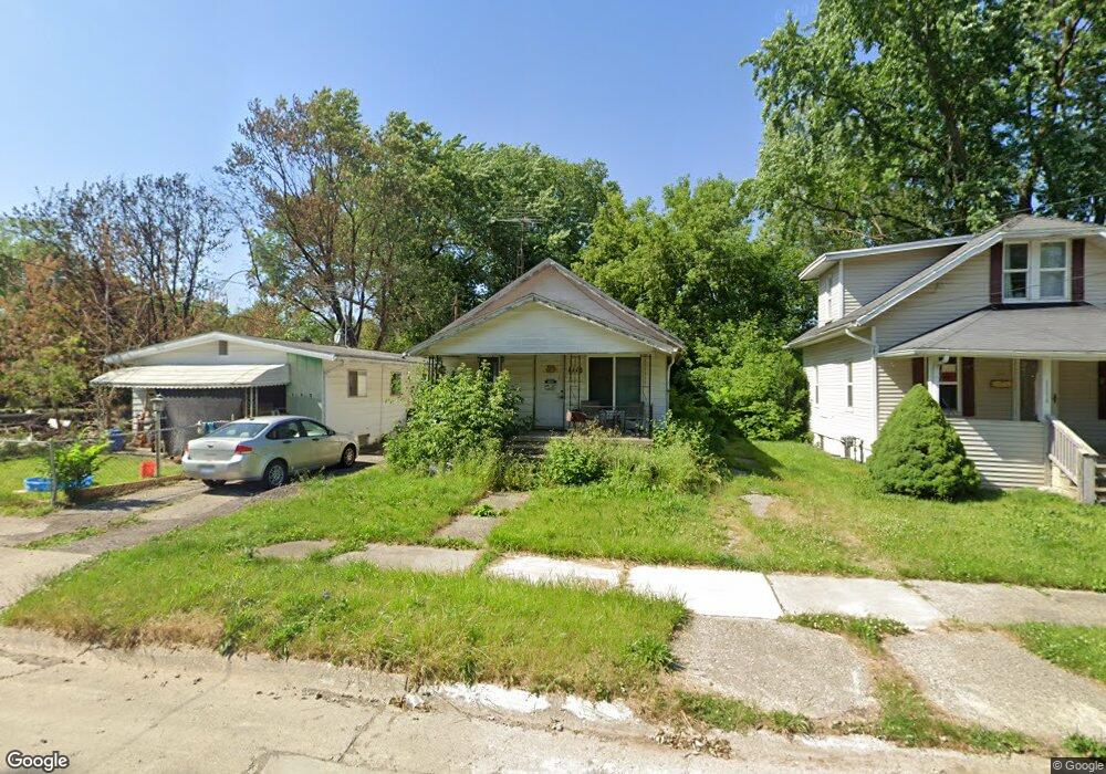
1118 Huron St Flint, MI 48507
South Side NeighborhoodEstimated Value: $45,000 - $50,265
3
Beds
1
Bath
800
Sq Ft
$60/Sq Ft
Est. Value
About This Home
This home is located at 1118 Huron St, Flint, MI 48507 and is currently estimated at $47,816, approximately $59 per square foot. 1118 Huron St is a home located in Genesee County with nearby schools including Neithercut Elementary School, Flint Southwestern Classical Academy, and International Academy of Flint (K-12).
Ownership History
Date
Name
Owned For
Owner Type
Purchase Details
Closed on
Sep 23, 2025
Sold by
Genesee County Treasurer
Bought by
Moegelinski Bianca Leeann
Current Estimated Value
Purchase Details
Closed on
May 3, 2016
Sold by
Stair Philip G and Genesee County Land Bank Autho
Bought by
Vankeuren Deborah and Huff Shannon
Purchase Details
Closed on
Feb 19, 2013
Sold by
The Genesee County Land Bank Authority
Bought by
Vankeuren Deborah and Huff Shannon
Purchase Details
Closed on
Dec 20, 2012
Sold by
Cherry Deborah L and Genesee County Treasurer
Bought by
Genesee County Land Bank
Purchase Details
Closed on
Feb 26, 1999
Sold by
Bond Marguerite and Vankeuren Deborah
Bought by
Barry Kenneth and Vankeuren Thomas
Create a Home Valuation Report for This Property
The Home Valuation Report is an in-depth analysis detailing your home's value as well as a comparison with similar homes in the area
Home Values in the Area
Average Home Value in this Area
Purchase History
| Date | Buyer | Sale Price | Title Company |
|---|---|---|---|
| Moegelinski Bianca Leeann | $3,800 | None Listed On Document | |
| Vankeuren Deborah | $6,000 | None Available | |
| Vankeuren Deborah | $6,000 | None Available | |
| Genesee County Land Bank | -- | None Available | |
| Barry Kenneth | -- | First American Title Ins Co |
Source: Public Records
Tax History
| Year | Tax Paid | Tax Assessment Tax Assessment Total Assessment is a certain percentage of the fair market value that is determined by local assessors to be the total taxable value of land and additions on the property. | Land | Improvement |
|---|---|---|---|---|
| 2025 | $1,015 | $16,000 | $0 | $0 |
| 2024 | $752 | $16,500 | $0 | $0 |
| 2023 | $742 | $13,200 | $0 | $0 |
| 2022 | $0 | $11,100 | $0 | $0 |
| 2021 | $768 | $10,000 | $0 | $0 |
| 2020 | $698 | $10,000 | $0 | $0 |
| 2019 | $1,077 | $10,200 | $0 | $0 |
| 2018 | $671 | $9,100 | $0 | $0 |
| 2017 | $654 | $0 | $0 | $0 |
| 2016 | $650 | $0 | $0 | $0 |
| 2015 | -- | $0 | $0 | $0 |
| 2014 | -- | $0 | $0 | $0 |
| 2012 | -- | $11,300 | $0 | $0 |
Source: Public Records
Map
Nearby Homes
- 1234 Huron St
- 1210 Pinehurst Ave
- 1310 Huron St
- 1310 Alvord Ave
- 1122 Markham St
- 1318 Ingleside Ave
- 939 Ingleside Ave
- 912 Huron St
- 1028 Campbell St
- 1130 W Atherton Rd
- 1410 Berrywood Ln
- 845 Alvord Ave
- 846 W Hemphill Rd
- 1627 Blackberry Ln
- 842 Leland St
- 1826 Greenbrook Ln
- 805 Alvord Ave
- 806 Alvord Ave
- 1902 Crestbrook Ln
- 1514 W Atherton Rd
Your Personal Tour Guide
Ask me questions while you tour the home.