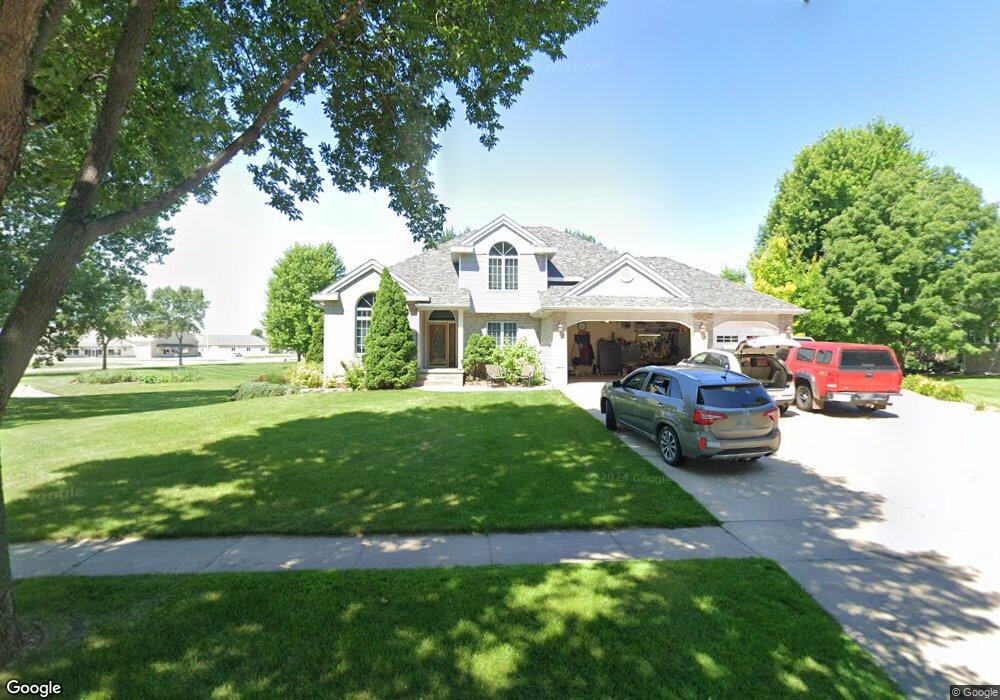
1118 Pheasant Run Rd Brookings, SD 57006
Estimated Value: $498,000 - $605,000
6
Beds
4
Baths
3,670
Sq Ft
$152/Sq Ft
Est. Value
About This Home
This home is located at 1118 Pheasant Run Rd, Brookings, SD 57006 and is currently estimated at $559,579, approximately $152 per square foot. 1118 Pheasant Run Rd is a home located in Brookings County with nearby schools including Brookings High School and St Thomas More Catholic School.
Ownership History
Date
Name
Owned For
Owner Type
Purchase Details
Closed on
Sep 22, 2011
Sold by
Ferris David G and Clark-Ferris Kimberly K
Bought by
Weisbecek Robert and Weisbeck Karen
Current Estimated Value
Home Financials for this Owner
Home Financials are based on the most recent Mortgage that was taken out on this home.
Original Mortgage
$256,800
Outstanding Balance
$175,519
Interest Rate
4.22%
Estimated Equity
$384,060
Create a Home Valuation Report for This Property
The Home Valuation Report is an in-depth analysis detailing your home's value as well as a comparison with similar homes in the area
Home Values in the Area
Average Home Value in this Area
Purchase History
| Date | Buyer | Sale Price | Title Company |
|---|---|---|---|
| Weisbecek Robert | -- | -- |
Source: Public Records
Mortgage History
| Date | Status | Borrower | Loan Amount |
|---|---|---|---|
| Open | Weisbecek Robert | $256,800 |
Source: Public Records
Tax History
| Year | Tax Paid | Tax Assessment Tax Assessment Total Assessment is a certain percentage of the fair market value that is determined by local assessors to be the total taxable value of land and additions on the property. | Land | Improvement |
|---|---|---|---|---|
| 2025 | $7,064 | $524,100 | $70,700 | $453,400 |
| 2024 | $6,938 | $490,700 | $70,700 | $420,000 |
| 2023 | $6,576 | $455,300 | $70,700 | $384,600 |
| 2022 | $6,206 | $421,100 | $70,700 | $350,400 |
| 2021 | $6,151 | $421,100 | $70,700 | $350,400 |
| 2020 | $5,319 | $359,800 | $70,700 | $289,100 |
| 2019 | $5,265 | $355,800 | $70,700 | $285,100 |
| 2018 | $5,165 | $355,800 | $70,700 | $285,100 |
| 2017 | $5,080 | $341,700 | $56,600 | $285,100 |
| 2016 | $5,031 | $328,900 | $56,600 | $272,300 |
| 2010 | -- | $286,700 | $0 | $0 |
Source: Public Records
Map
Nearby Homes
- 521 12th St S Unit 75
- 808 Sunflower Rd
- 1023 16th St S
- 1008 16th St S
- 723 Leprechaun Cir
- 1507 Sequoia Ct
- 1529 Steamboat Trail
- 300 Medary Ave S Unit 90
- 1407 Sheridan Cir
- 1401 Windermere Way
- TBD,TBD Hunter's Ridge Addition
- L3, B7 Prairie Hills Addition
- 228 Trail Ridge Rd
- 408 3rd Ave S Unit 140
- 25 Southern Estates Addition
- 24 Southern Estates Addition
- L27, B20 Timberline Addition
- 1804 Half Moon Rd S
- 725 Sunflower Rd
- 1907 Council Ridge Rd
- 1119 7th Ave S
- 1106 Pheasant Run Rd
- 805 12th St S
- 730 Arrowhead Pass
- 810 12th St S
- 817 12th St S
- 804 Arrowhead Pass
- 818 Arrowhead Pass
- 710 Arrowhead Pass
- 820 12th St S
- 805 Arrowhead Pass
- 833 12th St S
- 1227 Pheasant Run Rd
- 828 Arrowhead Pass
- 731 Arrowhead Pass
- 536 Swallow Ridge Rd
- 513 Swallow Ridge Rd
- 719 Arrowhead Pass
- 832 12th St S
- 825 Arrowhead Pass
Your Personal Tour Guide
Ask me questions while you tour the home.