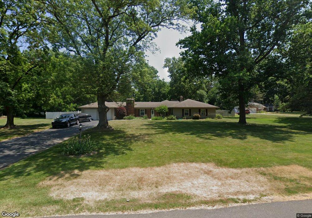
1118 Saint Andrews Rd Toledo, OH 43607
Scott Park NeighborhoodEstimated Value: $263,000 - $359,000
3
Beds
2
Baths
2,421
Sq Ft
$122/Sq Ft
Est. Value
About This Home
This home is located at 1118 Saint Andrews Rd, Toledo, OH 43607 and is currently estimated at $296,468, approximately $122 per square foot. 1118 Saint Andrews Rd is a home located in Lucas County with nearby schools including Keyser Elementary School, Rogers High School, and Victory Academy of Toledo.
Ownership History
Date
Name
Owned For
Owner Type
Purchase Details
Closed on
Sep 5, 2024
Sold by
Corfman Bridgit and Drodrill Bridgit
Bought by
Corfman Christopher and Corfman Bridgit
Current Estimated Value
Purchase Details
Closed on
Aug 27, 2009
Sold by
Greater Metropolitan Title Llc
Bought by
Dodrill Bridgit R
Home Financials for this Owner
Home Financials are based on the most recent Mortgage that was taken out on this home.
Original Mortgage
$144,042
Interest Rate
5.21%
Mortgage Type
FHA
Purchase Details
Closed on
Dec 5, 2007
Sold by
Quinn Deanna and Quinn Robert
Bought by
Equicredit Corp Of America
Purchase Details
Closed on
Oct 7, 1994
Sold by
Sass Nancy E
Bought by
Quinn Robert and Quinn Deanna
Create a Home Valuation Report for This Property
The Home Valuation Report is an in-depth analysis detailing your home's value as well as a comparison with similar homes in the area
Home Values in the Area
Average Home Value in this Area
Purchase History
| Date | Buyer | Sale Price | Title Company |
|---|---|---|---|
| Corfman Christopher | -- | None Listed On Document | |
| Dodrill Bridgit R | $146,700 | Attorney | |
| Equicredit Corp Of America | $100,000 | None Available | |
| Quinn Robert | $110,000 | -- |
Source: Public Records
Mortgage History
| Date | Status | Borrower | Loan Amount |
|---|---|---|---|
| Previous Owner | Dodrill Bridgit R | $144,042 | |
| Closed | Quinn Robert | -- |
Source: Public Records
Tax History Compared to Growth
Tax History
| Year | Tax Paid | Tax Assessment Tax Assessment Total Assessment is a certain percentage of the fair market value that is determined by local assessors to be the total taxable value of land and additions on the property. | Land | Improvement |
|---|---|---|---|---|
| 2024 | $2,772 | $87,010 | $21,210 | $65,800 |
| 2023 | $4,139 | $60,340 | $18,830 | $41,510 |
| 2022 | $4,090 | $60,340 | $18,830 | $41,510 |
| 2021 | $4,230 | $60,340 | $18,830 | $41,510 |
| 2020 | $4,023 | $49,525 | $15,470 | $34,055 |
| 2019 | $3,885 | $49,525 | $15,470 | $34,055 |
| 2018 | $3,734 | $49,525 | $15,470 | $34,055 |
| 2017 | $3,469 | $42,350 | $12,215 | $30,135 |
| 2016 | $3,517 | $121,000 | $34,900 | $86,100 |
| 2015 | $3,572 | $121,000 | $34,900 | $86,100 |
| 2014 | $2,666 | $42,360 | $12,220 | $30,140 |
| 2013 | $2,666 | $42,360 | $12,220 | $30,140 |
Source: Public Records
Map
Nearby Homes
- 4248 Hunters Trail Dr
- 4345 Foxchapel Rd
- 4236 S Terrace View St
- 2009 Garden Ln
- 735 Southbriar Rd
- 3825 Whitegate Dr
- 4057 Hillandale Rd
- 3925 Hillandale Rd
- 2130 Richards Rd
- 310 Richards Rd
- 2026 Pautucket Rd
- 4229 Wickford Point Dr
- 801 Hilltop Ln
- 4515 W Bancroft St
- 4519 W Bancroft St
- 2222 Talmadge Rd
- 710 Hilltop Ln
- 4709 W Bancroft St
- 3614 Edgevale Rd
- 5041 Ancil Rd
- 1058 Glann Rd
- 4325 Dorr St
- 4305 Dorr St
- 2133 Saint Andrews Rd
- 4349 Dorr St
- 1035 Saint Andrews Rd
- 1040 Glann Rd
- 1021 Glann Rd
- 2131 Saint Andrews Rd
- 2137 Saint Andrews Rd
- 2145 Saint Andrews Rd
- 1007 Saint Andrews Rd
- 4361 Dorr St
- 1001 Glann Rd
- 4336 Dorr St
- 1024 Saint Andrews Rd
- 1016 Glann Rd
- 1020 Glann Rd
- 4332 Glann Rd
- 4302 Dorr St