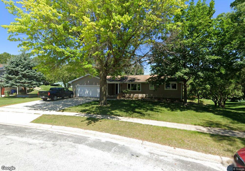
1118 Woodring Dr Waverly, IA 50677
Estimated Value: $277,000 - $332,274
3
Beds
3
Baths
2,195
Sq Ft
$140/Sq Ft
Est. Value
About This Home
This home is located at 1118 Woodring Dr, Waverly, IA 50677 and is currently estimated at $306,319, approximately $139 per square foot. 1118 Woodring Dr is a home located in Bremer County with nearby schools including Waverly-Shell Rock Senior High School and St. Paul's Lutheran School.
Ownership History
Date
Name
Owned For
Owner Type
Purchase Details
Closed on
Aug 19, 2011
Sold by
Froiland S Philip and Froiland Marilyn E
Bought by
Liebau Clayton J and Liebau Krystal J
Current Estimated Value
Home Financials for this Owner
Home Financials are based on the most recent Mortgage that was taken out on this home.
Original Mortgage
$155,032
Outstanding Balance
$103,774
Interest Rate
3.87%
Mortgage Type
Adjustable Rate Mortgage/ARM
Estimated Equity
$228,501
Create a Home Valuation Report for This Property
The Home Valuation Report is an in-depth analysis detailing your home's value as well as a comparison with similar homes in the area
Home Values in the Area
Average Home Value in this Area
Purchase History
| Date | Buyer | Sale Price | Title Company |
|---|---|---|---|
| Liebau Clayton J | $170,000 | None Available |
Source: Public Records
Mortgage History
| Date | Status | Borrower | Loan Amount |
|---|---|---|---|
| Open | Liebau Clayton J | $155,032 |
Source: Public Records
Tax History Compared to Growth
Tax History
| Year | Tax Paid | Tax Assessment Tax Assessment Total Assessment is a certain percentage of the fair market value that is determined by local assessors to be the total taxable value of land and additions on the property. | Land | Improvement |
|---|---|---|---|---|
| 2025 | $130 | $338,580 | $54,650 | $283,930 |
| 2024 | $130 | $312,750 | $54,650 | $258,100 |
| 2023 | -- | $298,870 | $39,470 | $259,400 |
| 2022 | $3,958 | $219,930 | $39,470 | $180,460 |
| 2021 | $3,904 | $219,930 | $39,470 | $180,460 |
| 2020 | $3,904 | $203,260 | $39,470 | $163,790 |
| 2019 | $3,550 | $196,630 | $0 | $0 |
| 2018 | $3,262 | $185,170 | $0 | $0 |
| 2017 | $3,262 | $187,840 | $0 | $0 |
| 2016 | $3,574 | $187,840 | $0 | $0 |
| 2015 | $3,574 | $175,550 | $0 | $0 |
| 2014 | $3,406 | $175,550 | $0 | $0 |
Source: Public Records
Map
Nearby Homes
- 1109 5th St NW
- 607 10th Ave NW
- 207 Deerfield Cir Unit Whitetail Bluff Lot
- 910 6th St NW
- 1111 Fawn Hollow Unit Whitetail Bluff Lot
- 1107 Fawn Hollow Unit Whitetail Bluff Lot
- 128 Red Fox Trail
- 102 9th Ave NW
- 415 5th St NW
- 1608 Hillside Ave
- 204 3rd Ave NW
- 212 2nd Ave NW
- 117 6th Ave NW
- 315 3rd Ave NE
- 602 1st Ave SW
- 0000 17th St NW
- 323 3rd Ave NE
- 105 E Bremer Ave Unit 2
- 105 E Bremer Ave Unit 1
- 403 2nd Ave NE
- 1116 Woodring Dr
- 727 Greenfield Ave
- 1120 Woodring Dr
- 735 Greenfield Ave
- 1117 Woodring Dr
- 725 Greenfield Ave
- 1122 Woodring Dr
- 510 10th Ave NW
- 1218 Cedar River Dr
- 1116 Cedar River Dr
- 1113 Woodring Dr
- 1112 Woodring Dr
- 1114 Cedar River Dr
- 736 Greenfield Ave
- 1111 Woodring Dr
- 1112 Cedar River Dr
- 1302 Cedar River Dr
- 1110 Woodring Dr
- 1203 Cedar River Dr
- 803 Greenfield Ave