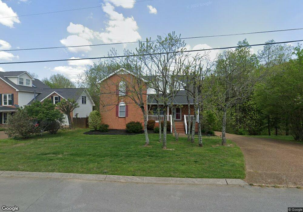
1119 Brookstone Blvd Mount Juliet, TN 37122
Estimated Value: $546,000 - $618,000
--
Bed
3
Baths
2,678
Sq Ft
$222/Sq Ft
Est. Value
About This Home
This home is located at 1119 Brookstone Blvd, Mount Juliet, TN 37122 and is currently estimated at $593,398, approximately $221 per square foot. 1119 Brookstone Blvd is a home located in Wilson County with nearby schools including Mt. Juliet Elementary School, Mt. Juliet Middle School, and Green Hill High School.
Ownership History
Date
Name
Owned For
Owner Type
Purchase Details
Closed on
Mar 23, 2012
Sold by
Droke James M
Bought by
Freeman Kenneth R and Freeman Tania J
Current Estimated Value
Home Financials for this Owner
Home Financials are based on the most recent Mortgage that was taken out on this home.
Original Mortgage
$201,178
Outstanding Balance
$138,853
Interest Rate
3.97%
Mortgage Type
Commercial
Estimated Equity
$454,545
Purchase Details
Closed on
Nov 9, 2010
Sold by
Decker Todd
Bought by
Droke James M
Purchase Details
Closed on
Apr 13, 1999
Sold by
Todd Decker
Bought by
Todd Decker
Create a Home Valuation Report for This Property
The Home Valuation Report is an in-depth analysis detailing your home's value as well as a comparison with similar homes in the area
Home Values in the Area
Average Home Value in this Area
Purchase History
| Date | Buyer | Sale Price | Title Company |
|---|---|---|---|
| Freeman Kenneth R | $207,400 | -- | |
| Droke James M | -- | -- | |
| Todd Decker | $29,900 | -- |
Source: Public Records
Mortgage History
| Date | Status | Borrower | Loan Amount |
|---|---|---|---|
| Open | Freeman Kenneth R | $201,178 |
Source: Public Records
Tax History Compared to Growth
Tax History
| Year | Tax Paid | Tax Assessment Tax Assessment Total Assessment is a certain percentage of the fair market value that is determined by local assessors to be the total taxable value of land and additions on the property. | Land | Improvement |
|---|---|---|---|---|
| 2024 | $1,875 | $98,225 | $21,250 | $76,975 |
| 2022 | $1,872 | $98,075 | $21,250 | $76,825 |
| 2021 | $1,980 | $98,075 | $21,250 | $76,825 |
| 2020 | $2,103 | $98,075 | $21,250 | $76,825 |
| 2019 | $260 | $78,325 | $18,750 | $59,575 |
| 2018 | $2,095 | $78,025 | $18,750 | $59,275 |
| 2017 | $2,095 | $78,025 | $18,750 | $59,275 |
| 2016 | $2,095 | $78,025 | $18,750 | $59,275 |
| 2015 | $2,162 | $78,025 | $18,750 | $59,275 |
| 2014 | $1,769 | $63,869 | $0 | $0 |
Source: Public Records
Map
Nearby Homes
- 1120 Brookstone Blvd
- 271 Page Dr
- 288 Page Dr
- 1013 Brookstone Blvd
- 1520 Brookstone Cir
- 222 Jackson Trail
- 1105 Camden Cir
- 493 Page Dr
- 212 Jackson Trail
- 506 Page Dr
- 144 W Division St
- 3107 Oxford Dr
- 700 Castle Rd
- 2001 Lynnhaven Ct
- 4014 Ethan Ave
- 2002 Lynnhaven Ct
- 2006 Lynnhaven Ct
- 2202 Dinah Ct
- 1733 Hartford Ln
- 604 Georgian Way
- 1117 Brookstone Blvd
- 1123 Brookstone Blvd
- 1115 Brookstone Blvd
- 1118 Brookstone Blvd
- 1301 Thoreau Ct
- 1116 Brookstone Blvd
- 1114 Brookstone Blvd
- 1302 Thoreau Ct
- 2103 Thoreau Place
- 2107 Thoreau Place
- 260 Page Dr
- 1113 Brookstone Blvd
- 1112 Brookstone Blvd
- 1122 Brookstone Blvd
- 2105 Thoreau Place
- 262 Page Dr
- 2104 Thoreau Place
- 1303 Thoreau Ct
- 1124 Brookstone Blvd
- 2106 Thoreau Place