1119 Cunningham Bridge Rd Dawson, PA 15428
Lower Tyrone Township NeighborhoodEstimated Value: $384,000 - $576,000
3
Beds
1
Bath
1,932
Sq Ft
$235/Sq Ft
Est. Value
About This Home
This home is located at 1119 Cunningham Bridge Rd, Dawson, PA 15428 and is currently estimated at $454,023, approximately $235 per square foot. 1119 Cunningham Bridge Rd is a home located in Fayette County with nearby schools including Frazier High School.
Ownership History
Date
Name
Owned For
Owner Type
Purchase Details
Closed on
Dec 2, 2015
Sold by
Rumbaugh Delaine A
Bought by
Baker Michael S and Baker Victoria L
Current Estimated Value
Home Financials for this Owner
Home Financials are based on the most recent Mortgage that was taken out on this home.
Original Mortgage
$190,000
Interest Rate
3.89%
Mortgage Type
Future Advance Clause Open End Mortgage
Purchase Details
Closed on
Jan 1, 1968
Bought by
Rumbaugh Ralph A and Rumbaugh Delaine A
Create a Home Valuation Report for This Property
The Home Valuation Report is an in-depth analysis detailing your home's value as well as a comparison with similar homes in the area
Home Values in the Area
Average Home Value in this Area
Purchase History
| Date | Buyer | Sale Price | Title Company |
|---|---|---|---|
| Baker Michael S | $380,000 | None Available | |
| Rumbaugh Ralph A | -- | -- |
Source: Public Records
Mortgage History
| Date | Status | Borrower | Loan Amount |
|---|---|---|---|
| Open | Baker Michael S | $340,000 | |
| Closed | Baker Victoria L | $190,000 | |
| Closed | Baker Victoria L | $350,000 | |
| Closed | Baker Michael S | $300,000 | |
| Previous Owner | Runbaugh Ralph A | $9,321 |
Source: Public Records
Tax History Compared to Growth
Tax History
| Year | Tax Paid | Tax Assessment Tax Assessment Total Assessment is a certain percentage of the fair market value that is determined by local assessors to be the total taxable value of land and additions on the property. | Land | Improvement |
|---|---|---|---|---|
| 2024 | $3,434 | $111,960 | $52,510 | $59,450 |
| 2023 | $6,595 | $111,960 | $52,510 | $59,450 |
| 2022 | $7,476 | $131,190 | $73,790 | $57,400 |
| 2021 | $7,476 | $131,190 | $73,790 | $57,400 |
| 2020 | $7,288 | $131,190 | $73,790 | $57,400 |
| 2019 | $6,798 | $131,190 | $73,790 | $57,400 |
| 2018 | $6,637 | $131,190 | $73,790 | $57,400 |
| 2017 | $6,433 | $131,190 | $73,790 | $57,400 |
| 2016 | -- | $119,240 | $73,790 | $45,450 |
| 2015 | -- | $119,240 | $73,790 | $45,450 |
| 2014 | -- | $238,480 | $147,580 | $90,900 |
Source: Public Records
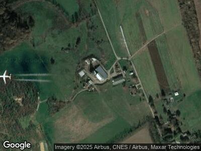
Map
Nearby Homes
- 1119 Cunningham Bridge Rd
- 1085 Cunningham Bridge Rd
- 1080 Cunningham Bridge Rd
- 1072 Cunningham Bridge Rd
- 103 Stone Rd
- 105 Stone Rd
- 139 Gillespie Rd
- 131 Gillespie Rd
- 113 Gillespie Rd
- 1048 Cunningham Bridge Rd
- 151 Gillespie Rd
- 1022 Cunningham Bridge Rd
- 150 Hernley Ln
- 157 Gillespie Rd
- 321 Creek Rd
- 307 Creek Rd
- 677 Dawson Scottdale Rd
- 123 Hernley Ln
- 713 Dawson Scottdale Rd
- 572 Creek Rd