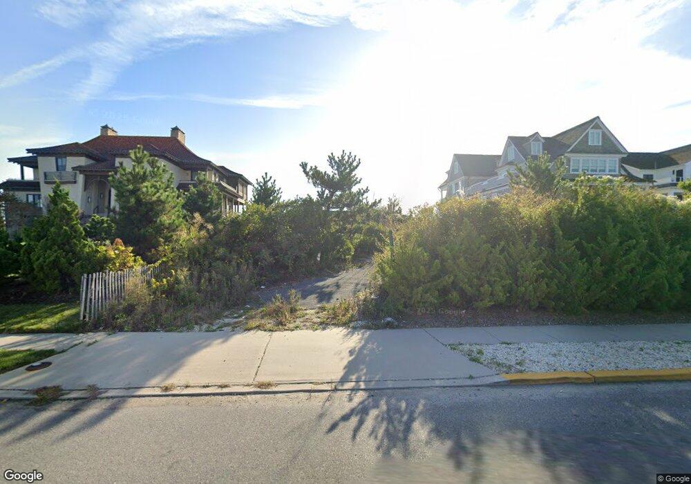
1119 Ocean Ave Mantoloking, NJ 08738
Estimated Value: $4,010,000 - $6,442,000
--
Bed
--
Bath
3,542
Sq Ft
$1,386/Sq Ft
Est. Value
About This Home
This home is located at 1119 Ocean Ave, Mantoloking, NJ 08738 and is currently estimated at $4,910,908, approximately $1,386 per square foot. 1119 Ocean Ave is a home located in Ocean County with nearby schools including G Harold Antrim Elementary School, Point Pleasant Beach High School, and St. Peter School.
Ownership History
Date
Name
Owned For
Owner Type
Purchase Details
Closed on
May 19, 2014
Sold by
Burke Stephen E
Bought by
Bay Head Montoloking Land Co
Current Estimated Value
Purchase Details
Closed on
Mar 9, 2004
Sold by
Ring Dorothy A
Bought by
Ring Dorothy A and Dorothy A Ring 2004 Qualified Personal R
Create a Home Valuation Report for This Property
The Home Valuation Report is an in-depth analysis detailing your home's value as well as a comparison with similar homes in the area
Home Values in the Area
Average Home Value in this Area
Purchase History
| Date | Buyer | Sale Price | Title Company |
|---|---|---|---|
| Bay Head Montoloking Land Co | -- | None Available | |
| Ring Dorothy A | -- | None Available | |
| Ring Dorothy A | -- | None Available |
Source: Public Records
Tax History Compared to Growth
Tax History
| Year | Tax Paid | Tax Assessment Tax Assessment Total Assessment is a certain percentage of the fair market value that is determined by local assessors to be the total taxable value of land and additions on the property. | Land | Improvement |
|---|---|---|---|---|
| 2025 | $20,950 | $2,441,700 | $2,425,500 | $16,200 |
| 2024 | $19,924 | $2,441,700 | $2,425,500 | $16,200 |
| 2023 | $17,092 | $2,441,700 | $2,425,500 | $16,200 |
| 2022 | $17,092 | $2,441,700 | $2,425,500 | $16,200 |
| 2021 | $17,188 | $2,441,700 | $2,425,500 | $16,200 |
| 2020 | $17,385 | $2,441,700 | $2,425,500 | $16,200 |
| 2019 | $17,141 | $2,441,700 | $2,425,500 | $16,200 |
| 2018 | $16,897 | $2,441,700 | $2,425,500 | $16,200 |
| 2017 | $16,906 | $2,425,500 | $2,425,500 | $0 |
| 2016 | $16,833 | $2,425,500 | $2,425,500 | $0 |
| 2015 | $16,566 | $2,425,500 | $2,425,500 | $0 |
| 2014 | $15,208 | $2,425,500 | $2,425,500 | $0 |
Source: Public Records
Map
Nearby Homes
- 1201 Ocean Ave
- 1207 Ocean Ave
- 1097 Barnegat Ln
- 1318 Ocean Ave
- 1063 Ocean Ave
- 1027 Ocean Ave
- 1519 Runyon Ln
- 982 Barnegat Ln
- 978 East Ave
- 954 Barnegat Ln
- 940 Barnegat Ln
- 122 Squan Beach Dr
- 920 East Ave
- 233 Curtis Point Dr
- 150 Sunset Ln
- 275 Curtis Point Dr
- 767 East Ave
- 776 South Dr
- 304 Schooner Ln
- 750 East Ave
- 1121 Ocean Ave
- 1117 Ocean Ave
- 1125 Ocean Ave
- 1115 Ocean Ave
- 1120 Ocean Ave
- 1127 Ocean Ave
- 1115 Barnegat Ln
- 1129 Ocean Ave
- 1113 Ocean Ave
- 1112 Ocean Ave
- 1123 Barnegat Ln
- 1117 Barnegat Ln
- 1126 Ocean Ave
- 1125 Barnegat Ln
- 1111 Barnegat Ln
- 1133 Ocean Ave
- 1110 Ocean Ave
- 1111 Ocean Ave
- 1109 Ocean Ave
- 1108 Ocean Ave