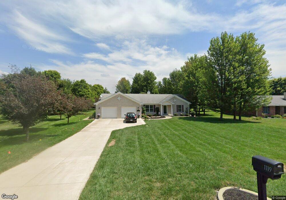
1119 S Bringhurst Rd Bringhurst, IN 46913
Estimated Value: $282,000 - $349,096
4
Beds
2
Baths
2,064
Sq Ft
$152/Sq Ft
Est. Value
About This Home
This home is located at 1119 S Bringhurst Rd, Bringhurst, IN 46913 and is currently estimated at $314,024, approximately $152 per square foot. 1119 S Bringhurst Rd is a home with nearby schools including Carroll Elementary School and Carroll Senior High School.
Ownership History
Date
Name
Owned For
Owner Type
Purchase Details
Closed on
Jul 22, 2015
Sold by
Trent Tony R and Shuman Tricia A
Bought by
Peck Robert J and Peck Debra E
Current Estimated Value
Purchase Details
Closed on
Jul 13, 2015
Sold by
Trent Martin L and Trent Glenna M
Bought by
Trent Tony R and Shuman Tricia A
Purchase Details
Closed on
Jul 9, 2015
Sold by
Peck Robert J and Peck Debra E
Bought by
Peck James F and Peck Joy L
Purchase Details
Closed on
Jul 1, 2012
Sold by
Le Trent Martin L
Bought by
Peck Robert and Peck Debra
Purchase Details
Closed on
May 17, 2011
Sold by
Trent Martin L and Trent Glenna M
Bought by
Trent Martin L and Trent Glenna M
Create a Home Valuation Report for This Property
The Home Valuation Report is an in-depth analysis detailing your home's value as well as a comparison with similar homes in the area
Purchase History
| Date | Buyer | Sale Price | Title Company |
|---|---|---|---|
| Peck Robert J | -- | None Available | |
| Trent Tony R | -- | None Available | |
| Peck James F | -- | None Available | |
| Peck Robert | $27,000 | -- | |
| Trent Martin L | -- | None Available |
Source: Public Records
Tax History
| Year | Tax Paid | Tax Assessment Tax Assessment Total Assessment is a certain percentage of the fair market value that is determined by local assessors to be the total taxable value of land and additions on the property. | Land | Improvement |
|---|---|---|---|---|
| 2025 | $1,560 | $295,500 | $31,800 | $263,700 |
| 2024 | $1,560 | $291,300 | $31,800 | $259,500 |
| 2023 | $1,365 | $251,600 | $26,600 | $225,000 |
| 2022 | $1,365 | $224,400 | $26,600 | $197,800 |
| 2021 | $1,237 | $192,600 | $26,600 | $166,000 |
| 2020 | $1,201 | $187,600 | $26,600 | $161,000 |
| 2019 | $1,261 | $188,200 | $19,900 | $168,300 |
| 2018 | $1,242 | $188,200 | $19,900 | $168,300 |
| 2017 | $1,191 | $188,700 | $19,900 | $168,800 |
| 2016 | $1,970 | $160,500 | $19,900 | $140,600 |
| 2014 | $149 | $13,400 | $13,400 | $0 |
| 2013 | $149 | $13,000 | $13,000 | $0 |
Source: Public Records
Map
Nearby Homes
- 117 E Catherine St
- 212 Brookview Ln
- 239 E Main St
- 121 W Walnut St
- 314 W Vine St
- 99 Westwood Dr
- 625 N State 75 Rd
- 964 E 400 S
- 1026 E 400 S
- 4802 S 20 W
- 480 S 10 E
- 170 S Water St
- 330 E Main St
- 3520 S 500 E
- 342 W Cumberland St
- 2309 S 625 E
- 3773 E 300 Rd N
- 105 W 8th St
- 00 Washington St
- 1007 S Michigan St
- 1141 S Bringhurst Rd
- 1075 S Bringhurst Rd
- 1110 S Bringhurst Rd
- 1140 S Bringhurst Rd
- 1090 S Bringhurst Rd
- 1160 S Bringhurst Rd
- 1040 S Bringhurst Rd
- 1019 S Bringhurst Rd
- 1182 S Bringhurst Rd
- 1020 S Bringhurst Rd
- 1211 S Bringhurst Rd
- 1208 S Bringhurst Rd
- 1512 S Center St
- 1235 S Bringhurst Rd
- 1508 S Center St
- 1504 S Center St
- 1503 S Center St
- 1260 S Bringhurst Rd
- 1265 S Bringhurst Rd
- 1416 S Center St
Your Personal Tour Guide
Ask me questions while you tour the home.