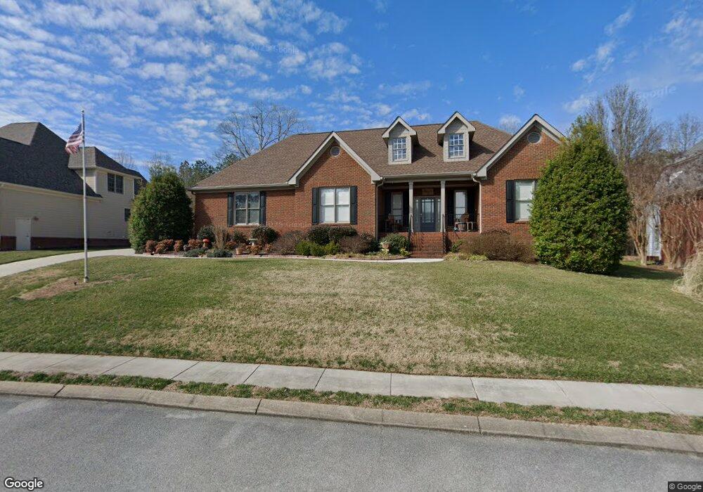
11193 Captain's Cove Soddy-Daisy, TN 37379
Estimated Value: $607,447 - $677,000
3
Beds
2
Baths
2,649
Sq Ft
$245/Sq Ft
Est. Value
About This Home
This home is located at 11193 Captain's Cove, Soddy-Daisy, TN 37379 and is currently estimated at $648,362, approximately $244 per square foot. 11193 Captain's Cove is a home located in Hamilton County.
Ownership History
Date
Name
Owned For
Owner Type
Purchase Details
Closed on
Nov 13, 2020
Sold by
Denmark Gordon K and Denmark Nancy C
Bought by
Mcdermid Robert and Mcdermid Sharon
Current Estimated Value
Home Financials for this Owner
Home Financials are based on the most recent Mortgage that was taken out on this home.
Original Mortgage
$307,000
Outstanding Balance
$273,186
Interest Rate
2.8%
Mortgage Type
New Conventional
Estimated Equity
$375,176
Purchase Details
Closed on
Nov 24, 2008
Sold by
Lewis Jeffrey B and Lewis Amy M
Bought by
Denmark Gordon K and Denmark Nancy C
Home Financials for this Owner
Home Financials are based on the most recent Mortgage that was taken out on this home.
Original Mortgage
$180,000
Interest Rate
6.51%
Mortgage Type
Purchase Money Mortgage
Purchase Details
Closed on
Sep 13, 2006
Sold by
George Luttrell Development Co Llc
Bought by
Lewis Jeffrey B and Lewis Amy M
Home Financials for this Owner
Home Financials are based on the most recent Mortgage that was taken out on this home.
Original Mortgage
$276,000
Interest Rate
6.52%
Mortgage Type
Purchase Money Mortgage
Create a Home Valuation Report for This Property
The Home Valuation Report is an in-depth analysis detailing your home's value as well as a comparison with similar homes in the area
Home Values in the Area
Average Home Value in this Area
Purchase History
| Date | Buyer | Sale Price | Title Company |
|---|---|---|---|
| Mcdermid Robert | $407,000 | Key Title & Escrow Llc | |
| Denmark Gordon K | $325,000 | Realty Center Title & Escrow | |
| Lewis Jeffrey B | $345,000 | Century Title & Escrow Inc |
Source: Public Records
Mortgage History
| Date | Status | Borrower | Loan Amount |
|---|---|---|---|
| Open | Mcdermid Robert | $307,000 | |
| Previous Owner | Denmark Gordon K | $180,000 | |
| Previous Owner | Lewis Jeffrey B | $276,000 |
Source: Public Records
Tax History Compared to Growth
Tax History
| Year | Tax Paid | Tax Assessment Tax Assessment Total Assessment is a certain percentage of the fair market value that is determined by local assessors to be the total taxable value of land and additions on the property. | Land | Improvement |
|---|---|---|---|---|
| 2024 | $2,318 | $103,600 | $0 | $0 |
| 2023 | $3,483 | $103,600 | $0 | $0 |
| 2022 | $3,483 | $103,600 | $0 | $0 |
| 2021 | $3,483 | $103,600 | $0 | $0 |
| 2020 | $3,496 | $84,675 | $0 | $0 |
| 2019 | $3,496 | $84,675 | $0 | $0 |
| 2018 | $3,496 | $84,675 | $0 | $0 |
| 2017 | $3,496 | $84,675 | $0 | $0 |
| 2016 | $3,350 | $0 | $0 | $0 |
| 2015 | $3,350 | $81,150 | $0 | $0 |
| 2014 | $3,350 | $0 | $0 | $0 |
Source: Public Records
Map
Nearby Homes
- 11312 Hixson Pike
- 1055 Apollo Dr
- 11734 Armstrong Rd
- 11008 Lovell Rd
- 11652 Hixson Pike
- 11636 Holly Cir
- 10496 Sovereign Pointe Dr
- 10627 Jeneva Ln
- 11570 Armstrong Rd
- 10428 Jeneva Ln
- 1235 Bentley Ln
- 11213 Dayton Pike
- 11036 High River Dr
- 1708 Restful Dr
- 11317 Cape View
- 10947 High River Dr
- 2110 Autumn River Dr
- 191 Depot St
- 1270 Jacob Dr
- 13212 Dayton Pike
- 11193 Captains Cove Dr
- 11193 Captains Cove Dr Unit 39
- 11191 Captain's Cove
- 11191 Captains Cove Dr
- 11191 Captains Cove Dr Unit 38
- 11195 Captains Cove Dr
- 11195 Captains Cove Dr Unit 40
- 11197 Captains Cove Dr
- 11197 Captain's Cove
- 11189 Captain's Cove
- 11189 Captains Cove Dr
- 11194 Captains Cove Dr
- 11194 Captains Cove Dr Unit 7
- 11196 Captains Cove Dr
- 11192 Captains Cove Dr
- 11198 Captain's Cove
- 11198 Captains Cove Dr
- 11198 Captains Cove Dr Unit 5
- 11187 Captains Cove Dr
- 11167 Captains Cove Dr