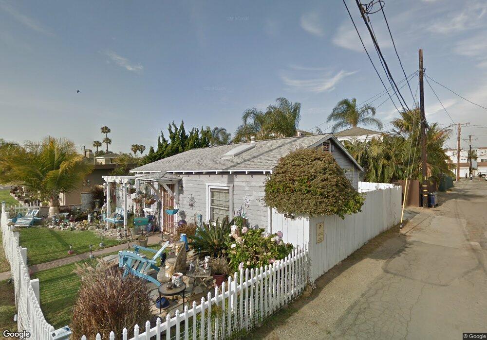
112 Alabama St Huntington Beach, CA 92648
Estimated Value: $887,000 - $1,277,000
2
Beds
1
Bath
710
Sq Ft
$1,623/Sq Ft
Est. Value
About This Home
This home is located at 112 Alabama St, Huntington Beach, CA 92648 and is currently estimated at $1,152,202, approximately $1,622 per square foot. 112 Alabama St is a home located in Orange County with nearby schools including Agnes L. Smith Elementary, Ethel Dwyer Middle, and Huntington Beach High School.
Ownership History
Date
Name
Owned For
Owner Type
Purchase Details
Closed on
Jul 12, 1995
Sold by
Green Melvin James and Green Byron F
Bought by
Dolan Mary
Current Estimated Value
Home Financials for this Owner
Home Financials are based on the most recent Mortgage that was taken out on this home.
Original Mortgage
$156,750
Interest Rate
7.63%
Purchase Details
Closed on
Jun 29, 1994
Sold by
Green Melvin J
Bought by
Green Melvin James
Create a Home Valuation Report for This Property
The Home Valuation Report is an in-depth analysis detailing your home's value as well as a comparison with similar homes in the area
Home Values in the Area
Average Home Value in this Area
Purchase History
| Date | Buyer | Sale Price | Title Company |
|---|---|---|---|
| Dolan Mary | $165,000 | Continental Lawyers Title Co | |
| Green Melvin James | -- | -- |
Source: Public Records
Mortgage History
| Date | Status | Borrower | Loan Amount |
|---|---|---|---|
| Closed | Dolan Mary | $156,750 |
Source: Public Records
Tax History Compared to Growth
Tax History
| Year | Tax Paid | Tax Assessment Tax Assessment Total Assessment is a certain percentage of the fair market value that is determined by local assessors to be the total taxable value of land and additions on the property. | Land | Improvement |
|---|---|---|---|---|
| 2025 | $3,435 | $288,670 | $243,910 | $44,760 |
| 2024 | $3,435 | $283,010 | $239,127 | $43,883 |
| 2023 | $3,354 | $277,461 | $234,438 | $43,023 |
| 2022 | $3,264 | $272,021 | $229,841 | $42,180 |
| 2021 | $3,203 | $266,688 | $225,335 | $41,353 |
| 2020 | $3,181 | $263,954 | $223,025 | $40,929 |
| 2019 | $3,144 | $258,779 | $218,652 | $40,127 |
| 2018 | $3,095 | $253,705 | $214,364 | $39,341 |
| 2017 | $3,053 | $248,731 | $210,161 | $38,570 |
| 2016 | $2,923 | $243,854 | $206,040 | $37,814 |
| 2015 | $2,893 | $240,192 | $202,946 | $37,246 |
| 2014 | $2,831 | $235,487 | $198,970 | $36,517 |
Source: Public Records
Map
Nearby Homes
- 111 Alabama St
- 400 Lake St
- 219 1st St
- 430 Lake St Unit 304
- 430 Lake St Unit 204
- 80 Huntington St Unit 424
- 80 Huntington St Unit 372
- 80 Huntington St Unit 618
- 80 Huntington St Unit 707
- 80 Huntington St Unit 514
- 414 Main St Unit 400
- 414 Main St Unit 330
- 414 Main St Unit 430
- 414 Main St Unit 200
- 414 Main St Unit 420
- 217 1st St
- 214 Walnut Ave
- 200 Pacific Coast Hwy Unit 130
- 308 5th St
- 316 6th St
- 110 Alabama St
- 206 Baltimore Ave
- 210 Baltimore Ave
- 106 Alabama St
- 209 Atlanta Ave
- 201 Atlanta Ave
- 113 Alabama St
- 119 Alabama St
- 109 Alabama St
- 216 Baltimore Ave
- 121 Alabama St
- 107 Alabama St
- 123 Alabama St
- 105 Alabama St
- 101 Alabama St
- 125 Alabama St
- 202 Alabama St
- 218 Baltimore Ave
- 201 Alabama St
- 213 Baltimore Ave