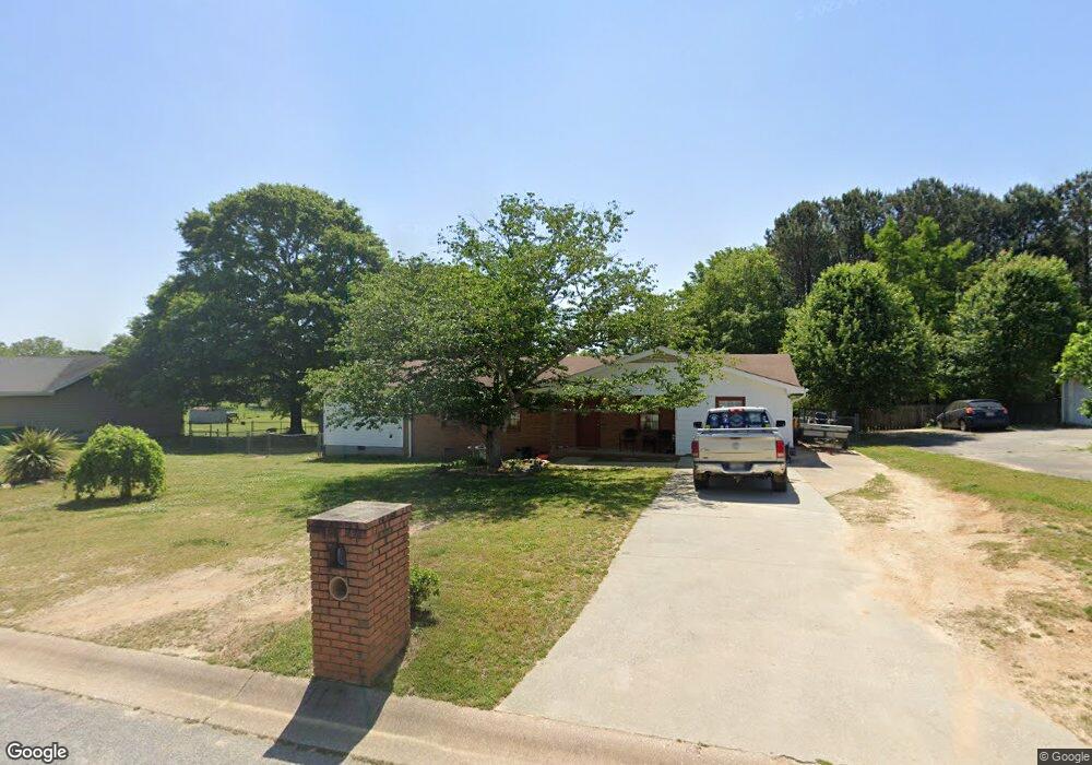
112 Ashwood Dr Winder, GA 30680
Estimated Value: $284,974 - $315,000
3
Beds
3
Baths
1,350
Sq Ft
$224/Sq Ft
Est. Value
About This Home
This home is located at 112 Ashwood Dr, Winder, GA 30680 and is currently estimated at $301,744, approximately $223 per square foot. 112 Ashwood Dr is a home located in Barrow County with nearby schools including County Line Elementary School, Russell Middle School, and Winder-Barrow High School.
Ownership History
Date
Name
Owned For
Owner Type
Purchase Details
Closed on
Feb 10, 2016
Sold by
Scott Mack A
Bought by
Scott Mack A and Garton Emma Marie
Current Estimated Value
Purchase Details
Closed on
Oct 26, 2004
Sold by
Scott Betty S
Bought by
Scotte Mack A
Purchase Details
Closed on
Mar 1, 2002
Sold by
Team Properties Inc
Bought by
And Scott Mack A
Purchase Details
Closed on
Jun 5, 2001
Sold by
Bridgeman Douglas B
Bought by
Team Properties Inc
Purchase Details
Closed on
Oct 26, 1997
Sold by
Bridgeman Douglas B
Bought by
Bridgeman Douglas B
Purchase Details
Closed on
Aug 9, 1991
Bought by
Bridgeman Douglas B
Create a Home Valuation Report for This Property
The Home Valuation Report is an in-depth analysis detailing your home's value as well as a comparison with similar homes in the area
Home Values in the Area
Average Home Value in this Area
Purchase History
| Date | Buyer | Sale Price | Title Company |
|---|---|---|---|
| Scott Mack A | -- | -- | |
| Scotte Mack A | -- | -- | |
| And Scott Mack A | $87,000 | -- | |
| Team Properties Inc | -- | -- | |
| Bridgeman Douglas B | -- | -- | |
| Bridgeman Douglas B | $11,800 | -- |
Source: Public Records
Tax History Compared to Growth
Tax History
| Year | Tax Paid | Tax Assessment Tax Assessment Total Assessment is a certain percentage of the fair market value that is determined by local assessors to be the total taxable value of land and additions on the property. | Land | Improvement |
|---|---|---|---|---|
| 2024 | $2,320 | $84,848 | $20,800 | $64,048 |
| 2023 | $1,837 | $84,848 | $20,800 | $64,048 |
| 2022 | $2,227 | $64,588 | $17,200 | $47,388 |
| 2021 | $2,088 | $56,702 | $12,000 | $44,702 |
| 2020 | $1,773 | $49,990 | $12,000 | $37,990 |
| 2019 | $1,508 | $41,278 | $10,000 | $31,278 |
| 2018 | $1,505 | $41,278 | $10,000 | $31,278 |
| 2017 | $988 | $33,125 | $8,800 | $24,325 |
| 2016 | $1,082 | $31,240 | $8,800 | $22,440 |
| 2015 | $1,102 | $31,820 | $8,800 | $23,020 |
| 2014 | $1,008 | $28,798 | $5,488 | $23,310 |
| 2013 | -- | $27,733 | $5,488 | $22,245 |
Source: Public Records
Map
Nearby Homes
- 926 Live Oak Ct Unit 2
- 980 Lake Rockwell Way
- 0 E Northcrest Dr Unit 10648147
- 469 Plantation Dr
- 27 Creekside Dr
- 746 Baskins Cir
- 412 Regan Dr
- 401 N 5th Ave
- 615 Wellington Dr
- 436 Northcrest Dr
- 381 W Candler St
- 623 Teal Dr
- 713 Mallard Dr
- 172 Settle St
- 326 Miles Patrick Rd
- 318 Ryan Rd
- The Paisley Plan at Rockwell Farms
- The Rockwell Plan at Rockwell Farms
- The Barnes Plan at Rockwell Farms
- The Reynolds Plan at Rockwell Farms
- 110 Ashwood Dr Unit 2
- 114 Ashwood Dr Unit 2
- 114 Ashwood Dr
- 0 Ashwood Dr Unit 7324316
- 0 Ashwood Dr Unit 8665049
- 0 Ashwood Dr Unit 8539896
- 0 Ashwood Dr Unit 8099549
- 0 Ashwood Dr Unit 8089754
- 0 Ashwood Dr Unit 7592548
- 0 Ashwood Dr
- 121 Northridge Dr
- 123 Northridge Dr
- 108 Ashwood Dr Unit 2
- 116 Ashwood Dr
- 116 Ashwood Dr Unit 2
- 119 Northridge Dr
- 125 Northridge Dr
- 115 Ashwood Dr
- 109 Ashwood Dr
- 109 Ashwood Dr