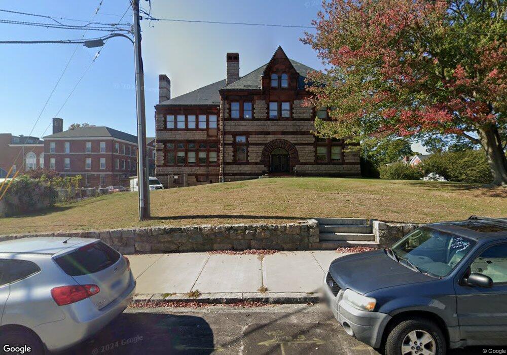
112 Broad St New London, CT 06320
Williams Neighborhood
--
Bed
3
Baths
20,411
Sq Ft
1.57
Acres
About This Home
This home is located at 112 Broad St, New London, CT 06320. 112 Broad St is a home located in New London County with nearby schools including Harbor Elementary School, Bennie Dover Jackson Middle School, and New London High School.
Ownership History
Date
Name
Owned For
Owner Type
Purchase Details
Closed on
Mar 31, 1993
Sold by
Krider Milton D
Bought by
Louhisdon Jean C
Home Financials for this Owner
Home Financials are based on the most recent Mortgage that was taken out on this home.
Original Mortgage
$65,000
Interest Rate
6.88%
Mortgage Type
Unknown
Purchase Details
Closed on
Feb 27, 1987
Sold by
Mcgill Patrick
Bought by
Kos Richard W
Home Financials for this Owner
Home Financials are based on the most recent Mortgage that was taken out on this home.
Original Mortgage
$99,900
Interest Rate
9.19%
Mortgage Type
Purchase Money Mortgage
Create a Home Valuation Report for This Property
The Home Valuation Report is an in-depth analysis detailing your home's value as well as a comparison with similar homes in the area
Home Values in the Area
Average Home Value in this Area
Purchase History
| Date | Buyer | Sale Price | Title Company |
|---|---|---|---|
| Louhisdon Jean C | $85,000 | -- | |
| Louhisdon Jean C | $85,000 | -- | |
| Kos Richard W | $114,900 | -- |
Source: Public Records
Mortgage History
| Date | Status | Borrower | Loan Amount |
|---|---|---|---|
| Closed | Kos Richard W | $96,110 | |
| Closed | Kos Richard W | $65,000 | |
| Previous Owner | Kos Richard W | $99,900 |
Source: Public Records
Tax History Compared to Growth
Tax History
| Year | Tax Paid | Tax Assessment Tax Assessment Total Assessment is a certain percentage of the fair market value that is determined by local assessors to be the total taxable value of land and additions on the property. | Land | Improvement |
|---|---|---|---|---|
| 2025 | $0 | $2,865,700 | $418,500 | $2,447,200 |
| 2024 | -- | $2,865,700 | $418,500 | $2,447,200 |
| 2023 | $0 | $2,569,560 | $363,370 | $2,206,190 |
| 2022 | $0 | $2,569,560 | $363,370 | $2,206,190 |
| 2021 | $0 | $2,569,560 | $363,370 | $2,206,190 |
| 2020 | $0 | $2,569,560 | $363,370 | $2,206,190 |
| 2019 | $0 | $2,569,560 | $363,370 | $2,206,190 |
| 2018 | $0 | $2,274,440 | $330,330 | $1,944,110 |
| 2017 | $0 | $2,274,440 | $330,330 | $1,944,110 |
| 2016 | -- | $2,274,440 | $330,330 | $1,944,110 |
| 2015 | -- | $2,274,440 | $330,330 | $1,944,110 |
| 2014 | -- | $2,274,440 | $330,330 | $1,944,110 |
Source: Public Records
Map
Nearby Homes
- 38 Mountain Ave
- 40 Pearl St
- 59 Connecticut Ave
- 55 Connecticut Ave
- 9 Brewer St Unit 3
- 9 Brewer St Unit 1
- 9 Brewer St Unit 2
- 9 Brewer St
- 2 Coit St Unit 1
- 139 Vauxhall St
- 49 Belden St
- 400 Bank St Unit 105
- 18 W Pleasant St
- 26 Jefferson Ave
- 835 Bank St
- 23 Whittlesey St
- 265 Crystal Ave
- 77 Colman St
- 271 Crystal Ave
- 385 Broad St
- 94 Broad St
- 90 Broad St
- 35 Brainard St
- 89 Broad St
- 89 Broad St
- 87 Broad St
- 78 Broad St
- 33 Brainard St
- 103 Broad St Unit 2nd Fl.
- 164 Hempstead St
- 164 Hempstead St Unit 1 First Floor
- 29 Brainard St
- 58 Brainard St
- 105 Broad St
- 25 Brainard St
- 73 Broad St
- 105 Broad St
- 23 Brainard St
- 154 Hempstead St
- 21 Brainard St