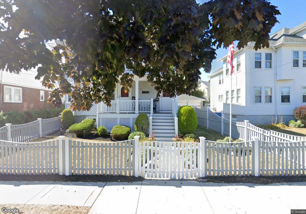
112 Brookfield Rd Unit 114 Winthrop, MA 02152
Downtown Winthrop NeighborhoodEstimated Value: $844,000 - $1,034,000
5
Beds
2
Baths
2,829
Sq Ft
$332/Sq Ft
Est. Value
About This Home
This home is located at 112 Brookfield Rd Unit 114, Winthrop, MA 02152 and is currently estimated at $939,577, approximately $332 per square foot. 112 Brookfield Rd Unit 114 is a home located in Suffolk County with nearby schools including William P. Gorman/Fort Banks Elementary School, Arthur T. Cummings Elementary School, and Winthrop Middle School.
Ownership History
Date
Name
Owned For
Owner Type
Purchase Details
Closed on
Aug 22, 1997
Sold by
Rutherford Gloria R
Bought by
Letterie Dawn M
Current Estimated Value
Create a Home Valuation Report for This Property
The Home Valuation Report is an in-depth analysis detailing your home's value as well as a comparison with similar homes in the area
Home Values in the Area
Average Home Value in this Area
Purchase History
| Date | Buyer | Sale Price | Title Company |
|---|---|---|---|
| Letterie Dawn M | $214,000 | -- |
Source: Public Records
Mortgage History
| Date | Status | Borrower | Loan Amount |
|---|---|---|---|
| Open | Letterie Dawn M | $384,000 | |
| Closed | Letterie Dawn M | $10,000 | |
| Closed | Letterie Dawn M | $145,000 | |
| Closed | Letterie Dawn M | $11,000 |
Source: Public Records
Tax History Compared to Growth
Tax History
| Year | Tax Paid | Tax Assessment Tax Assessment Total Assessment is a certain percentage of the fair market value that is determined by local assessors to be the total taxable value of land and additions on the property. | Land | Improvement |
|---|---|---|---|---|
| 2025 | $9,881 | $957,500 | $437,700 | $519,800 |
| 2024 | $9,029 | $866,500 | $420,700 | $445,800 |
| 2023 | $9,601 | $897,300 | $385,000 | $512,300 |
| 2022 | $9,580 | $814,600 | $343,900 | $470,700 |
| 2021 | $9,364 | $738,500 | $307,000 | $431,500 |
| 2020 | $9,131 | $723,500 | $307,000 | $416,500 |
| 2019 | $8,980 | $681,300 | $282,900 | $398,400 |
| 2018 | $8,740 | $617,200 | $242,900 | $374,300 |
| 2017 | $8,212 | $569,900 | $231,700 | $338,200 |
| 2016 | $7,785 | $506,500 | $201,400 | $305,100 |
| 2015 | $6,920 | $482,600 | $195,600 | $287,000 |
| 2014 | $6,134 | $393,700 | $150,500 | $243,200 |
Source: Public Records
Map
Nearby Homes
- 9 Marshall St
- 87 Hermon St
- 35 Somerset Ave Unit 6
- 10 Somerset Ave Unit 405
- 10 Somerset Ave Unit 403
- 10 Somerset Ave Unit 404
- 10 Somerset Ave Unit 408
- 10 Somerset Ave Unit 201
- 10 Somerset Ave Unit 211
- 10 Somerset Ave Unit 206
- 550 Pleasant St Unit 11D
- 550 Pleasant St Unit 506
- 34 Fremont St
- 9 Atlantic St Unit 2
- 174 Winthrop St Unit 2
- 19 Pleasant Park Rd
- 14 Pleasant Park Rd
- 105 Circuit Rd
- 56 Main St
- 62 Lowell Rd
- 108 Brookfield Rd
- 116 Brookfield Rd
- 118 Brookfield Rd Unit 118 Brookfield
- 118 Brookfield Rd Unit 2
- 122 Brookfield Rd
- 124 Brookfield Rd
- 86 Ingleside Ave
- 86 Ingleside Ave Unit 1
- 80 Ingleside Ave
- 45 Enfield Rd
- 94 Brookfield Rd
- 126 Brookfield Rd
- 126 Brookfield Rd Unit 1
- 83 Ingleside Ave
- 78 Ingleside Ave
- 130 Brookfield Rd
- 88 Brookfield Rd
- 39 Enfield Rd Unit 41
- 77 Ingleside Ave
- 35 Enfield Rd