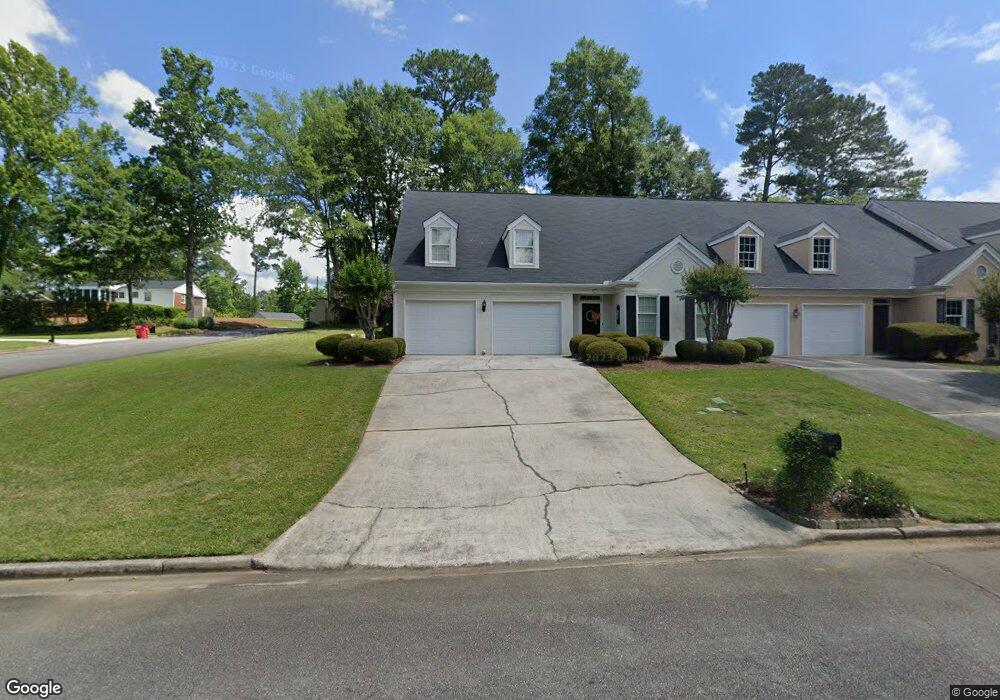
112 Brookstone Way Macon, GA 31210
Estimated Value: $218,859 - $227,000
2
Beds
2
Baths
1,647
Sq Ft
$135/Sq Ft
Est. Value
About This Home
This home is located at 112 Brookstone Way, Macon, GA 31210 and is currently estimated at $222,715, approximately $135 per square foot. 112 Brookstone Way is a home located in Bibb County with nearby schools including Lane Elementary School, Howard Middle School, and Howard High School.
Ownership History
Date
Name
Owned For
Owner Type
Purchase Details
Closed on
Mar 7, 2008
Sold by
Cannon James W and Cannon Delinda T
Bought by
Coppage Elaine
Current Estimated Value
Purchase Details
Closed on
Sep 20, 2006
Sold by
Mcanally Robbie R
Bought by
Cannon James W and Cannon Delinda T
Purchase Details
Closed on
Sep 12, 2006
Sold by
Cambell Donna C
Bought by
Cannon James W and Cannon Delinda T
Purchase Details
Closed on
Sep 28, 2001
Create a Home Valuation Report for This Property
The Home Valuation Report is an in-depth analysis detailing your home's value as well as a comparison with similar homes in the area
Home Values in the Area
Average Home Value in this Area
Purchase History
| Date | Buyer | Sale Price | Title Company |
|---|---|---|---|
| Coppage Elaine | $162,500 | None Available | |
| Cannon James W | -- | None Available | |
| Cannon James W | -- | Attorneys | |
| Cannon James W | -- | None Avilebel | |
| -- | $155,000 | -- |
Source: Public Records
Tax History Compared to Growth
Tax History
| Year | Tax Paid | Tax Assessment Tax Assessment Total Assessment is a certain percentage of the fair market value that is determined by local assessors to be the total taxable value of land and additions on the property. | Land | Improvement |
|---|---|---|---|---|
| 2025 | $1,466 | $74,227 | $16,000 | $58,227 |
| 2024 | $1,518 | $74,227 | $16,000 | $58,227 |
| 2023 | $1,061 | $74,227 | $16,000 | $58,227 |
| 2022 | $1,946 | $70,115 | $12,100 | $58,015 |
| 2021 | $1,561 | $54,934 | $9,350 | $45,584 |
| 2020 | $1,595 | $54,934 | $9,350 | $45,584 |
| 2019 | $1,246 | $45,711 | $8,415 | $37,296 |
| 2018 | $2,087 | $45,711 | $8,415 | $37,296 |
| 2017 | $1,026 | $41,567 | $8,415 | $33,152 |
| 2016 | $938 | $41,567 | $8,415 | $33,152 |
| 2015 | $1,371 | $44,574 | $9,350 | $35,224 |
| 2014 | $2,028 | $48,814 | $11,000 | $37,814 |
Source: Public Records
Map
Nearby Homes
- 1224 Timberlane Dr
- 602 Commanche Dr
- 673 Commanche Dr
- 750 Stonington Place
- 556 Commanche Place
- 825 Forest Lake Dr S
- 1270 Lake Valley Rd
- 859 Forest Lake Dr S
- 1344 Lake Valley Rd
- 731 Lokchapee Dr
- 753 Lokchapee Dr
- 106 Brandon Way
- 668 Monticlair Dr
- 4620 S Stratford Oaks Dr
- 636 Lokchapee Ridge
- 870 Glen Hill Ct
- 627 Lokchapee Ridge
- 4713 Lattimore Dr
- 938 Lundy Terrace
- 4630 Sprucewood Dr
- 120 Brookstone Way
- 128 Brookstone Way
- 111 Brookstone Ct
- 765 Forest Lake Dr S
- 140 Brookstone Way
- 123 Brookstone Ct
- 115 Brookstone Way
- 773 Forest Lake Dr S
- 753 Forest Lake Dr S
- 154 Brookstone Way
- 127 Brookstone Way
- 109 Brookstone Ln
- 105 Brookstone Ln
- 115 Brookstone Ln
- 743 Forest Lake Dr S
- 137 Brookstone Way
- 781 Forest Lake Dr S
- 140 Brookstone Ct
- 127 Brookstone Ln
- 177 Brookstone Way