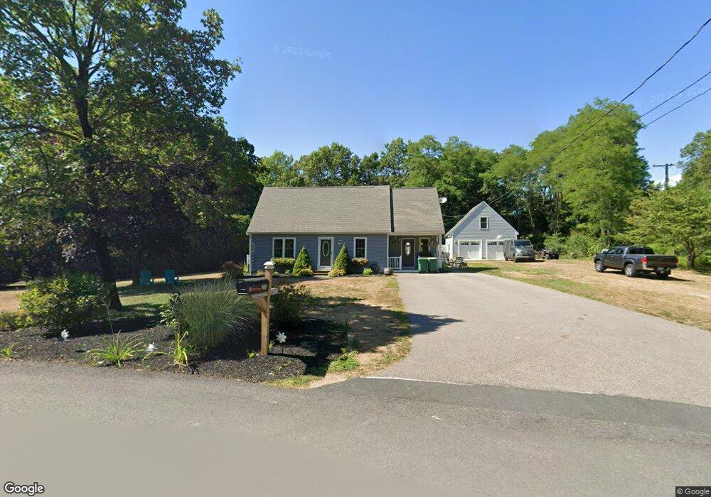
112 Brown Ave Mansfield, MA 02048
Estimated Value: $436,000 - $662,000
3
Beds
1
Bath
1,236
Sq Ft
$467/Sq Ft
Est. Value
About This Home
This home is located at 112 Brown Ave, Mansfield, MA 02048 and is currently estimated at $576,770, approximately $466 per square foot. 112 Brown Ave is a home located in Bristol County with nearby schools including Everett W. Robinson Elementary School, Jordan/Jackson Elementary School, and Harold L. Qualters Middle School.
Ownership History
Date
Name
Owned For
Owner Type
Purchase Details
Closed on
Dec 1, 2020
Sold by
Cannon Jill M and Dadmun Shawn M
Bought by
Dadmun Ret and Dadmun
Current Estimated Value
Purchase Details
Closed on
Jun 29, 2001
Sold by
Miller Edna Mae
Bought by
Cannon Jill M and Dadmun Shawn
Home Financials for this Owner
Home Financials are based on the most recent Mortgage that was taken out on this home.
Original Mortgage
$172,500
Interest Rate
7.14%
Mortgage Type
Purchase Money Mortgage
Create a Home Valuation Report for This Property
The Home Valuation Report is an in-depth analysis detailing your home's value as well as a comparison with similar homes in the area
Home Values in the Area
Average Home Value in this Area
Purchase History
| Date | Buyer | Sale Price | Title Company |
|---|---|---|---|
| Dadmun Ret | -- | None Available | |
| Cannon Jill M | $230,000 | -- |
Source: Public Records
Mortgage History
| Date | Status | Borrower | Loan Amount |
|---|---|---|---|
| Previous Owner | Cannon Jill M | $239,700 | |
| Previous Owner | Cannon Jill M | $249,000 | |
| Previous Owner | Cannon Jill M | $172,500 | |
| Previous Owner | Cannon Jill M | $57,500 |
Source: Public Records
Tax History Compared to Growth
Tax History
| Year | Tax Paid | Tax Assessment Tax Assessment Total Assessment is a certain percentage of the fair market value that is determined by local assessors to be the total taxable value of land and additions on the property. | Land | Improvement |
|---|---|---|---|---|
| 2025 | $7,145 | $542,500 | $219,600 | $322,900 |
| 2024 | $7,366 | $545,600 | $219,600 | $326,000 |
| 2023 | $7,283 | $516,900 | $219,600 | $297,300 |
| 2022 | $6,989 | $460,700 | $203,200 | $257,500 |
| 2021 | $6,761 | $440,200 | $188,300 | $251,900 |
| 2020 | $6,482 | $422,000 | $188,300 | $233,700 |
| 2019 | $6,085 | $399,800 | $156,800 | $243,000 |
| 2018 | $6,032 | $378,800 | $142,100 | $236,700 |
| 2017 | $5,316 | $353,900 | $138,100 | $215,800 |
| 2016 | $5,087 | $330,100 | $138,300 | $191,800 |
| 2015 | $4,763 | $307,300 | $131,400 | $175,900 |
Source: Public Records
Map
Nearby Homes
- 24 Maverick Dr
- 116 George St
- 11 Landry Ave
- 150 Gilbert St
- 196 Donald Tennant Cir
- 4 Buckskin Dr
- 5 Old Wood Rd
- 15 Old Wood Rd
- 16 Treasure Island Rd
- 255 Mckeon Dr
- 57 Vine St
- 28 Messenger St
- 115 Westfield Dr
- Lot 5 Jeffrey Dr
- 406 South St
- 9 Sunnyside Dr Unit 9
- Lot 2 Jeffrey Dr
- 11 Buckthorn Ln
- 9 Oak Dr
- 12 Houde St