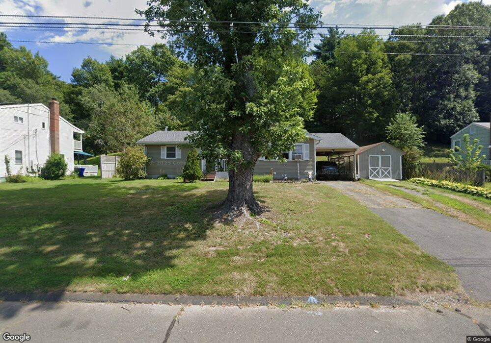
112 Cornell Dr Enfield, CT 06082
Estimated Value: $289,936 - $318,000
3
Beds
1
Bath
1,180
Sq Ft
$257/Sq Ft
Est. Value
About This Home
This home is located at 112 Cornell Dr, Enfield, CT 06082 and is currently estimated at $303,484, approximately $257 per square foot. 112 Cornell Dr is a home located in Hartford County with nearby schools including Nathan Hale Elementary School, Eli Whitney Elementary School, and Enfield High School.
Ownership History
Date
Name
Owned For
Owner Type
Purchase Details
Closed on
May 21, 2018
Sold by
Smith Donald
Bought by
Smith Tami
Current Estimated Value
Purchase Details
Closed on
Oct 17, 2005
Sold by
Pelkey Joanne
Bought by
Smith Donald and Smith Tami
Home Financials for this Owner
Home Financials are based on the most recent Mortgage that was taken out on this home.
Original Mortgage
$136,000
Interest Rate
5.78%
Purchase Details
Closed on
Apr 30, 1991
Sold by
Saunders Brian
Bought by
Pelkey Charles and Pelkey Joanne
Home Financials for this Owner
Home Financials are based on the most recent Mortgage that was taken out on this home.
Original Mortgage
$110,000
Interest Rate
9.5%
Mortgage Type
Unknown
Purchase Details
Closed on
May 13, 1987
Sold by
Rancourt Andre
Bought by
Saunders Brian
Create a Home Valuation Report for This Property
The Home Valuation Report is an in-depth analysis detailing your home's value as well as a comparison with similar homes in the area
Home Values in the Area
Average Home Value in this Area
Purchase History
| Date | Buyer | Sale Price | Title Company |
|---|---|---|---|
| Smith Tami | -- | -- | |
| Smith Donald | $170,000 | -- | |
| Pelkey Charles | $118,000 | -- | |
| Saunders Brian | $94,000 | -- |
Source: Public Records
Mortgage History
| Date | Status | Borrower | Loan Amount |
|---|---|---|---|
| Previous Owner | Saunders Brian | $136,000 | |
| Previous Owner | Saunders Brian | $34,000 | |
| Previous Owner | Saunders Brian | $126,000 | |
| Previous Owner | Saunders Brian | $110,000 |
Source: Public Records
Tax History
| Year | Tax Paid | Tax Assessment Tax Assessment Total Assessment is a certain percentage of the fair market value that is determined by local assessors to be the total taxable value of land and additions on the property. | Land | Improvement |
|---|---|---|---|---|
| 2025 | $5,514 | $157,100 | $63,000 | $94,100 |
| 2024 | $5,312 | $157,100 | $63,000 | $94,100 |
| 2023 | $5,272 | $157,100 | $63,000 | $94,100 |
| 2022 | $4,853 | $157,100 | $63,000 | $94,100 |
| 2021 | $4,519 | $120,290 | $52,070 | $68,220 |
| 2020 | $4,489 | $120,290 | $52,070 | $68,220 |
| 2019 | $4,483 | $120,290 | $52,070 | $68,220 |
| 2018 | $4,363 | $120,290 | $52,070 | $68,220 |
| 2017 | $4,099 | $120,290 | $52,070 | $68,220 |
| 2016 | $4,003 | $119,990 | $53,420 | $66,570 |
| 2015 | $3,880 | $119,990 | $53,420 | $66,570 |
| 2014 | $3,783 | $119,990 | $53,420 | $66,570 |
Source: Public Records
Map
Nearby Homes
- 120 Cornell Dr
- 104 Cornell Dr
- 107 Cornell Dr
- 115 Cornell Dr
- 99 Cornell Dr
- 96 Cornell Dr
- 123 Cornell Dr
- 128 Cornell Dr
- 91 Cornell Dr
- 88 Cornell Dr
- 136 Cornell Dr
- 131 Cornell Dr
- 146 Columbia Rd
- 154 Columbia Rd
- 83 Cornell Dr
- 138 Columbia Rd
- 162 Columbia Rd
- 130 Columbia Rd
- 139 Cornell Dr
- 14 Northfield Rd
Your Personal Tour Guide
Ask me questions while you tour the home.