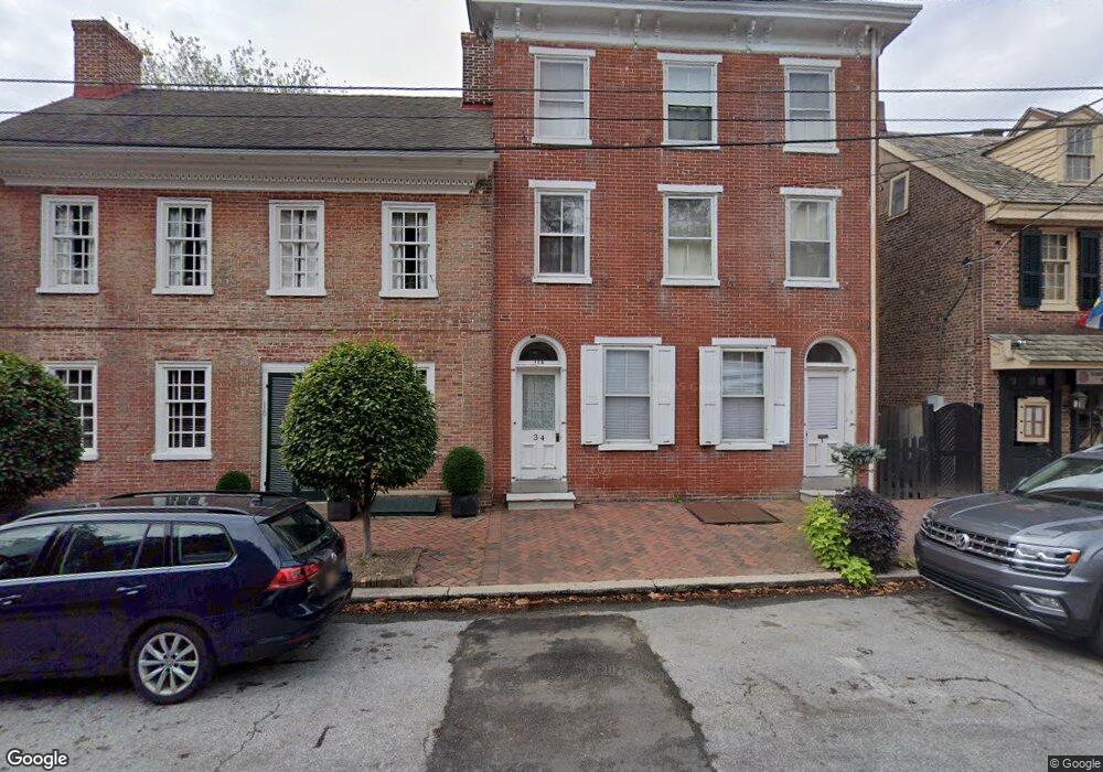
112 Delaware St New Castle, DE 19720
Estimated Value: $463,000 - $943,000
5
Beds
5
Baths
4,080
Sq Ft
$187/Sq Ft
Est. Value
About This Home
This home is located at 112 Delaware St, New Castle, DE 19720 and is currently estimated at $763,200, approximately $187 per square foot. 112 Delaware St is a home located in New Castle County with nearby schools including Carrie Downie Elementary School, Calvin R. McCullough Middle School, and St. Peter Catholic School.
Ownership History
Date
Name
Owned For
Owner Type
Purchase Details
Closed on
Apr 12, 2012
Sold by
Resetar Leonard P
Bought by
L & R Indusitres Llc
Current Estimated Value
Purchase Details
Closed on
Apr 28, 2003
Sold by
Whary Pamela B
Bought by
Resetar Leonard P
Purchase Details
Closed on
Apr 12, 2002
Sold by
Whary Pamela B
Bought by
Whary Pamela B
Create a Home Valuation Report for This Property
The Home Valuation Report is an in-depth analysis detailing your home's value as well as a comparison with similar homes in the area
Home Values in the Area
Average Home Value in this Area
Purchase History
| Date | Buyer | Sale Price | Title Company |
|---|---|---|---|
| L & R Indusitres Llc | -- | None Available | |
| Resetar Leonard P | $435,000 | -- | |
| Whary Pamela B | -- | -- |
Source: Public Records
Mortgage History
| Date | Status | Borrower | Loan Amount |
|---|---|---|---|
| Open | L & R Industries Llc | $400,000 | |
| Closed | L & R Industries Llc | $250,000 |
Source: Public Records
Tax History
| Year | Tax Paid | Tax Assessment Tax Assessment Total Assessment is a certain percentage of the fair market value that is determined by local assessors to be the total taxable value of land and additions on the property. | Land | Improvement |
|---|---|---|---|---|
| 2024 | $4,303 | $149,900 | $18,300 | $131,600 |
| 2023 | $3,889 | $149,900 | $18,300 | $131,600 |
| 2022 | $4,042 | $149,900 | $18,300 | $131,600 |
| 2021 | $4,024 | $149,900 | $18,300 | $131,600 |
| 2020 | $4,024 | $149,900 | $18,300 | $131,600 |
| 2019 | $4,820 | $149,900 | $18,300 | $131,600 |
| 2018 | $3,965 | $149,900 | $18,300 | $131,600 |
| 2017 | $3,705 | $149,900 | $18,300 | $131,600 |
| 2016 | $3,240 | $149,900 | $18,300 | $131,600 |
| 2015 | $3,242 | $149,900 | $18,300 | $131,600 |
| 2014 | $3,243 | $149,900 | $18,300 | $131,600 |
Source: Public Records
Map
Nearby Homes
- 110 Delaware St
- 116 Delaware St
- 10 Dalby Aly
- 118 Delaware St
- 12 Dalby Aly
- 102 Delaware St
- 120 Delaware St Unit C
- 120 Delaware St
- 120 Delaware St Unit A
- 120 Delaware St Unit B
- 16 Dalby Aly
- 2 The Strand
- 1 Battery Park Unit 3
- 3 Battery Park
- 117 Delaware St
- 115 Delaware St
- 113 Delaware St
- 119 Delaware St
- 4 The Strand
- 121 Delaware St
Your Personal Tour Guide
Ask me questions while you tour the home.