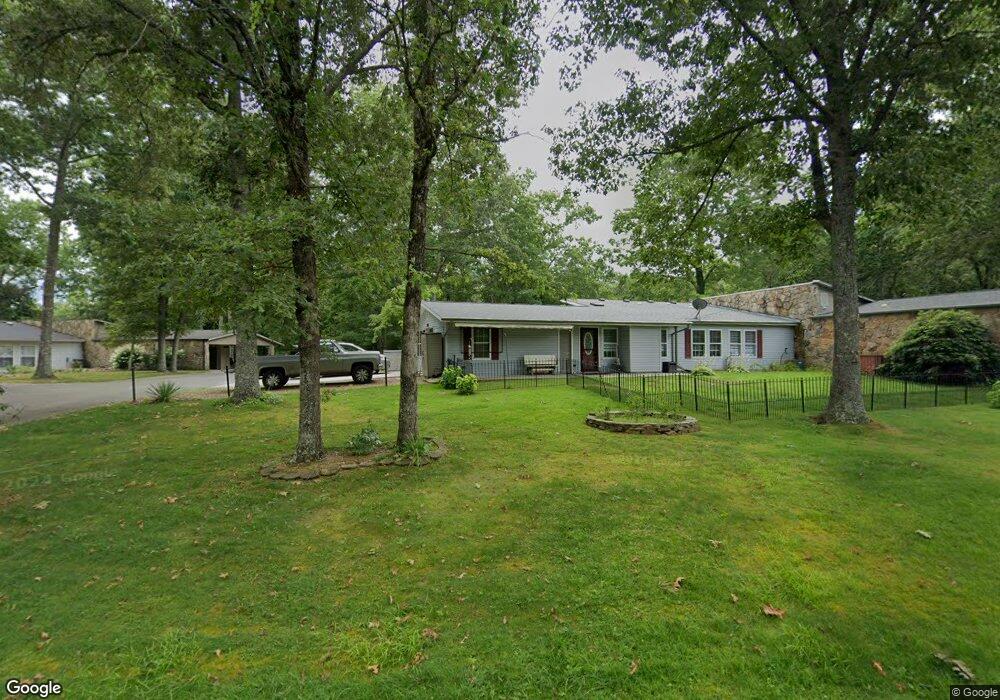
112 Dovenshire Dr Crossville, TN 38558
Estimated Value: $215,000 - $234,000
2
Beds
2
Baths
1,450
Sq Ft
$157/Sq Ft
Est. Value
About This Home
This home is located at 112 Dovenshire Dr, Crossville, TN 38558 and is currently estimated at $226,944, approximately $156 per square foot. 112 Dovenshire Dr is a home located in Cumberland County with nearby schools including Crab Orchard Elementary School and Stone Memorial High School.
Ownership History
Date
Name
Owned For
Owner Type
Purchase Details
Closed on
May 14, 2003
Sold by
Lemle Betty Suzanne
Bought by
Ulrich Mark D
Current Estimated Value
Home Financials for this Owner
Home Financials are based on the most recent Mortgage that was taken out on this home.
Original Mortgage
$35,000
Outstanding Balance
$14,948
Interest Rate
5.79%
Estimated Equity
$211,996
Purchase Details
Closed on
Sep 9, 1997
Sold by
Piotraschke Ralph H
Bought by
Piotraschke Jessie E
Create a Home Valuation Report for This Property
The Home Valuation Report is an in-depth analysis detailing your home's value as well as a comparison with similar homes in the area
Home Values in the Area
Average Home Value in this Area
Purchase History
| Date | Buyer | Sale Price | Title Company |
|---|---|---|---|
| Ulrich Mark D | $44,000 | -- | |
| Piotraschke Jessie E | $26,500 | -- |
Source: Public Records
Mortgage History
| Date | Status | Borrower | Loan Amount |
|---|---|---|---|
| Open | Piotraschke Jessie E | $35,000 |
Source: Public Records
Tax History Compared to Growth
Tax History
| Year | Tax Paid | Tax Assessment Tax Assessment Total Assessment is a certain percentage of the fair market value that is determined by local assessors to be the total taxable value of land and additions on the property. | Land | Improvement |
|---|---|---|---|---|
| 2025 | -- | $37,600 | $2,000 | $35,600 |
| 2024 | $427 | $37,600 | $2,000 | $35,600 |
| 2023 | $427 | $37,600 | $0 | $0 |
| 2022 | $427 | $37,600 | $2,000 | $35,600 |
| 2021 | $385 | $24,625 | $1,500 | $23,125 |
| 2020 | $385 | $24,625 | $1,500 | $23,125 |
| 2019 | $317 | $24,625 | $1,500 | $23,125 |
| 2018 | $317 | $20,275 | $1,500 | $18,775 |
| 2017 | $317 | $20,275 | $1,500 | $18,775 |
| 2016 | $365 | $23,875 | $1,500 | $22,375 |
| 2015 | $358 | $23,875 | $1,500 | $22,375 |
| 2014 | $359 | $23,958 | $0 | $0 |
Source: Public Records
Map
Nearby Homes
- 130 Dovenshire Dr
- 207 Saint George Dr
- 219 St George Dr
- 151 Saint George Dr
- 107 Brighton Ln
- 229 Saint George Dr
- 150 Dovenshire Dr
- 230 Saint George Dr
- 155 Dovenshire Dr
- 233 St George Dr
- 238 Saint George Dr
- 638 Crestview Loop
- 110 Delbridge Ln
- 246 St George Dr
- 113 Ashdown Ln
- 11 Oxford Cir
- 104 Juniper Dr
- 13 Oxford Cir
- 107 Ivy Ln
- 105 Kings Ln
- 110 Dovenshire Dr
- 114 Dovenshire Dr
- 108 Dovenshire Dr
- 118 Dovenshire Dr
- 116 Dovenshire Dr
- 104 Dovenshire Dr
- 107 Dovenshire Dr
- 111 Dovenshire Dr
- 17 Lake Forest Ln
- 113 Dovenshire Dr
- 124 Dovenshire Dr
- 105 Dovenshire Dr
- 109 Dovenshire Dr
- 102 Dovenshire Dr
- 15 Lake Forest Ln
- 103 Dovenshire Dr
- 201 Saint George Dr
- 203 Saint George Dr
- 132 Dovenshire Dr
- 29 Dockside Ct