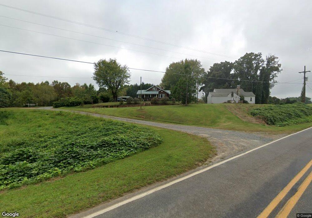
112 Dunbar Ln Pilot Mountain, NC 27041
Estimated Value: $189,465 - $469,000
3
Beds
1
Bath
1,644
Sq Ft
$187/Sq Ft
Est. Value
About This Home
This home is located at 112 Dunbar Ln, Pilot Mountain, NC 27041 and is currently estimated at $307,366, approximately $186 per square foot. 112 Dunbar Ln is a home with nearby schools including Westfield Elementary School, Pilot Mountain Middle School, and East Surry High School.
Ownership History
Date
Name
Owned For
Owner Type
Purchase Details
Closed on
Nov 21, 2013
Sold by
Johnson Jonathan Dale
Bought by
Johnson Jonathan Dale and Johnson Katrina
Current Estimated Value
Purchase Details
Closed on
Apr 25, 2008
Sold by
Graham Joan Lawson
Bought by
Johnson Jonathan Dale
Home Financials for this Owner
Home Financials are based on the most recent Mortgage that was taken out on this home.
Original Mortgage
$110,250
Outstanding Balance
$70,548
Interest Rate
6.08%
Mortgage Type
New Conventional
Estimated Equity
$236,818
Create a Home Valuation Report for This Property
The Home Valuation Report is an in-depth analysis detailing your home's value as well as a comparison with similar homes in the area
Home Values in the Area
Average Home Value in this Area
Purchase History
| Date | Buyer | Sale Price | Title Company |
|---|---|---|---|
| Johnson Jonathan Dale | -- | None Available | |
| Johnson Jonathan Dale | $122,500 | None Available |
Source: Public Records
Mortgage History
| Date | Status | Borrower | Loan Amount |
|---|---|---|---|
| Open | Johnson Jonathan Dale | $110,250 |
Source: Public Records
Tax History Compared to Growth
Tax History
| Year | Tax Paid | Tax Assessment Tax Assessment Total Assessment is a certain percentage of the fair market value that is determined by local assessors to be the total taxable value of land and additions on the property. | Land | Improvement |
|---|---|---|---|---|
| 2024 | $712 | $101,800 | $18,000 | $83,800 |
| 2023 | $700 | $101,800 | $18,000 | $83,800 |
| 2022 | $700 | $101,800 | $18,000 | $83,800 |
| 2021 | $712 | $101,800 | $18,000 | $83,800 |
| 2020 | $706 | $98,100 | $18,000 | $80,100 |
| 2019 | $703 | $98,100 | $18,000 | $80,100 |
| 2018 | $677 | $98,100 | $0 | $0 |
| 2017 | $666 | $98,100 | $0 | $0 |
| 2016 | $666 | $98,100 | $0 | $0 |
| 2013 | -- | $100,350 | $0 | $0 |
Source: Public Records
Map
Nearby Homes
- Lot 4,5,6 Sideview Ln
- 6595 Westfield Rd
- 140 Daniels Dell Ln
- Lot 5 Howell Rd
- 731 Indian Grove Church Rd
- 446 Gilley Rd
- 310 Jessup Grove Church Rd
- 4 Jessup Grove Church Rd
- xx Gilley Rd Unit 20.63 acres
- 00 Albion Church Rd
- 1125 Apple Blossom Ln
- 7.8ac Norman Rd
- 1993 Cook School Rd
- 0 Chestnut Ridge Rd
- 109 E Norman Rd
- 2109 Cook School Rd
- 3.9Ac Pell Rd
- 733 Slate Mountain Rd
- 0 Norman Rd
- 182 Black Walnut Trail
- 1532 Toms Creek Church Rd
- 122 Dunbar Ln
- 1533 Toms Creek Church Rd
- 0000 Toms Creek Church
- 1591 Toms Creek Church Rd
- 1475 Toms Creek Church Rd
- 1625 Toms Creek Church Rd
- 1428 Toms Creek Church Rd
- 0 Toms Creek Church Rd
- 00 Toms Creek Church Rd
- 000 Toms Creek Church Rd
- 1405 Toms Creek Church Rd
- 1073 Cleo Cain Rd
- 213 Bosea Way
- TBD Toms Creek Church Rd
- 181 Bosea Way
- 10 Ac Cleo Cain Rd
- 1344 Toms Creek Church Rd
- 117 Crook Ln
- 155 Little Brook Trail