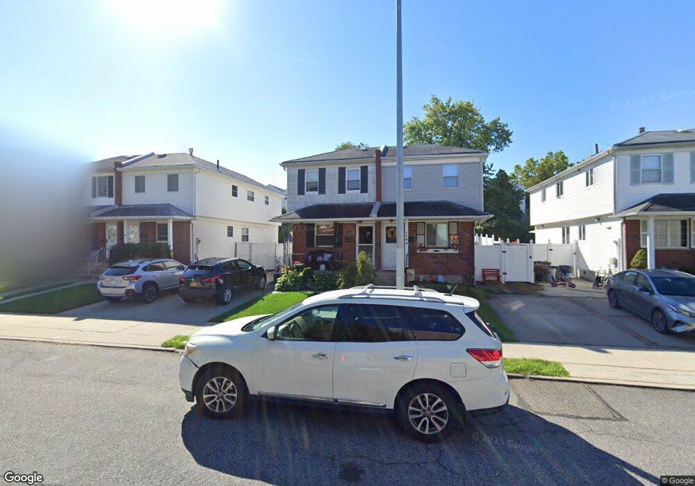
112 E Brandis Ave Staten Island, NY 10308
Eltingville NeighborhoodEstimated Value: $648,000 - $707,000
3
Beds
2
Baths
1,600
Sq Ft
$425/Sq Ft
Est. Value
About This Home
This home is located at 112 E Brandis Ave, Staten Island, NY 10308 and is currently estimated at $679,502, approximately $424 per square foot. 112 E Brandis Ave is a home located in Richmond County with nearby schools including P.S. 32 The Gifford School, I.S. 075 Frank D. Paulo, and Susan E Wagner High School.
Ownership History
Date
Name
Owned For
Owner Type
Purchase Details
Closed on
Aug 15, 2007
Sold by
Shaker Zakaria and Rezkalla Magda
Bought by
Brennan Karen
Current Estimated Value
Home Financials for this Owner
Home Financials are based on the most recent Mortgage that was taken out on this home.
Original Mortgage
$333,000
Outstanding Balance
$211,699
Interest Rate
6.74%
Mortgage Type
Purchase Money Mortgage
Estimated Equity
$467,803
Purchase Details
Closed on
Sep 10, 1998
Sold by
Jones Michael J and Jones Rita
Bought by
Shaker Zakaria M and Rezkalla Magda R
Create a Home Valuation Report for This Property
The Home Valuation Report is an in-depth analysis detailing your home's value as well as a comparison with similar homes in the area
Home Values in the Area
Average Home Value in this Area
Purchase History
| Date | Buyer | Sale Price | Title Company |
|---|---|---|---|
| Brennan Karen | $370,000 | Commonwealth Land Title Insu | |
| Shaker Zakaria M | $157,500 | First American Title Ins Co |
Source: Public Records
Mortgage History
| Date | Status | Borrower | Loan Amount |
|---|---|---|---|
| Open | Brennan Karen | $333,000 |
Source: Public Records
Tax History Compared to Growth
Tax History
| Year | Tax Paid | Tax Assessment Tax Assessment Total Assessment is a certain percentage of the fair market value that is determined by local assessors to be the total taxable value of land and additions on the property. | Land | Improvement |
|---|---|---|---|---|
| 2025 | $6,025 | $37,680 | $7,139 | $30,541 |
| 2024 | $6,025 | $36,480 | $6,957 | $29,523 |
| 2023 | $5,946 | $29,280 | $6,813 | $22,467 |
| 2022 | $5,583 | $32,340 | $8,460 | $23,880 |
| 2021 | $5,865 | $30,900 | $8,460 | $22,440 |
| 2020 | $5,608 | $30,360 | $8,460 | $21,900 |
| 2019 | $5,229 | $30,060 | $8,460 | $21,600 |
| 2018 | $4,974 | $24,400 | $7,578 | $16,822 |
| 2017 | $4,751 | $23,306 | $7,899 | $15,407 |
| 2016 | $4,642 | $23,223 | $8,085 | $15,138 |
| 2015 | $3,998 | $22,080 | $6,883 | $15,197 |
| 2014 | $3,998 | $20,832 | $7,019 | $13,813 |
Source: Public Records
Map
Nearby Homes
- 443 Ridgewood Ave
- 88 Cortelyou Ave
- 467 Ridgewood Ave
- 74 E Brandis Ave
- 58 Getz Ave
- 924 Armstrong Ave Unit 2-3
- 131 Cortelyou Ave Unit 1-1
- 543 Eltingville Blvd
- 919 Armstrong Ave
- 437 Eltingville Blvd
- 350 Bartlett Ave
- 350 Brookfield Ave
- 339 Abingdon Ave
- 621 Barlow Ave
- 57 Middle Loop Rd
- 622 Barlow Ave
- 0 Getz Ave
- 379 Brookfield Ave
- 307 Abingdon Ave
- 212 Cortelyou Ave
- 114 E Brandis Ave
- 108 E Brandis Ave
- 116 E Brandis Ave
- 106 E Brandis Ave
- 118 E Brandis Ave
- 104 E Brandis Ave
- 122 E Brandis Ave
- 102 E Brandis Ave
- 109 E Macon Ave
- 107 E Macon Ave
- 111 E Macon Ave
- 105 E Macon Ave
- 115 E Macon Ave
- 124 E Brandis Ave
- 100 E Brandis Ave
- 103 E Macon Ave
- 117 E Macon Ave
- 101 E Macon Ave
- 126 E Brandis Ave
- 98 E Brandis Ave