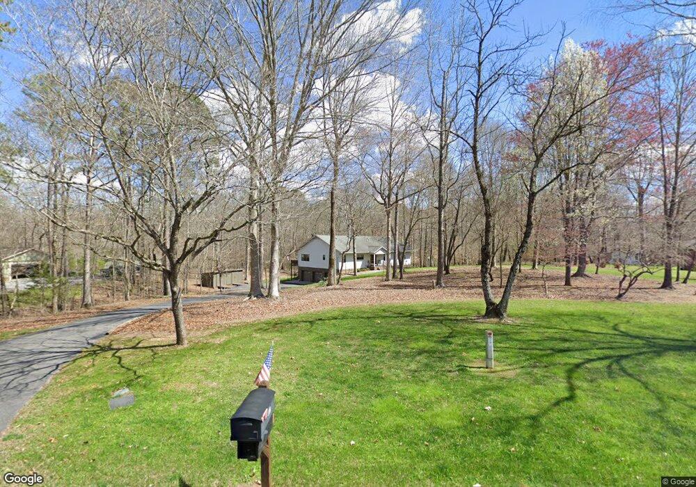
112 Forrestway Dr La Fayette, GA 30728
Noble NeighborhoodEstimated Value: $303,628 - $477,000
--
Bed
2
Baths
2,707
Sq Ft
$136/Sq Ft
Est. Value
About This Home
This home is located at 112 Forrestway Dr, La Fayette, GA 30728 and is currently estimated at $368,407, approximately $136 per square foot. 112 Forrestway Dr is a home located in Walker County with nearby schools including Rock Spring Elementary School, Lafayette High School, and Alice M Daley Adventist School.
Ownership History
Date
Name
Owned For
Owner Type
Purchase Details
Closed on
Oct 21, 2020
Sold by
Sperry Karen C L
Bought by
Karen C Sperry Rev Trust
Current Estimated Value
Purchase Details
Closed on
Apr 14, 2017
Sold by
Sperry Karen
Bought by
Sperry Cynthia Luella and Sperry Adam Del
Purchase Details
Closed on
Mar 31, 2017
Sold by
Sperry Cynthia Luella
Bought by
Sperry Karen C
Purchase Details
Closed on
Jun 28, 1996
Sold by
Jerry Lewis Quinn and Jerry Terry
Bought by
Sperry Virgil R and Sperry Karen C
Purchase Details
Closed on
Jul 23, 1973
Sold by
Hammond Dewey
Bought by
Jerry Lewis Quinn and Jerry Terry
Purchase Details
Closed on
Jan 1, 1972
Bought by
Parker Sam
Purchase Details
Closed on
Jan 1, 1971
Sold by
Parker Sam
Bought by
Hammond Dewey
Create a Home Valuation Report for This Property
The Home Valuation Report is an in-depth analysis detailing your home's value as well as a comparison with similar homes in the area
Home Values in the Area
Average Home Value in this Area
Purchase History
| Date | Buyer | Sale Price | Title Company |
|---|---|---|---|
| Karen C Sperry Rev Trust | -- | -- | |
| Sperry Cynthia Luella | -- | -- | |
| Sperry Karen C | -- | -- | |
| Sperry Virgil R | $8,000 | -- | |
| Jerry Lewis Quinn | -- | -- | |
| Parker Sam | -- | -- | |
| Hammond Dewey | -- | -- |
Source: Public Records
Tax History Compared to Growth
Tax History
| Year | Tax Paid | Tax Assessment Tax Assessment Total Assessment is a certain percentage of the fair market value that is determined by local assessors to be the total taxable value of land and additions on the property. | Land | Improvement |
|---|---|---|---|---|
| 2024 | $383 | $135,102 | $14,400 | $120,702 |
| 2023 | $383 | $131,222 | $14,400 | $116,822 |
| 2022 | $275 | $106,761 | $7,200 | $99,561 |
| 2021 | $1,690 | $90,996 | $7,200 | $83,796 |
| 2020 | $1,295 | $72,986 | $7,200 | $65,786 |
| 2019 | $1,332 | $72,986 | $7,200 | $65,786 |
| 2018 | $1,931 | $72,986 | $7,200 | $65,786 |
| 2017 | $1,867 | $72,986 | $7,200 | $65,786 |
| 2016 | $1,867 | $72,986 | $7,200 | $65,786 |
| 2015 | $1,705 | $62,605 | $7,200 | $55,405 |
| 2014 | $1,588 | $62,605 | $7,200 | $55,405 |
| 2013 | $1,931 | $62,605 | $7,200 | $55,405 |
Source: Public Records
Map
Nearby Homes
- 63 Loughridge Ln
- 4544 N Highway 27
- 4582 Highway N 27
- 4654 Us Highway 27
- 1186 E Reed Rd
- 516 W Reed Rd
- 521 Wheeler Rd
- 663 Diamond Cir
- 906 Diamond Cir
- Lot 3 Cedar Farm Rd
- 1585 E Reed Rd
- 0 Veeler Rd Unit 1522679
- 0 Veeler Rd Unit 10628696
- 894 896 Wheeler Unit 1 & 2
- 894 896 Wheeler
- 0 E Warren Rd Unit RTC2681365
- 0 E Warren Rd Unit 1395828
- Hanover Plan at Price's Crossing
- Cali Plan at Price's Crossing
- Belhaven Plan at Price's Crossing
- 148 Forrestway Dr
- 70 Forrestway Dr
- 192 Forrestway Dr
- 26 Forrestway Dr
- 49 Forrestway Dr
- 157 Forrestway Dr
- 185 Forrestway Dr
- 250 Forrestway Dr
- 569 E Reed Rd
- 223 Forrestway Dr
- 142 Loughridge Ln
- 456 E Reed Rd
- 387 E Reed Rd
- 592 E Reed Rd
- 245 Forrestway Dr
- 404 E Reed Rd
- 121 Loughridge Ln
- 242 E Reed Rd
- 284 Forrestway Dr
- 43 Loughridge Ln