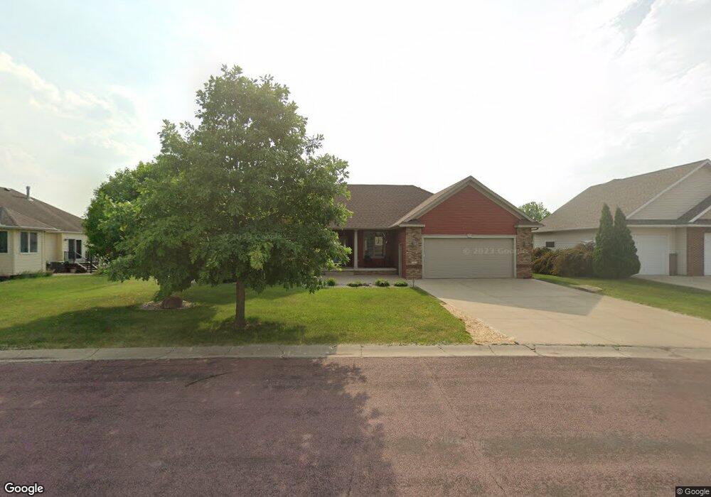
112 Jacob Dr Unit 112 Jacob Drive Mankato, MN 56001
Buscher Park NeighborhoodEstimated Value: $448,000 - $505,000
4
Beds
3
Baths
1,705
Sq Ft
$283/Sq Ft
Est. Value
About This Home
This home is located at 112 Jacob Dr Unit 112 Jacob Drive, Mankato, MN 56001 and is currently estimated at $483,199, approximately $283 per square foot. 112 Jacob Dr Unit 112 Jacob Drive is a home located in Blue Earth County with nearby schools including Rosa Parks Elementary School, Prairie Winds Middle School, and Mankato East Senior High School.
Ownership History
Date
Name
Owned For
Owner Type
Purchase Details
Closed on
Dec 18, 2024
Sold by
Stilson Christine
Bought by
Ewing Ashley and Ewing Steven
Current Estimated Value
Home Financials for this Owner
Home Financials are based on the most recent Mortgage that was taken out on this home.
Original Mortgage
$402,000
Outstanding Balance
$398,838
Interest Rate
6.79%
Mortgage Type
New Conventional
Estimated Equity
$84,361
Purchase Details
Closed on
May 10, 2024
Sold by
Gina Marie Risty Trust
Bought by
Stilson Christine
Purchase Details
Closed on
Mar 20, 2009
Sold by
Rome Reichel Construction Inc
Bought by
Risty Gina M
Purchase Details
Closed on
May 2, 2007
Sold by
Jacob Estates Llc
Bought by
Rome Reichel Construction Inc
Create a Home Valuation Report for This Property
The Home Valuation Report is an in-depth analysis detailing your home's value as well as a comparison with similar homes in the area
Home Values in the Area
Average Home Value in this Area
Purchase History
| Date | Buyer | Sale Price | Title Company |
|---|---|---|---|
| Ewing Ashley | $485,000 | Stewart Title Company | |
| Stilson Christine | $459,900 | -- | |
| Risty Gina M | $287,000 | -- | |
| Rome Reichel Construction Inc | $360,000 | -- |
Source: Public Records
Mortgage History
| Date | Status | Borrower | Loan Amount |
|---|---|---|---|
| Open | Ewing Ashley | $402,000 |
Source: Public Records
Tax History Compared to Growth
Tax History
| Year | Tax Paid | Tax Assessment Tax Assessment Total Assessment is a certain percentage of the fair market value that is determined by local assessors to be the total taxable value of land and additions on the property. | Land | Improvement |
|---|---|---|---|---|
| 2025 | $5,042 | $442,100 | $51,800 | $390,300 |
| 2024 | $5,042 | $449,700 | $51,800 | $397,900 |
| 2023 | $4,976 | $454,000 | $51,800 | $402,200 |
| 2022 | $4,376 | $424,700 | $51,800 | $372,900 |
| 2021 | $4,332 | $349,400 | $51,800 | $297,600 |
| 2020 | $4,130 | $329,300 | $51,800 | $277,500 |
| 2019 | $3,888 | $329,300 | $51,800 | $277,500 |
| 2018 | $3,616 | $310,900 | $51,800 | $259,100 |
| 2017 | $3,262 | $292,500 | $51,800 | $240,700 |
| 2016 | $3,248 | $278,100 | $51,800 | $226,300 |
| 2015 | $31 | $278,100 | $51,800 | $226,300 |
| 2014 | $3,010 | $265,800 | $51,800 | $214,000 |
Source: Public Records
Map
Nearby Homes
- 124 Joshua Ct
- TBD Woodridge
- 2 A Madison Ave
- 117 Savannah Ct
- 108 Ella Ct
- 421 421 Woodhaven Ln
- 124 124 Quinion Dr
- 105 Plato St
- 205 Viking Dr
- 216 216 South Brook Cir
- 121 Viking Ct
- 20 20 Caroletta Ct
- 20 Caroletta Ct
- 101 Wickfield Dr
- 105 Viking Ct
- 1040 1040 Stoltzman Rd
- 100 Emily Ln
- 208 Chancery Ln
- TBD S Brook Way
- 112 Rosewood Dr Unit 108 Rosewood Drive
- 315 315 Woodhaven Cir
- 108 Jacob Dr
- 315 Woodhaven Cir
- 315 Woodhaven Cir Unit 315 Woodhaven Circle
- 319 Woodhaven Cir
- 201 Woodhaven Cir
- 205 205 Woodhaven Cir
- 205 Woodhaven Cir
- 209 Woodhaven Cir
- 104 Jacob Dr
- 104 Jacob Dr Unit 104 Jacob Drive
- 323 Woodhaven Cir
- 323 Woodhaven Cir Unit 323 Woodhaven Circle
- 145 Jacob Dr
- 149 Jacob Dr
- 133 Jacob Dr
- 213 Woodhaven Cir
- 213 Woodhaven Cir Unit 213 Woodhaven Circle
- 137 Jacob Dr
- 308 Woodhaven Cir