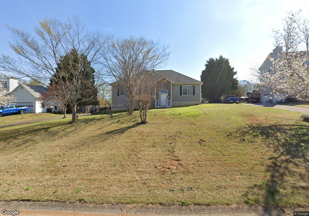
112 Logan Cole Dr Acworth, GA 30102
Oak Grove NeighborhoodEstimated Value: $379,873 - $397,000
3
Beds
2
Baths
1,955
Sq Ft
$199/Sq Ft
Est. Value
About This Home
This home is located at 112 Logan Cole Dr, Acworth, GA 30102 and is currently estimated at $388,437, approximately $198 per square foot. 112 Logan Cole Dr is a home located in Cherokee County with nearby schools including Oak Grove Elementary School, E. T. Booth Middle School, and Etowah High School.
Ownership History
Date
Name
Owned For
Owner Type
Purchase Details
Closed on
Aug 8, 2007
Sold by
Lane John B and Lane Michelle A
Bought by
Cottle Tim and Cottle Allison
Current Estimated Value
Home Financials for this Owner
Home Financials are based on the most recent Mortgage that was taken out on this home.
Original Mortgage
$174,510
Outstanding Balance
$108,904
Interest Rate
6.56%
Mortgage Type
New Conventional
Estimated Equity
$279,533
Purchase Details
Closed on
Feb 21, 1997
Sold by
Padgett Joe
Bought by
Burrell Kathy
Create a Home Valuation Report for This Property
The Home Valuation Report is an in-depth analysis detailing your home's value as well as a comparison with similar homes in the area
Home Values in the Area
Average Home Value in this Area
Purchase History
| Date | Buyer | Sale Price | Title Company |
|---|---|---|---|
| Cottle Tim | $193,900 | -- | |
| Burrell Kathy | $132,400 | -- |
Source: Public Records
Mortgage History
| Date | Status | Borrower | Loan Amount |
|---|---|---|---|
| Open | Cottle Tim | $174,510 | |
| Closed | Burrell Kathy | $0 |
Source: Public Records
Tax History Compared to Growth
Tax History
| Year | Tax Paid | Tax Assessment Tax Assessment Total Assessment is a certain percentage of the fair market value that is determined by local assessors to be the total taxable value of land and additions on the property. | Land | Improvement |
|---|---|---|---|---|
| 2025 | $2,967 | $127,428 | $30,000 | $97,428 |
| 2024 | $2,961 | $128,184 | $30,000 | $98,184 |
| 2023 | $2,299 | $117,376 | $30,000 | $87,376 |
| 2022 | $2,214 | $91,452 | $13,400 | $78,052 |
| 2021 | $2,112 | $79,168 | $13,400 | $65,768 |
| 2020 | $2,022 | $75,240 | $13,400 | $61,840 |
| 2019 | $1,880 | $69,120 | $13,400 | $55,720 |
| 2018 | $1,763 | $63,920 | $13,400 | $50,520 |
| 2017 | $1,753 | $157,800 | $13,400 | $49,720 |
| 2016 | $1,721 | $153,600 | $13,400 | $48,040 |
| 2015 | $1,633 | $144,600 | $13,400 | $44,440 |
| 2014 | $1,651 | $145,900 | $13,400 | $44,960 |
Source: Public Records
Map
Nearby Homes
- 206 Cameron Ct
- 302 Seth Way
- 6312 Woodstock Rd
- 6222 Westridge Trace
- 6147 Little Ridge Rd
- 6155 Little Ridge Rd
- 6137 Little Ridge Rd
- 6226 Westridge Trace
- 6375 Caladium Dr
- 577 Oakside Place
- 313 Maltibie Dr
- 6390 Woodstock Rd
- 271 Oak Grove Way
- 145 Winner St
- 626 Spanish Oak Dr
- 536 Rendezvous Rd
- 402 Royal Oak Dr
- 108 Creekwood Trail
- 240 Ridge Mill Dr
- 320 Oak Leaf Place
- 114 Logan Cole Dr
- 110 Logan Cole Dr
- 116 Logan Cole Dr
- 108 Logan Cole Dr
- 0 Logan Cole Dr Unit 7016874
- 0 Logan Cole Dr Unit 8586936
- 0 Logan Cole Dr Unit 8212251
- 0 Logan Cole Dr Unit 8415502
- 0 Logan Cole Dr Unit 3199576
- 0 Logan Cole Dr
- 201 Cameron Ct
- 106 Logan Cole Dr
- 200 Cameron Ct
- 118 Logan Cole Dr
- 6151 Kemp Dr
- 109 Logan Cole Dr
- 107 Logan Cole Dr
- 115 Logan Cole Dr
- 120 Logan Cole Dr
- 6191 Kemp Dr