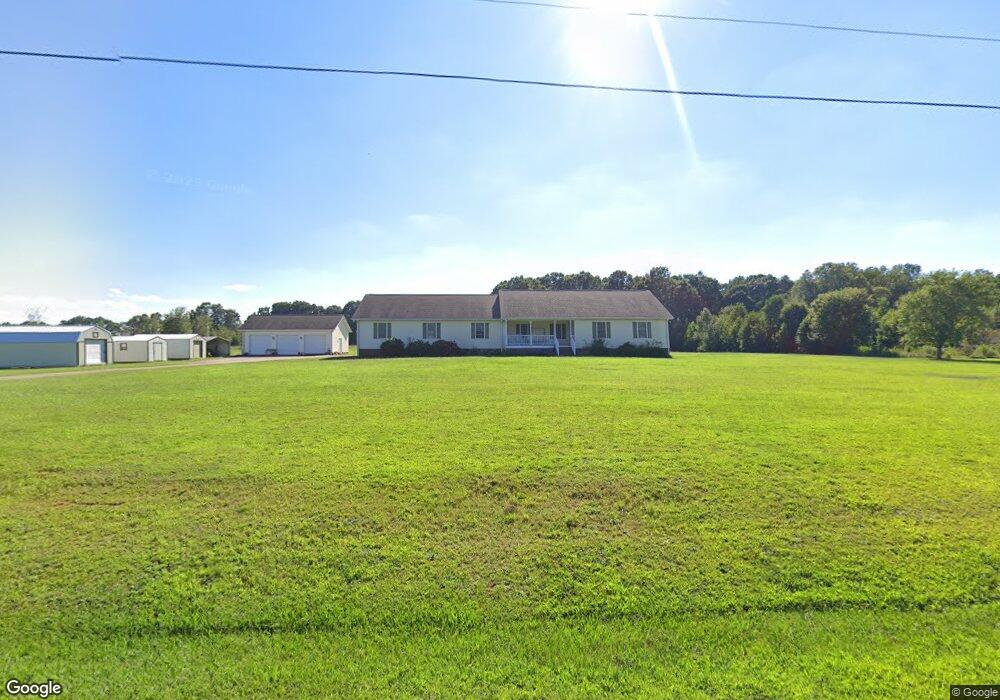
112 Matthew Dr Belton, SC 29627
Estimated Value: $322,000 - $429,106
4
Beds
--
Bath
1,995
Sq Ft
$190/Sq Ft
Est. Value
About This Home
This home is located at 112 Matthew Dr, Belton, SC 29627 and is currently estimated at $379,277, approximately $190 per square foot. 112 Matthew Dr is a home with nearby schools including Belton Honea Path High School.
Ownership History
Date
Name
Owned For
Owner Type
Purchase Details
Closed on
Oct 26, 2004
Sold by
Cox Charles M
Bought by
Grant Shirley F Cox
Current Estimated Value
Purchase Details
Closed on
Jan 29, 2002
Sold by
Cox Charles M
Bought by
Hollingsworth Travis W
Purchase Details
Closed on
Aug 23, 2001
Sold by
Cox Charles M
Bought by
Mcclain John R
Purchase Details
Closed on
Jul 17, 2001
Sold by
Cox Charles M
Bought by
Rutledge Harmon T
Purchase Details
Closed on
Mar 13, 2001
Sold by
Cox Charles M
Bought by
Davenport Mark A
Purchase Details
Closed on
Jan 29, 2001
Sold by
Cox Charles M
Bought by
Sell Addison K
Purchase Details
Closed on
Jan 24, 2001
Sold by
Cox Charles M
Bought by
Davenport Mark A
Create a Home Valuation Report for This Property
The Home Valuation Report is an in-depth analysis detailing your home's value as well as a comparison with similar homes in the area
Home Values in the Area
Average Home Value in this Area
Purchase History
| Date | Buyer | Sale Price | Title Company |
|---|---|---|---|
| Grant Shirley F Cox | -- | -- | |
| Hollingsworth Travis W | $10,900 | -- | |
| Mcclain John R | $18,000 | -- | |
| Rutledge Harmon T | $18,000 | -- | |
| Davenport Mark A | $9,200 | -- | |
| Sell Addison K | $30,000 | -- | |
| Davenport Mark A | $26,500 | -- |
Source: Public Records
Tax History Compared to Growth
Tax History
| Year | Tax Paid | Tax Assessment Tax Assessment Total Assessment is a certain percentage of the fair market value that is determined by local assessors to be the total taxable value of land and additions on the property. | Land | Improvement |
|---|---|---|---|---|
| 2024 | $1,044 | $10,760 | $260 | $10,500 |
| 2023 | $1,044 | $10,760 | $260 | $10,500 |
| 2022 | $1,051 | $10,760 | $260 | $10,500 |
| 2021 | $920 | $9,050 | $250 | $8,800 |
| 2020 | $915 | $9,050 | $250 | $8,800 |
| 2019 | $1,192 | $9,050 | $250 | $8,800 |
| 2018 | $1,220 | $9,050 | $250 | $8,800 |
| 2017 | -- | $9,050 | $250 | $8,800 |
| 2016 | $1,134 | $8,490 | $240 | $8,250 |
| 2015 | $1,226 | $8,490 | $240 | $8,250 |
| 2014 | $1,238 | $8,490 | $240 | $8,250 |
Source: Public Records
Map
Nearby Homes
- 111 Matthew Dr
- 104 Matthew Dr
- 109 Matthew Dr
- 301 Griffin Rd
- 303 Griffin Rd
- 107 Matthew Dr
- 305 Griffin Rd
- 307 Griffin Rd
- 100 Matthew Dr
- 1410 Broadway School Rd
- 100 Matthew Dr
- 240 Sylvia Rd
- 304 Griffin Rd
- 1424 Broadway School Rd
- 1404 Broadway School Rd
- 309 Griffin Rd
- 308 Griffin Rd
- 236 Griffin Rd
- 234 Sylvia Rd
- 230 Sylvia Rd